
Climate
When the Himalayas Collapse Without Warning, What Counts as Preparedness?
Nepal flash floods show why Himalayan disaster preparedness must go beyond early warnings to safer infrastructure, land-use planning and climate adaptation.

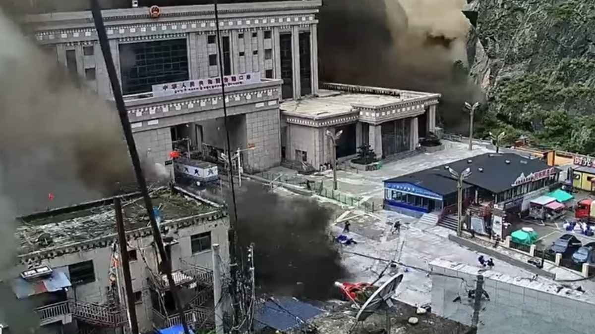
The Rasuwa disaster (Nepal flash floods) has killed more than 1,000 people in Nepal and China and left thousands missing. The catastrophe exposes a harder problem than the absence of an alarm: how do you protect communities and infrastructure when mountain hazards can cascade within minutes?
On the morning of August 26, a mass of ice and rock broke loose high in Nepal’s Rasuwa district and plunged roughly 1,200 metres into the valley below. Within minutes, the resulting debris and water surged into the Bhotekoshi River system.
A week later, the scale of the disaster is far clearer and far more devastating than initial reports suggested. Nepal’s National Disaster Risk Reduction and Management Authority (NDRRMA) has reported 1,050 deaths and 3,916 people missing. China has reported another 16 deaths and 546 missing in the affected area across the border, taking the combined death toll to 1,066. More than 11,800 people have been rescued in Nepal, but the search continues in remote valleys and at damaged hydropower projects. The numbers continue to shift as rescue teams recover bodies and families search for missing relatives.
Nepal flash floods expose the limits of early warning
Researchers analyzing satellite imagery, seismic signals, and video footage say the flood was likely triggered by an ice-rock avalanche rather than a conventional glacial lake outburst flood (GLOF). The distinction matters: while a glacial lake’s water levels and drainage systems can be monitored for early warnings, an unstable mountain slope can fail suddenly, turning a quiet landscape into a debris corridor within minutes.
A disaster that outran the warning system
ICIMOD’s assessment notes that the collapse occurred around 8:37 am Nepal Standard Time, producing a magnitude 5.2 seismic signal. Hydrological data shows how rapidly the event unfolded: water levels on the Trishuli River at Galchchi rose nine metres in just 30 minutes, while levels at Malekhu rose seven metres in a similar window, washing away several monitoring stations in the process.
This highlights a hard reality in disaster management: a warning system is only useful if there is enough lead time to act.
Dr. Farooq Azam, Senior Cryosphere Specialist at ICIMOD, described the Rasuwa event as a sudden-onset hazard with no detection and no time for warnings. Because deep-seated bedrock or sub-glacial instabilities remain invisible to standard surveillance, identifying a failure point in advance is rarely possible. The take-away isn’t that early-warning systems are useless, but rather that they cannot be the sole pillars of Himalayan safety.
From early warning to early preparedness
When casualties run into the thousands, the scope of the problem extends far beyond simple flood management. Nearly 1.6 million people have been affected across a broad area, with extensive destruction to roads, bridges, markets, communications, and power grids. As of September 1, NDRRMA figures show at least 639 hydropower workers missing, while over 21,000 security personnel remain deployed for search and rescue.
When a sudden mountain hazard strikes, built infrastructure often compounds the catastrophe. Destroyed roads delay emergency crews, collapsed bridges isolate entire villages, damaged power plants force dangerous confined-space rescues, and lost monitoring stations blind teams downstream.
Because of this, Azam advocates shifting focus toward long-term resilience: stricter land-use planning, safer infrastructure siting, and public awareness of high-altitude risks. He emphasizes that environmental impact assessments must evaluate how a shifting mountain landscape will affect a project over its entire operational lifetime—not just during construction. Planners can no longer just ask if a bridge or power plant can survive today’s weather; they have to design for conditions 30, 50, or 70 years down the line.
The Himalayas are not a static landscape
While current scientific evidence does not draw a direct line from climate change to this single avalanche, the event occurred within a mountain ecosystem experiencing rapid physical changes.
Glaciological assessments show accelerating mass loss across the Himalayas, with negative mass balance recorded in 89% of observed years over the last five decades. The Hindu Kush Himalaya region has also seen significant 21st-century warming, rising between 0.15°C and 0.60°C per decade.
These shifts ripple through the whole ecosystem. Snow cover patterns are shifting, permafrost is thawing, and slope stability is deteriorating. Thawing permafrost is particularly concerning high up, where frozen ground acts as a natural glue; as it thaws, erosion, landslides, and slope failure increase, directly threatening down-valley infrastructure. Climate change doesn’t need to directly trigger an avalanche to make the entire region significantly more fragile.
Black carbon is another pressure on the cryosphere
Particulate pollution presents another major stressor. A study by Climate Trends found that black carbon concentrations on the Indian side of the Himalayas rose by roughly 7.74% between 2000–09 and 2010–19. The study recorded a notable jump in average snow-surface temperatures, which rose from -11.27°C (2000–09) to -7.13°C (2020–23).
Black carbon darkens snow, reducing its reflectivity and accelerating surface melting. Because mountain ice acts as a natural water reservoir for downstream populations, this melting threatens long-term water security. While black carbon didn’t explicitly cause the Rasuwa slide, it underscores why regional environmental risks must be tackled holistically rather than in isolated hazard buckets.
The problem begins with where we build
Ultimately, the hardest questions around Rasuwa are geographical: Where are we building towns, laying roads, and placing power plants?
Over recent decades, infrastructure has steadily encroached onto lower riverbanks and active floodplains. While older communities historically built on higher ground to avoid active river channels, modern land-use planning frequently ignores these natural boundaries. Bringing local and indigenous geographical knowledge back into modern engineering decisions is a practical starting point for adaptation.
Anjal Prakash, Professor of Public Policy at FLAME University and an IPCC author, points out that the region does not suffer from a lack of science. Researchers have tracked retreating glaciers, changing permafrost, and rising snowlines for decades. The failure, he argues, lies in policy— translating well-documented risks into smarter zoning and construction choices.
A regional disaster cannot be managed country by country
The Rasuwa crisis also demonstrates why disaster planning cannot stop at national borders. The affected river systems cross international boundaries, the failure originated near the Nepal-China border, and the resulting debris washed through multiple downstream jurisdictions.
The World Meteorological Organization points to this as a clear example of cascading transboundary hazards. Aarti Khosla, Director of Climate Trends, similarly notes that risks across the Hindu Kush Himalaya affect India and neighboring countries equally, requiring joint approaches to monitoring, early warning, and climate adaptation.
Data sharing across borders is essential. A flood warning downstream in one country often relies on sensor data from upstream in another. When development choices or infrastructure failures in one nation can trigger impacts across the border, regional coordination becomes a necessity rather than an option.
The future risk is not just more floods
Disaster risk in the Himalayas is often oversimplified into a single concept: Glacial Lake Outburst Floods (GLOFs).
GLOFs are a major threat, but the vocabulary needs to expand. The mountains face ice falls, rockslides, landslide-dammed rivers, debris flows, and slope failures—often interacting all at once. An avalanche blocks a river; the temporary dam holds back water until it breaches; the resulting torrent sweeps up massive amounts of rock and earth; the debris wipes out bridges and monitoring equipment, leaving downstream teams blind to what is coming next. Preparing for mountain hazards means preparing for these linked multi-stage events, not just isolated floods.
What preparedness should look like now
A practical response requires pairing early-warning technology with long-term climate adaptation:
- Diversify warning networks: Expand river sensors, satellite tracking, and local alert channels where lead time exists, while planning for events that offer no notice at all.
- Update zoning and land use: Base building regulations on dynamic river and slope modeling rather than static historical maps.
- Mandate life-cycle risk assessments: Require infrastructure projects to factor in climate and cryosphere projections over their entire intended lifespan.
- Build system redundancy: Ensure communications, transit routes, and monitoring stations have backups so a single failure point doesn’t collapse an entire emergency response.
- Integrate local knowledge: Use community insights on historical floods and terrain stability alongside satellite and scientific data.
- Formalize transboundary cooperation: Share real-time hydrological, seismic, and weather data across international borders.
The mountains are changing. Policy must catch up.
The long-term outlook for the region is stark. Under high-emissions scenarios, Himalayan glaciers could lose over 60% of their volume by 2100; even moderate scenarios project losses of up to 35%.
These projections outline a fundamental transformation of the mountain environment. Glacial retreat initially leads to periods of higher runoff—”peak water”—followed by declining long-term water availability, directly impacting farming, drinking water, and energy production across South Asia.
As UN Climate Change Executive Secretary Simon Stiell has noted, rising temperatures are making severe mountain disasters more frequent. In the Himalayas, the core issue is that expanding human settlements and multi-million-dollar infrastructure projects are sitting in the path of a rapidly changing landscape designed around historical climate assumptions.
When a mountain moves without warning, safety relies entirely on decisions made years or decades before the collapse happens.

Climate
What If the Next Disaster Is Worse Than Anything We’ve Seen?
MIT researchers have developed a machine-learning tool that can generate plausible extreme-weather scenarios beyond historical records, offering planners a new way to prepare for unprecedented floods, heatwaves and storms.
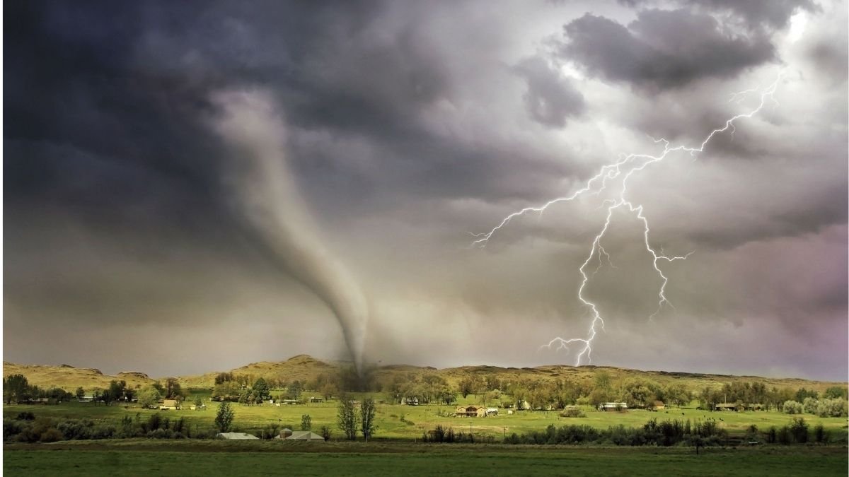
The devastating floods in Nepal this month have shown how quickly an extreme event can overwhelm infrastructure, disrupt power systems and create cascading risks. Across the region, India is also dealing with intense monsoon activity, with the India Meteorological Department issuing repeated warnings for heavy to extremely heavy rainfall in several states.
But disaster planners face a harder question: What happens when the next extreme event is worse than anything in the historical record? Historical data is essential for estimating risk, but it cannot provide a blueprint for an event that has never happened before. Researchers at the Massachusetts Institute of Technology (MIT) have developed a machine-learning method that attempts to fill that gap.
Called Extreme Event Aware, or η-learning, the method generates statistically plausible scenarios of unprecedented extreme events without needing examples of such events in its training data.
Climate Extreme Events and Historical records
Traditional risk models often learn from past disasters. But if the event being planned for is more severe than anything previously recorded, there may be little data to work with. For example, if a city’s highest recorded rainfall is 200 millimetres, planners may still need to understand what a plausible 300-millimetre event could look like.
“We are trying to model extreme, unprecedented events that no one has seen before, that are not in the dataset,” said Kai Chang, an MIT graduate student and member of the research team. The new method combines information about how frequently extreme values occur with spatial data showing how weather events are distributed.
Testing an Extreme Storm
The researchers tested the method using 25 years of precipitation data from across the continental United States. They trained the algorithm on spatial data from only the first six months of the record, which contained few or no examples of the most extreme rainfall events. The model then generated plausible scenarios for rainfall events beyond those in its training data.
A planner could use the system to explore a once-in-100-year storm and examine its potential size, intensity and area of impact. The goal is to generate multiple plausible scenarios that can be used to test infrastructure and emergency planning.
India and Climate Extremes
The challenge is relevant to India, where climate risks are already affecting large populations. A 2025 Council on Energy, Environment and Water assessment found that 417 of 734 districts, or 57%, are at high or very high risk from extreme heat. These districts account for about 76% of India’s population. More than 70% of districts have also experienced at least five additional very warm nights per summer compared with the 1982–2011 baseline.
Flood risk is also expected to grow. A World Bank assessment estimates that the area exposed to urban pluvial flooding in India could increase 3.6 to seven times by 2070. The number of urban residents exposed to a 1-in-100-year, 50-centimetre flood could rise from 11.1 million in 2023 to 25.4–46.4 million by 2070, depending on the scenario.
Preparing for the Worst Case Scenario
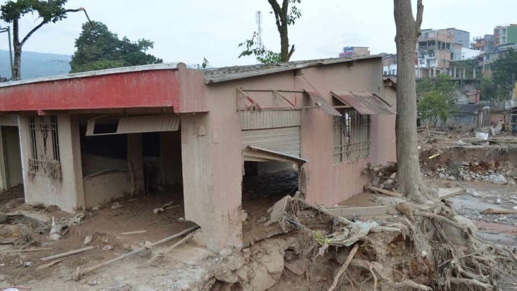
A scenario-generation tool could allow planners to examine that possibility, from the size of a flood to the duration of a heatwave, before infrastructure is tested by the real event.
The MIT researchers say the approach could also be applied to wildfires, floods and other complex systems, including financial markets. As climate risks evolve, resilience may increasingly depend not just on preparing for disasters that have happened, but on understanding those that are plausible even when they have never happened before.
Climate
Nepal’s Glacier Disaster Exposes the Unequal Cost of Climate Change
Nepal contributes only about 0.1% of global greenhouse-gas emissions, yet its communities face growing risks from glacier loss, floods and landslides. The latest glacier-related disaster shows how climate vulnerability can fall hardest on countries that have contributed little to global warming.
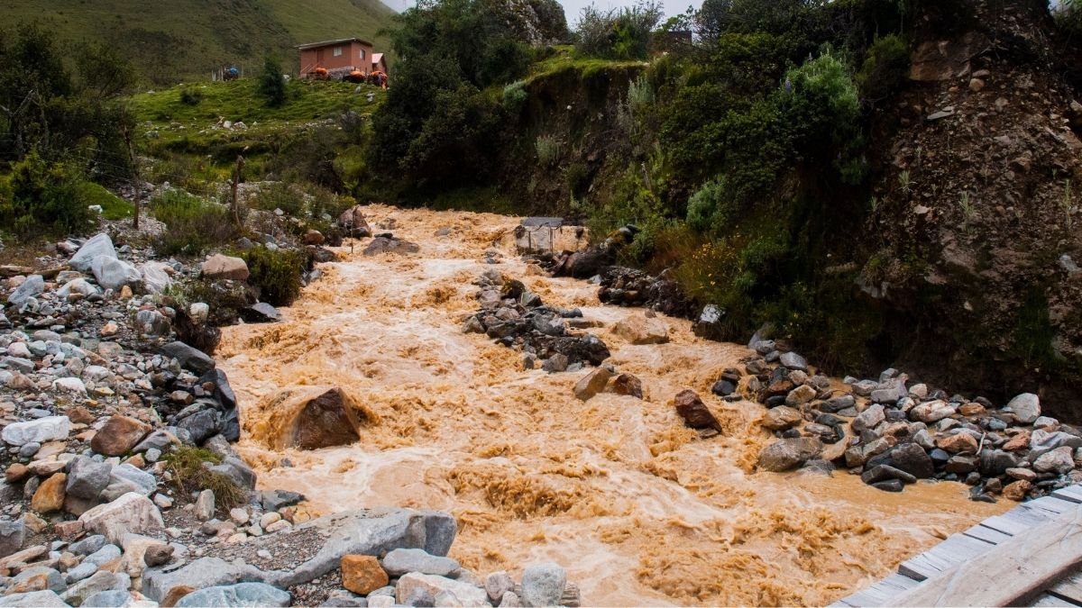
A glacier collapse in Nepal has set off a chain of floods and landslides along the country’s border with China, killing hundreds of people and leaving thousands missing. Roads and bridges have been swept away, hydropower facilities damaged and a key trade route disrupted. The disaster has also brought an uncomfortable question to the surface. Nepal has contributed very little to the greenhouse-gas emissions driving global warming. Yet the country’s mountains are among the places where a changing climate is being felt most sharply.
Nepal’s disaster authorities said on August 29 that 626 people had died and 2,426 remained missing after the floods on August 26. China has reported seven deaths and hundreds of people missing in Tibet. Bad weather has slowed helicopter operations, while damaged roads and other infrastructure have made it difficult for rescuers to reach some areas.
The disaster began high in the mountains, where a large section of glacier broke away, sending ice, rock and debris into the river system below. The resulting surge tore through valleys in Nepal and Tibet, damaging homes, roads, bridges and other infrastructure. Scientists are still working to establish exactly what caused the glacier to collapse.
That uncertainty is important. There is not enough evidence to say that climate change caused this particular event. But the collapse happened in a Himalayan region that is warming rapidly and losing ice at an accelerating rate.
A Country that Emits Little
Nepal’s share of global greenhouse-gas emissions is about less than 0.1%, according to the World Bank. That is a small contribution when compared with the major economies whose industries, transport systems and energy use account for much larger shares of global emissions. Nepal’s economy has not been built around the kind of large fossil-fuel industries that have driven emissions in many wealthier countries.
Yet geography leaves Nepal unusually exposed. Much of the country lies in the Himalayas, where communities live below steep slopes, glaciers and rivers. Floods, landslides, drought and glacial lake outbursts already pose serious risks. When a hazard begins high in the mountains, its effects can travel quickly into valleys where people live and where roads, hydropower projects and other infrastructure are concentrated.
For Nepal, the problem is therefore not simply how much carbon it emits. It is how much damage it can absorb when the climate and its mountain environment change.
The Himalayas are Changing
The August disaster comes as Nepal’s glaciers undergo a profound transformation. The country’s glaciers have lost nearly one-third of their ice in just over three decades, according to estimates cited by the United Nations. The pace of ice loss in the decade before 2023 was about 65% faster than during the previous decade.
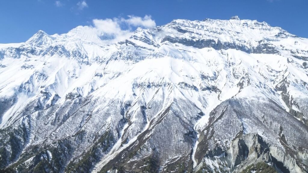
As temperatures rise, glaciers retreat and snow and ice patterns change. Mountain slopes can become less stable, while melting ice and changing water flows can alter the risks faced by communities downstream. The danger is not limited to one type of event. A collapse high on a mountain can trigger an avalanche or debris flow, which can block a river, create a temporary lake and set up another flood further downstream.
That sequence is now playing out in the aftermath of the August 26 disaster. The force of the flood damaged infrastructure and changed parts of the river system. New blockages and lakes have also raised concerns about further flooding. For people living in these valleys, the danger does not necessarily end when the first flood passes. Damaged roads can cut off communities from food and medical care. Disrupted water and sanitation systems can create additional health risks. And rebuilding can take months or years.
When Disaster Meets Poverty
Climate risk becomes harder to manage when a country has limited resources to prepare for it. The World Bank estimates that climate impacts could leave Nepal’s economy at least 7% smaller by 2050 if climate risks are not adequately addressed. Floods, landslides, drought and water stress already threaten livelihoods and infrastructure.
The latest disaster shows what those risks look like on the ground. More than 90,000 people need urgent assistance, while UNICEF estimates that about 17,000 children require humanitarian support. Eighteen schools have been destroyed and another 20 damaged. Entire communities have been swept away, leaving survivors in need of shelter and basic supplies.
The damage is also hitting infrastructure that Nepal depends on for its economy. Hydropower plants, roads and the border crossing with China have been affected, disrupting electricity generation, transport and trade. For a country still working to expand access to basic services and economic opportunities, a disaster of this scale creates a difficult trade-off. Money that could have gone towards schools, healthcare, roads or jobs may instead have to be spent repairing what has been destroyed.
The Cost of a Crisis Nepal did Little to Create
Nepal has committed to reaching net-zero emissions by 2045 and sees hydropower as an important part of its development. But Nepal becoming a lower-emissions economy will not, by itself, stop glaciers from retreating or prevent hazards in the Himalayas. The drivers of global warming extend far beyond Nepal’s borders. That makes adaptation critical. Better early-warning systems can give communities more time to move out of harm’s way. Monitoring glaciers and glacial lakes can help identify dangerous changes before they become disasters. Stronger roads, bridges, schools and health facilities can reduce the damage when extreme events occur.
All of this requires money, something that countries with small economies and limited fiscal space do not always have in sufficient amounts. The August disaster does not prove that climate change caused the glacier collapse. But it has occurred against a clear backdrop of rising temperatures and rapid ice loss in the Himalayas.
Nepal’s predicament is therefore larger than this one disaster. The country has contributed only a small amount to the greenhouse gases accumulating in the atmosphere, yet its communities are being asked to cope with a landscape that is becoming harder to predict. The people living beneath the Himalayas did not build the global carbon economy. But they are increasingly having to deal with what it has left behind.
That is where the climate debate becomes tangible, not in emissions charts alone, but in the homes, schools, roads and livelihoods that can disappear when a mountain gives way.
Climate
The Giant Steel Gates Guarding the Netherlands from the Sea
The Maeslantkering is the Netherlands’ giant movable flood barrier, protecting Rotterdam and South Holland while keeping one of Europe’s busiest ports open.

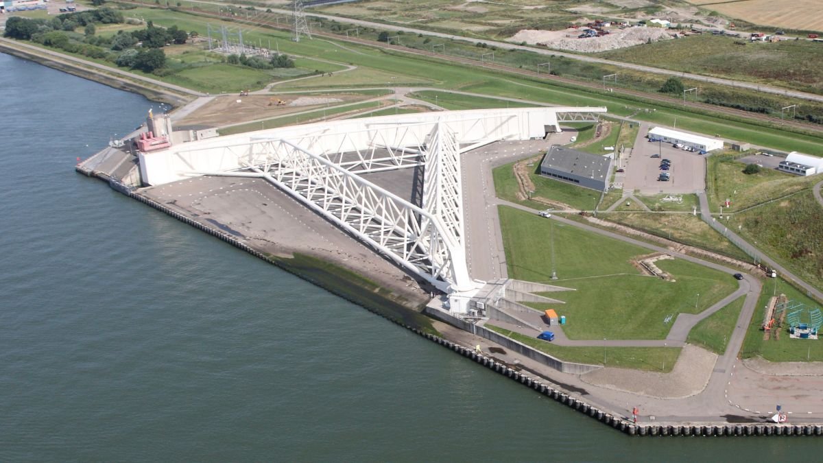
The Maeslantkering uses two enormous movable steel gates to protect Rotterdam and South Holland from extreme storm surges while keeping the river open to ships.
Imagine a wall of water rising from the sea, threatening to flood low lying towns, farmlands, and entire cities. Now picture two massive steel arms, each as long as the Eiffel Tower, floating out from the riverbanks to join together and hold that water back.
This is not a scene from a movie. It is a real piece of infrastructure spanning the Nieuwe Waterweg river channel near Hoek van Holland in the Netherlands. Known as the Maeslantkering, or the Maeslant Barrier, it is the largest movable flood barrier on Earth. For more than three million people living in South Holland, including the port city of Rotterdam, these steel gates are the main defense against extreme ocean storms.
Maeslantkering: Why the Netherlands’ Giant Flood Barrier Matters
Why the Dutch Built a Gate Instead of a Wall The Netherlands has managed water for centuries, as nearly a third of the country sits below sea level. After a devastating North Sea flood in 1953, the Dutch government built a vast network of dams, dikes, and storm surge barriers across the country, known as the Delta Works.
However, the river route leading to Rotterdam created a practical problem. Rotterdam is home to Europe’s largest and busiest seaport. Blocking the river permanently with a fixed dam was impossible because cargo ships need round the clock access. The initial plan was to build higher earthen dikes along the riverbanks. But as engineers examined future sea level projections, they realized standard dikes would have to be enormous. Building them meant demolishing historic neighborhoods and disrupting communities for decades.
The solution was a different approach altogether: a storm surge barrier that stays open during normal weather to keep shipping lanes clear, but swings shut when severe storms approach.
How the Gates Work
The mechanics of the Maeslantkering are straightforward in design, but huge in scale. The barrier relies on two hollow steel gates parked in dry docks on opposite sides of the river.
When a major storm hits, hydraulic engines push the gates out into the waterway, where they float like barges until they meet in the middle. Once aligned, valves open and the gates fill with river water. As they gain weight, they sink onto a concrete bed built into the river floor.
The operation of the Maeslantkering relies heavily on automation. The entire closure process is directed by a specialized computer system called the Decision Support System, known by its Dutch acronym BOS
As the gates lower, water rushes underneath them at high speed. This natural currents sweep away sand and silt so the structures rest flat against the riverbed without getting stuck on sediment. When the storm passes and ocean levels drop, pumps empty the water from inside the gates. The buoyant structures float back up and swing back into their docks, reopening the river to maritime traffic.
Automated Controls with Human Oversight
The operation of the Maeslantkering relies heavily on automation. The entire closure process is directed by a specialized computer system called the Decision Support System, known by its Dutch acronym BOS.
The software constantly monitors weather forecasts, incoming tides, and river flow rates. If calculations show water levels will rise 3 meters above normal in Rotterdam, the system initiates the closure process automatically. Leaving the trigger to software removes the risk of human delay or miscalculation during a sudden storm emergency.
Even with automation running the system, human engineers remain on site. Whenever severe weather threatens the coast, a technical team monitors the operations from a nearby control room, ready to take manual control if a system fault occurs.
Balancing Ships, Farms, and Rising Tides
Closing the barrier stops all ship traffic into Rotterdam, so shutting the gates is never done without cause. The barrier only closes during major storm events, though engineers run a routine test closure every September to keep the machinery and operational teams prepared.
As sea levels change and seasonal river flows shift, the Maeslantkering remains a critical piece of Dutch water management. It demonstrates how civil engineering can function alongside natural waterways, protecting millions of residents while keeping an essential trade route open to the world.


Farmers Borrowed to Build ‘Diggis’. Two Years Later, They Are Still Waiting for the Subsidy

When the Himalayas Collapse Without Warning, What Counts as Preparedness?

India’s Moonshot Moment: Can New Delhi Turn Orbit Into Influence

India Is Digitising Fertilizer Use. But Will It Help Farmers Use It Better?

What If the Next Disaster Is Worse Than Anything We’ve Seen?

When the Monsoon Returns, Fear Returns: How Climate Disasters Are Reshaping Mental Health in Himachal Pradesh

Astronomers Discover a ‘Black Hole Star’, a New Kind of Object in the Early Universe

From Bell Labs to the Classroom: Finding Purpose After Retirement

From Soil to Profit: How Organic Turmeric Changed the Fortunes of a Tribal Farming Family

Our Algorithm Knows What We Want Before We Do. That is the Problem.

-

 Math1 month ago
The 2026 Fields Medals: Four Proofs, Four Decades-Old Problems Solved
-
Climate1 month ago
After Kerala’s Deadliest Landslide, the Hardest Thing to Rebuild Was Childhood
-
Society2 months ago
West Asia Crisis: Can Kerala’s Returning Gulf Migrants Find a Future in the Green Economy?
-
Space & Physics3 months ago
India Semiconductor Mission: ‘It’s Not About Fabs. It’s About Building An Entire Ecosystem’
-
Climate3 months ago
The Climate World Cup? How Climate Change Could Affect Player Performance at the 2026 World Cup
-
Society2 months ago
What Is Civilisational Diplomacy? Understanding India’s Newest Foreign Policy Tool
-
Society3 months ago
From Bell Labs to the Classroom: A Second Career in Teaching
-
Space & Physics3 months ago
Engineers Develop Dual-Mode Propulsion System for Next-Generation Small Satellites