
Climate
Monsoon Intensifies Across 10 States as IMD Issues Heavy Rain Alert
The southwest monsoon is set to intensify across India as a Bay of Bengal depression strengthens, prompting heavy rain alerts for more than 10 states. With many regions already affected by floods and landslides, the fresh spell of rainfall could worsen flooding, disrupt daily life and increase disaster risks.

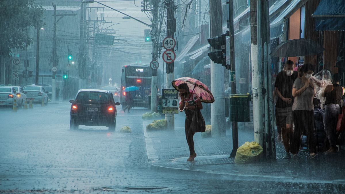
The southwest monsoon is set to intensify across large parts of India over the next few days as a depression over the northwest Bay of Bengal strengthens, prompting the India Meteorological Department (IMD) to issue heavy rainfall alerts for more than 10 states.
The weather system is expected to bring heavy to extremely heavy rainfall across eastern, central, western and northern India, increasing the risk of floods, landslides and waterlogging. The fresh spell of rain comes at a time when several states are already dealing with the impacts of an active monsoon, making them more vulnerable to further weather-related disasters.
Bay of Bengal Depression to Strengthen Monsoon
According to the IMD, a low-pressure area over the northwest Bay of Bengal and adjoining Odisha–West Bengal coast is likely to intensify into a depression before moving west-northwest across Odisha, Chhattisgarh and central India.
A depression is a well-organised low-pressure weather system that forms over warm ocean waters. During the southwest monsoon, the Bay of Bengal is the primary region where these systems develop. As they move inland, they transport large amounts of moisture from the sea, producing widespread rainfall over several states. Although weaker than cyclones, monsoon depressions are among the most important drivers of India’s seasonal rainfall.
The IMD has forecast isolated extremely heavy rainfall over Odisha and Chhattisgarh, while heavy to very heavy rainfall is expected across parts of Madhya Pradesh, Maharashtra, Gujarat, Rajasthan, Uttar Pradesh, Uttarakhand, Himachal Pradesh, Gangetic West Bengal, Konkan and Goa. Widespread rainfall is also likely across the northeastern states, including Assam, Meghalaya, Arunachal Pradesh, Nagaland, Manipur, Mizoram and Tripura.
Fresh Rain Could Worsen Existing Floods
The latest depression arrives after several weeks of intense monsoon activity across the country. States such as Himachal Pradesh and Uttarakhand have witnessed recurring landslides and flash floods, while Assam has experienced repeated flooding as the Brahmaputra and its tributaries swelled following continuous rainfall. Parts of Gujarat, Maharashtra and central India have also reported flooding and waterlogging after successive spells of heavy rain.
Meteorologists say the concern is not only the amount of rain expected but also where it will fall. Much of the landscape in these regions has already become saturated, reducing its ability to absorb additional rainfall.
When soil reaches its storage capacity, fresh rainfall flows directly into streams and rivers instead of soaking into the ground. This increases surface runoff, causing rivers to rise more rapidly and raising the risk of flash floods and urban flooding. In hilly regions, continuous rainfall also weakens slopes, making landslides more likely.
Growth of Climate Challenge
Scientists increasingly describe situations like these as compound weather events, where one weather event amplifies the impact of another. A fresh spell of heavy rain falling over flood-affected areas can prolong flooding, delay recovery and increase damage to homes, roads and public infrastructure.
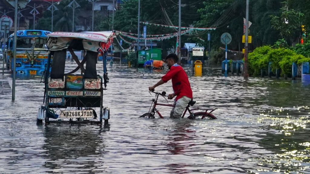
Climate change is expected to make these risks more pronounced. According to the Intergovernmental Panel on Climate Change (IPCC), the atmosphere can hold about 7% more moisture for every 1°C rise in temperature, increasing the potential for intense rainfall during monsoon weather systems. Studies by the India Meteorological Department and the Indian Institute of Tropical Meteorology have also reported an increase in short-duration extreme rainfall events across parts of India over recent decades.
Authorities Urge Vigilance
The IMD has advised residents in flood- and landslide-prone areas to closely monitor weather updates and follow local advisories. Fishermen have been warned against venturing into the Bay of Bengal and adjoining parts of the Arabian Sea due to rough sea conditions.
State disaster management agencies are also monitoring river levels, reservoir inflows and vulnerable districts as the depression moves inland.
While the active monsoon is expected to replenish reservoirs and support the ongoing kharif cropping season, the latest depression highlights the growing challenge of managing consecutive extreme rainfall events. For communities already affected by floods and landslides, the coming days will test the resilience of infrastructure, disaster response systems and local preparedness as another round of heavy rain sweeps across the country.









Climate
15,800 Additional Heat Deaths Projected: Can India’s Mortality Data Capture the Real Toll?
India could see 15,800 additional heat-related deaths, according to a Climate Impact Lab projection. But can India’s mortality data capture the true health toll of extreme heat and rising temperatures?

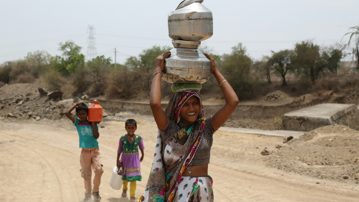
India is heading into another winter against the backdrop of a changing climate, with scientists warning that rising global temperatures are altering the country’s weather patterns. Heatwaves are becoming a growing public-health concern, yet one question remains hard to answer: “How many heat deaths is India actually recording from extreme heat?”
A new report by the Climate Impact Lab, an initiative of the University of Chicago’s Energy Policy Institute, puts the toll in the thousands. Titled ‘451,000 at Risk’ and published in September 2026, it projects about 15,800 additional deaths in India, with a stated range of ±1,600, between September 2026 and February 2027. The comparison is with the same months of an average year between 1996 and 2025. That makes India the fourth most affected country in the report’s ranking, behind Nigeria, Indonesia and Sudan. The figure comes with an important caveat: it is a modelled estimate, not a count of deaths recorded by India’s health system.
The timing matters. Of India’s projected total, 7,400 deaths fall between December and February, and the Lab expects heat-related deaths in India and Pakistan to keep rising into their summer, beyond the forecast window. It says it will update its projections as the El Niño progresses.
El Niño, the ‘Little Boy’
El Niño is Spanish for ‘the little boy’, but the concern it is causing is far from small as global temperatures continue to reach exceptional levels.
El Niño is a naturally occurring climate pattern associated with unusually warm waters in the central and eastern tropical Pacific Ocean. It can temporarily push global temperatures higher and influence rainfall and temperature patterns across the world, including the Indian monsoon. The Lab describes the current event as a ‘Super El Niño’ that began in June and is expected to last through the northern-hemisphere spring, and notes that it could become the strongest on record.
The report projects that global land temperatures will be about 1.2°C above normal in the coming months, largely because of El Niño. That is comparable to the warming climate change is projected to deliver 20 years from now, and the Lab expects 44 per cent more extremely hot days than in a normal year.
Scientists have increasingly examined El Niño alongside the longer-term influence of human-caused climate change. While El Niño is a natural phenomenon, its effects occur against a warmer global baseline created by the accumulation of greenhouse gases in the atmosphere.
Recent records show the scale of that warming. The EU’s Copernicus Climate Change Service has recorded exceptionally warm months and seasons in recent years, and 2024 was the first calendar year in which the global mean temperature exceeded 1.5°C above the pre-industrial level, according to the Lancet Countdown. Single months or years above 1.5°C do not by themselves mean the Paris Agreement limit has been breached, which is judged on a multidecadal average. On 2 September, the UN Environment Programme (UNEP) published its ‘Limiting Overshoot’ report, which warns that global temperature rise is set to cross 1.5°C, likely within the next few years.
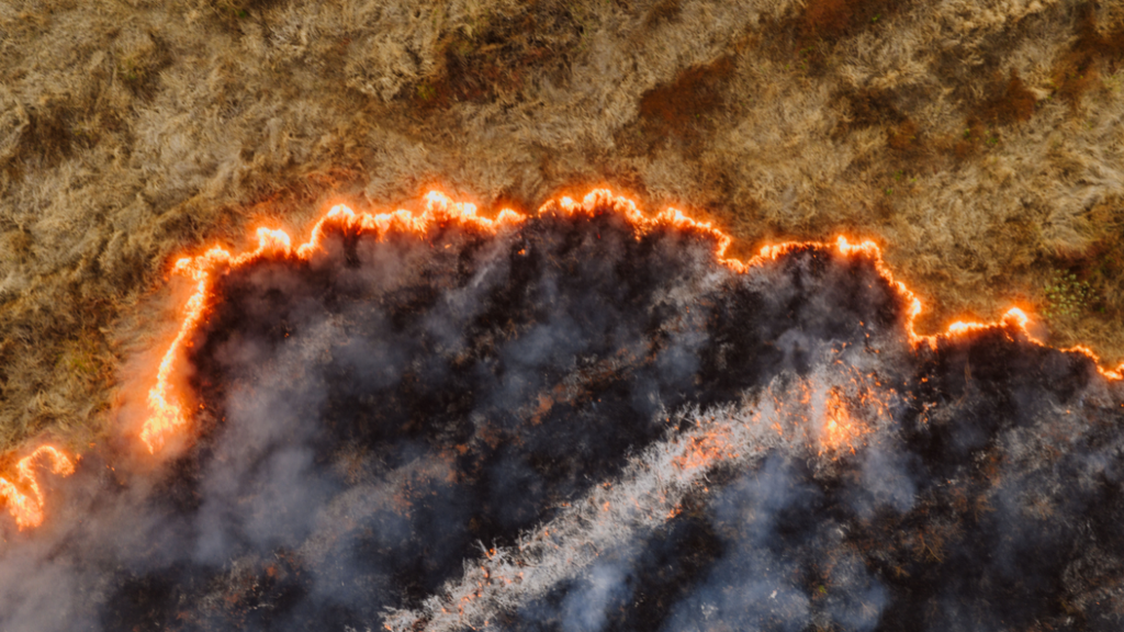
An aerial view of a wildfire burning through dry vegetation, highlighting the growing risk of extreme heat and fire in a warming climate.Image credit:Kelly/Pexels
The changing climate is also being felt in more variable rainfall. According to the India Meteorological Department (IMD), India received 706.9 mm of rain between 1 June and 22 September against a normal of 832.4 mm, a deficit of about 15 per cent. Rainfall has not been uniform across the country: some regions have had significant rain, while others have faced prolonged deficits or intense, short-duration downpours.
Rainfall, temperature and humidity also interact to shape heat exposure. A warmer atmosphere can increase the intensity of certain heat events, while high humidity makes it harder for the body to cool itself through sweating.
The Hidden Mortality Problem
The 2025 report of the Lancet Countdown on Health and Climate Change found that heat-related deaths have risen by 63 per cent since the 1990s, averaging an estimated 546,000 a year between 2012 and 2021.
The Lab projects around 451,000 additional heat-related deaths worldwide, compared with a normal year, from June 2026 to February 2027, the first nine months of the El Niño event. About 239,000 of those (±11,000) fall in the six months from September to February, the same window as India’s figure.
The Global South is expected to be hit hardest. Nigeria, Sudan, Niger and Chad, which the report groups as the Sahel, together face 66,800 additional deaths, of which Nigeria accounts for around 31,400, Sudan 17,500, Niger 10,000 and Chad 8,000. Indonesia is projected to see 19,300 additional deaths, and the Philippines, Vietnam, Thailand and Cambodia together 19,400. Brazil’s projected figure is 13,300.
Emily Grover-Kopec, Director within the Energy & Climate practice at Rhodium Group and co-author of Climate impact lab report said the estimates are based on temperature–mortality relationships and seasonal temperature forecasts from the European Centre for Medium-Range Weather Forecasts’ SEAS5 system. The Lab says it applied those relationships, which account for differences in local climate, vulnerability and adaptive capacity across 24,378 regions, to the forecasts. It says the full methodology will appear in an upcoming peer-reviewed journal, so the analysis has not yet been through that process.
Counting deaths from extreme heat is considerably harder than counting deaths from an accident or an infectious disease.
Part of the difficulty lies in how deaths are recorded. Heat may not appear as the immediate cause of death on a death certificate. A person exposed to extreme temperatures may die from cardiovascular disease, respiratory illness, kidney failure or another complication, making it difficult to establish the role heat played.
When temperatures rise sharply, hospitals may see more patients with dehydration, heatstroke and other heat-related illnesses. But extreme heat can also worsen existing medical conditions, and deaths from those conditions may not be recorded as heat-related.
This creates a gap between observed deaths and excess mortality: the number of deaths above what would normally be expected in a given period.
In India, that gap starts with how deaths are counted. According to an analysis by Rakesh Dubbudu on India Together, the country has no single authority, definition or process for a heat-related death. The National Disaster Management Authority counts deaths tied to declared heatwaves, the National Crime Records Bureau relies on police registers, and the health ministry counts clinically suspected heatstroke. For 2000–2020, the crime records bureau’s total exceeded 20,600, the disaster authority’s was about 17,700 and the IMD’s about 10,500. The Associated Press reported in 2024 that for 2020 the crime records bureau recorded 530 heatstroke deaths while the disaster authority reported four.
The wider system has its own limits. India’s civil registration system recorded 86.6 lakh deaths in 2023, a registration level of 97.2 per cent, but medical certification of the cause of death is far less complete, and heatstroke is hard to certify after death, especially in rural areas where post-mortems are rare.
Beyond the Numbers
The projection of thousands of additional deaths is therefore more than a statistical matter. It raises a larger question: whether India’s public-health and mortality surveillance systems can keep pace with a changing climate.
Michael Greenstone, a co-founder of the Climate Impact Lab and the Milton Friedman Distinguished Service Professor in Economics at the University of Chicago, said the report allows decision-makers to see ‘exactly where emergency actions can be taken now’ to save tens of thousands of lives in the coming months.
Co-author Tamma Carleton, the Lab’s faculty head of research and an assistant professor at the University of California, Berkeley, said that better-targeted emergency efforts can save many lives this year, but that resources must also be mobilised now to design, deploy and evaluate the planning tools that will save lives in the years ahead.
The Lab argues that targeted action could avoid tens of thousands of deaths. It points to early-warning systems and heat action plans, cooling centres, protections for outdoor workers, expanded health-system capacity, more accurate temperature forecasting and wider access to cooling technologies, while noting that many of these measures have been evaluated only in specific geographies.
As climate change raises the frequency and intensity of extreme heat in many regions, the ability to measure its human cost will matter more.
The question is no longer only how hot India is becoming. It is also whether the country’s data systems can tell us how many lives that heat is costing.
Climate
Why Delhi’s Air Gets Worse in Winter
Delhi’s cooler weather signals the approach of the winter pollution season, when weak winds and temperature inversions can trap pollutants near the ground.
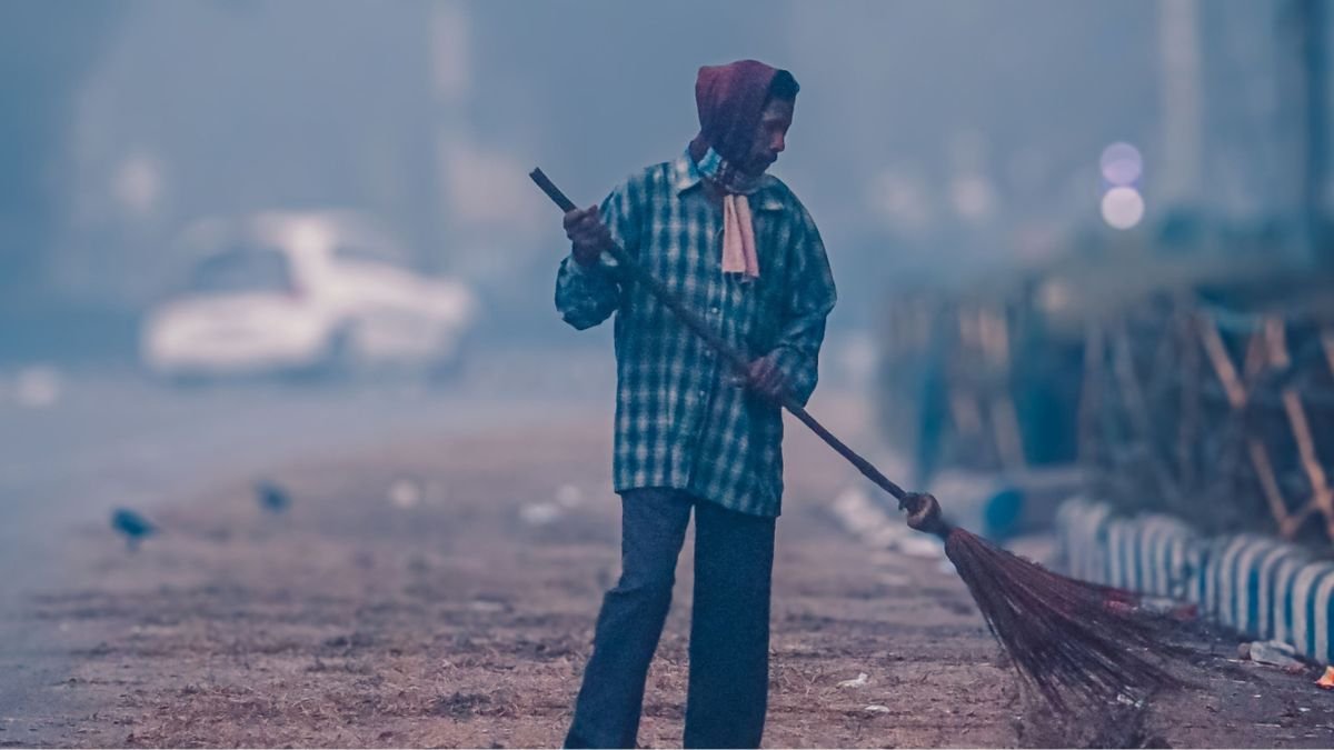
Delhi has had a taste of cooler weather earlier than usual. On Sunday, the capital recorded a minimum temperature of 21°C at Safdarjung, its lowest September minimum in 18 years. Conversations to tackle winter pollution are also surfacing along with it. Rain and northerly winds kept the air relatively clean too, with the 4 pm AQI at 53.
But that clean-air window may not last. As the southwest monsoon retreats and winter approaches, Delhi is entering the season when pollution can begin to linger in the air for longer. The government is already preparing for it.
On Monday, Union Environment Minister Bhupender Yadav met Delhi Chief Minister Rekha Gupta and senior officials to review preparations for the winter pollution season. The measures include restrictions on older vehicles entering Delhi, “No PUCC, No Fuel” checks, higher parking charges, staggered office timings and work-from-home arrangements. Construction and demolition will also face tighter restrictions during the winter months.
Air Stops Moving
Delhi’s winter pollution is not simply a result of colder temperatures. The problem begins when cold weather changes how the atmosphere behaves. During winter, winds can become weaker and the layer of air in which pollutants normally mix can become shallower. Pollution from vehicles, industries, construction and other sources then has less space to disperse.
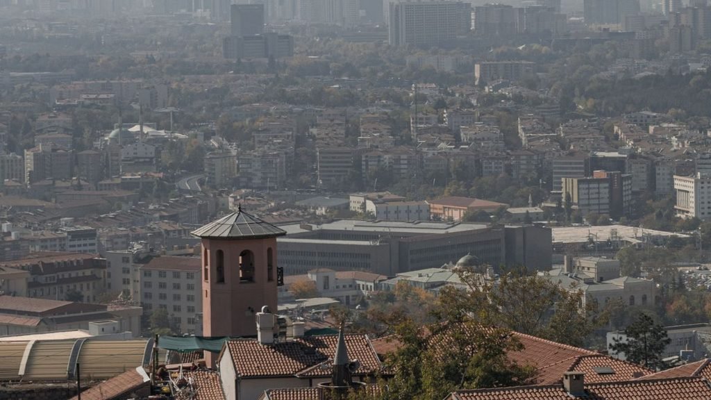
A temperature inversion can make this worse. Cold air stays close to the ground while warmer air sits above it, forming a kind of lid that prevents pollutants from rising and spreading. For people on the ground, the result is familiar: hazier skies, poorer visibility and air that can remain polluted for days.
What Changes After Monsoon
The monsoon gives Delhi some natural help in clearing the air. Rain removes particles from the atmosphere, while stronger winds help disperse emissions. Once the rains withdraw, that help diminishes. If winds are weak and the atmosphere becomes stagnant, pollution can begin to build up.
And Delhi does not produce all of that pollution on its own. Emissions from traffic, industries, construction, road dust and waste burning within the city mix with pollution transported from neighbouring areas. Agricultural fires in northern India can add to the particulate load during parts of the post-monsoon season.
Why the Recent Cold Matters
In December 2025, falling temperatures, dense fog and shallow atmospheric mixing accompanied a deterioration in air quality. On December 18, the maximum temperature was 20.1°C while the city’s 24-hour AQI reached 373.
That is why winter pollution is partly a weather story and partly an emissions story. As winter sets in, the amount of pollution released by the city and surrounding region matters. So does what happens to that pollution once it enters the atmosphere.
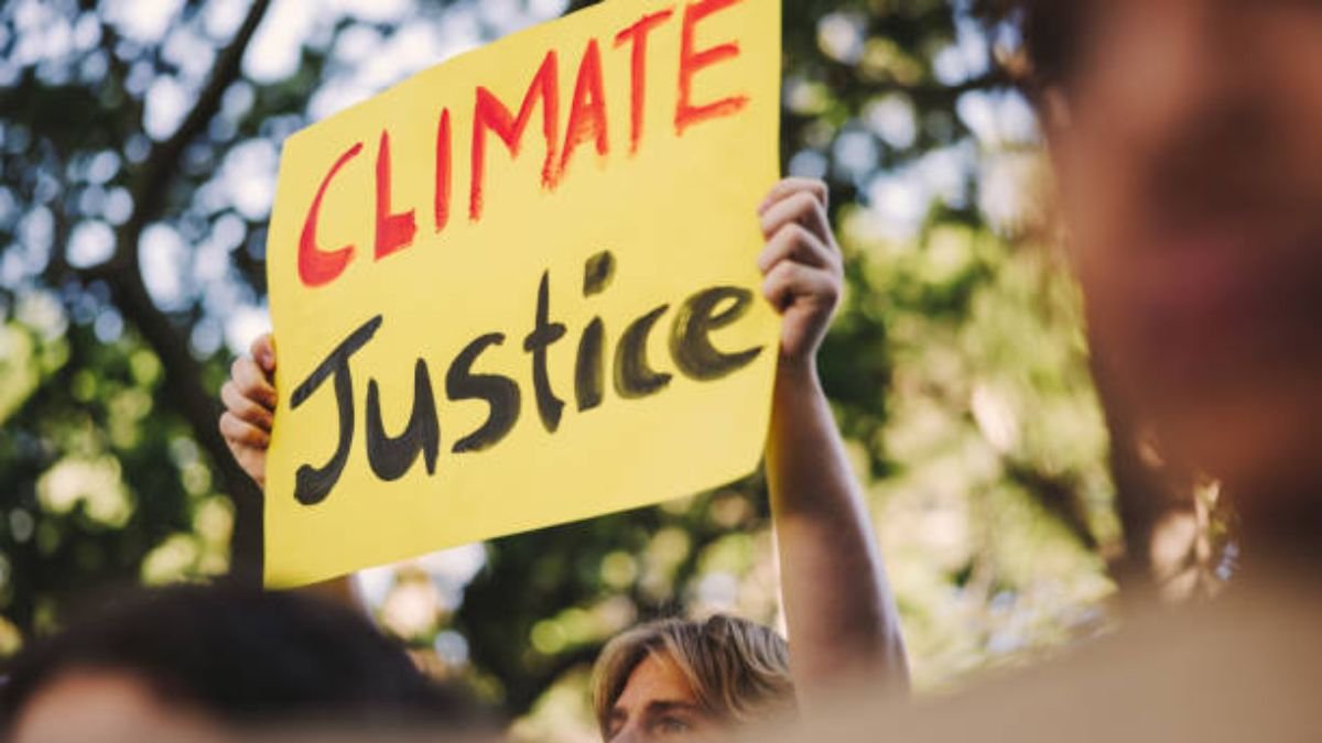
Nepal contributes less than 0.1% of global greenhouse gas emissions, yet catastrophic floods have killed more than 1,400 people, left thousands missing and caused damage estimated at around 10% of the country’s GDP.
For Prime Minister Balendra Shah, that contrast captures the climate justice challenge facing vulnerable countries. Addressing the United Nations General Assembly on Thursday, Shah described the Bhotekoshi-Trishuli disaster in northern Nepal as a “Himalayan Tsunami” and urged the international community to respond to climate disasters with greater financial support and stronger regional cooperation.
“The Bhotekoshi-Trishuli disaster was not just a local tragedy, it was a warning to the world,” Shah said.
Low-emitting Country Facing a High Climate Cost
Nepal’s contribution to global warming is small, but its exposure to climate hazards is high. Shah said the country is repeatedly forced to rebuild infrastructure and restore livelihoods after disasters, often relying on borrowing to finance recovery.
The UN has also highlighted this imbalance. UN Resident Coordinator in Nepal Lila Pieters Yahia said Nepal’s experience demonstrates the losses faced by countries that have contributed little to climate change.
Nepal has sought support from the Loss and Damage Fund, which was created to help vulnerable developing countries respond to climate impacts that cannot be avoided through adaptation alone. Its request was under consideration, according to the UN. The immediate funding gap remains significant. A UN-backed flash appeal sought 49.6 million dollars to assist about 84,000 people affected by the floods. By September 9, only 22 million dollars had been received.
For Shah, this is why climate justice has to translate into accessible finance. “Climate Justice cannot just remain a beautiful phrase in a United Nations document,” he said.
The Himalayan Risk
Shah also connected the floods to growing risks in the Himalayan environment. He pointed to melting permafrost and unstable mountain slopes, which can increase the risks of landslides, avalanches and floods. These hazards can also cross national boundaries through shared river systems.

“Climate change does not recognize borders,” he said. “Glaciers and floods do not travel with a visa stamped on passports.” The UN has reported extensive damage to roads, schools, power systems and water infrastructure in the affected areas. It has also warned that recovery will require resilient infrastructure and livelihoods rather than simply replacing what was destroyed.
What Nepal Wants
Shah proposed a Himalayan Climate Resilience Mechanism involving Nepal, India and China. The proposed framework would share satellite data and technical expertise, monitor dangerous glacial lakes, strengthen early-warning systems and coordinate disaster assistance across borders.
He also called for greater access to grant-based climate finance, arguing that existing international mechanisms remain inadequate for countries facing repeated climate-related losses. “When the house is burning, we do not ask the family to complete fifty forms. We act,” Shah said.
The proposal comes as Nepal continues to deal with the immediate aftermath of the floods. The UN has released 2.5 million dollars through its Central Emergency Response Fund and has coordinated assistance covering food, shelter, health, water and sanitation, education and protection.
The UN Response
The UN’s response has gone beyond emergency relief. UN Secretary-General António Guterres met Shah in New York and expressed condolences over the deaths and destruction. Their discussions included relocating people living along vulnerable riverbanks, green reconstruction and the risk of glacial lake outburst floods.
The UN has also publicly backed the broader principle behind Nepal’s climate-justice appeal, while supporting the country’s recovery from the floods. That leaves a larger question for the international climate system: whether countries facing severe climate impacts can access sufficient funding to recover and prepare without taking on deeper debt.
For Nepal, the flood has turned that question into an immediate one. Shah ended his address by returning to the warning from the Himalayas. “And when the next warning comes from the rooftop of the world: Let us be ready to hear it, and ready to act.”


15,800 Additional Heat Deaths Projected: Can India’s Mortality Data Capture the Real Toll?

How Wind Turbines Could Produce More Power From the Same Wind

Artemis Accords Reach 76 Countries: What It Means for India

Why Delhi’s Air Gets Worse in Winter

AI Is Growing Fast, But Women Remain Underrepresented

From Scams to Screens: How the National Stock Exchange Rewrote India’s Equity Story

Farmers Borrowed to Build ‘Diggis’. Two Years Later, They Are Still Waiting for the Subsidy

Aim for the Stars: Anjali Thomas’s Journey from a Small College in Kerala to the Frontiers of Medical Imaging

When the Himalayas Collapse Without Warning, What Counts as Preparedness?

Anxiety Freezes Career Decisions. Curiosity Unfreezes Them

-

 Math2 months ago
The 2026 Fields Medals: Four Proofs, Four Decades-Old Problems Solved
-
Climate2 months ago
After Kerala’s Deadliest Landslide, the Hardest Thing to Rebuild Was Childhood
-
Society3 months ago
West Asia Crisis: Can Kerala’s Returning Gulf Migrants Find a Future in the Green Economy?
-
Space & Physics4 months ago
India Semiconductor Mission: ‘It’s Not About Fabs. It’s About Building An Entire Ecosystem’
-
Interviews6 days ago
From Scams to Screens: How the National Stock Exchange Rewrote India’s Equity Story
-
Climate4 months ago
The Climate World Cup? How Climate Change Could Affect Player Performance at the 2026 World Cup
-
Society3 months ago
What Is Civilisational Diplomacy? Understanding India’s Newest Foreign Policy Tool
-
Society4 months ago
From Bell Labs to the Classroom: A Second Career in Teaching