Climate
After Kalladi, Meppadi’s Biggest Fear Still Looms Above the Hill
A landslide at the Kalladi tunnel project has renewed fears in Meppadi, where residents say every monsoon brings uncertainty. Experts explain why fragile geology, changing rainfall and human interventions are increasing landslide risks.

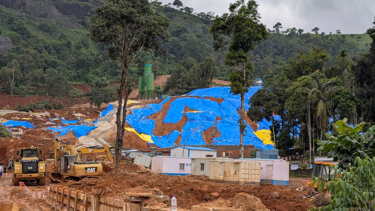
Every monsoon, residents of Kalladi in Wayanad look not at the rain, but at the hill above their homes. Two years after the Chooralmala tragedy, Kalladi landslide has reignited questions about whether fragile landscapes, climate change, and development are together creating an increasingly dangerous future.
MEPPADI (WAYANAD, KERALA): Every monsoon begins with a Look Up. When the rain begins, Nishal no longer watches the road outside his house. He watches the hill. A massive mound of excavated soil sits on the slope above his village in Kalladi, a hamlet in Meppadi panchayat in Kerala’s Wayanad district, where work on the Anakkampoyil–Kalladi–Meppadi twin-tunnel project is underway. It has sat there since the earth was excavated for the project, and with every spell of rain, it has become the first thing residents look at.
“People are scared to live here,” Nishal says. “The soil was kept there so it could be used later for construction. But once the monsoon arrives, we don’t feel safe anymore. If it isn’t managed properly, another disaster could happen.”
His fears are rooted in recent memory.
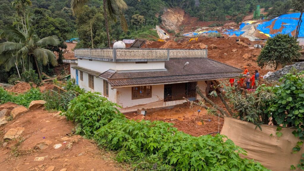
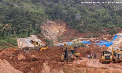
On July 7, 2026, a landslide swept through the tunnel construction site, killing eight workers. Although the disaster was far smaller than the Chooralmala-Mundakkai landslides that devastated Meppadi in July 2024, it reopened a question many thought would have been answered after that tragedy, two years ago: how safe are the hills people continue to live beneath?
The Landslide Changed the Questions
For Roshna, a former Block Panchayat member who lives near the construction site, the latest landslide has made every rainy day uncertain again.
“I am 56 now. If something happens to my house, I cannot build another one,” she says.
She is not opposed to the tunnel project. Few residents say they are. What worries them is whether the landscape has been made more fragile than it already was.
After the landslide, a committee was appointed to study how the excavated soil stored on the hill could be removed safely. Residents say experts have suggested reducing the height of the mound gradually instead of removing it all at once.
“I only want the issue to be handled properly,” Roshna says. “The project should be completed safely.”
More Than Just Heavy Rain
The Kalladi landslide has also drawn attention because it did not unfold under the same conditions as the Chooralmala disaster.
Scientific studies on the 2024 landslides show that Chooralmala was preceded by nearly two weeks of persistent rainfall that progressively saturated the slopes before they failed. That prolonged rainfall was a crucial factor behind the scale of the disaster.
Prof. S. Abhilash, Head of the Department of Atmospheric Sciences, Cochin University of Science and Technology say the situation at Kalladi was different.
“Landslides are not caused by the rainfall received on a single day,” he says. “What matters is antecedent rainfall. When rain continues over several days, the soil becomes saturated. At that stage, even another 20 or 30 millimetres of rain can trigger a landslide.”
That is why, he says, rainfall alone cannot explain the Kalladi incident. The geology of the slope and the way the landscape has been altered also need to be understood. He argues that replacing native deep-rooted trees with coffee and tea plantations, which have shallower root systems, has made the slopes more vulnerable to landslides.
Why Meppadi Keeps Failing
The hills around Meppadi have always been vulnerable.
The Western Ghats are among the oldest mountain systems in the world. Millions of years of weathering under the southwest monsoon have weakened the rocks beneath Wayanad. Above them lie thick layers of weathered soil. In places such as Meppadi, the terrain is further weakened by steep slopes, fractured rocks, foliated joints and geological lineaments.
“Meppadi has historically remained a landslide-prone area,” says Prof. S. Abhilash. “Not every high-hazard zone experiences repeated landslides, but this landscape has all the conditioning factors that make slope failure more likely.”
The record bears that out. In 2019, a landslide at Puthumala, another settlement within Meppadi panchayat, killed 17 people, five years before Chooralmala. Kalladi is now the third major landslide to strike this one panchayat in seven years. The Geological Survey of India estimates that nearly 19,301 sq. km, or 49.7 per cent of Kerala, falls within landslide-prone terrain, with Wayanad among the districts facing the highest risk — GSI assessments put 51 per cent of Wayanad and 74 per cent of Idukki on mountainous slopes classified as landslide-prone. Kerala recorded 2,239 major landslides between 2015 and 2022, the highest of any state in the country, according to Union government data.
A Changing Monsoon Meets an Old Landscape
The vulnerability of the hills is now intersecting with a changing climate.
Prof. Abhilash says the warming southeastern Arabian Sea is altering the behaviour of rain-bearing clouds over Kerala. Vertically developed cumulonimbus clouds that once discharged much of their moisture over the sea are increasingly moving inland. Over the past decade, northern Kerala has witnessed more frequent episodes of intense rainfall, contributing to flash floods and landslides.
But climate alone does not explain what is happening.
“The trigger may be rain,” he says, “but whether a slope fails depends on the condition of the landscape.”
Where Development Meets Risk
That is where residents believe the conversation should now shift.
Prof. Abhilash says replacing native forests with plantations, cutting roads through hillsides and excavating the base of slopes without adequate stabilisation can all increase landslide risk. In Kerala’s weathered mountains, where thick soil rests on fragile bedrock, even relatively small disturbances can destabilise a slope.
“The tunnel project is not the problem,” he says. “The question is whether the site was geologically suitable.”
He argues that infrastructure in fragile mountain regions should be preceded by detailed geological investigations, slope stability assessments and rigorous environmental impact studies rather than relying on engineering models developed for very different terrains.
Waiting for the Next Rain
After the Kalladi landslide, Dilip Buildcon Ltd — the construction company Konkan Railway Corporation awarded the tunnel project to in June 2025 — announced ₹6 lakh as immediate assistance to the families of its seven employees who died in the incident. The family of a contract worker was offered ₹5 lakh, while the Kerala government announced an ex gratia of ₹5 lakh for each bereaved family.
For Nishal and his neighbours, however, compensation is not what occupies their thoughts.
What they see every day is the mound of earth still overlooking their homes.
It is not simply excavated soil. It is a reminder that, in Meppadi, recovery is measured not only by rebuilding after a landslide, but by whether people can trust the hillside above them again.








Climate
Climate Science Faces a Deadline: Can the IPCC Deliver Before the 2028 Global Stocktake?
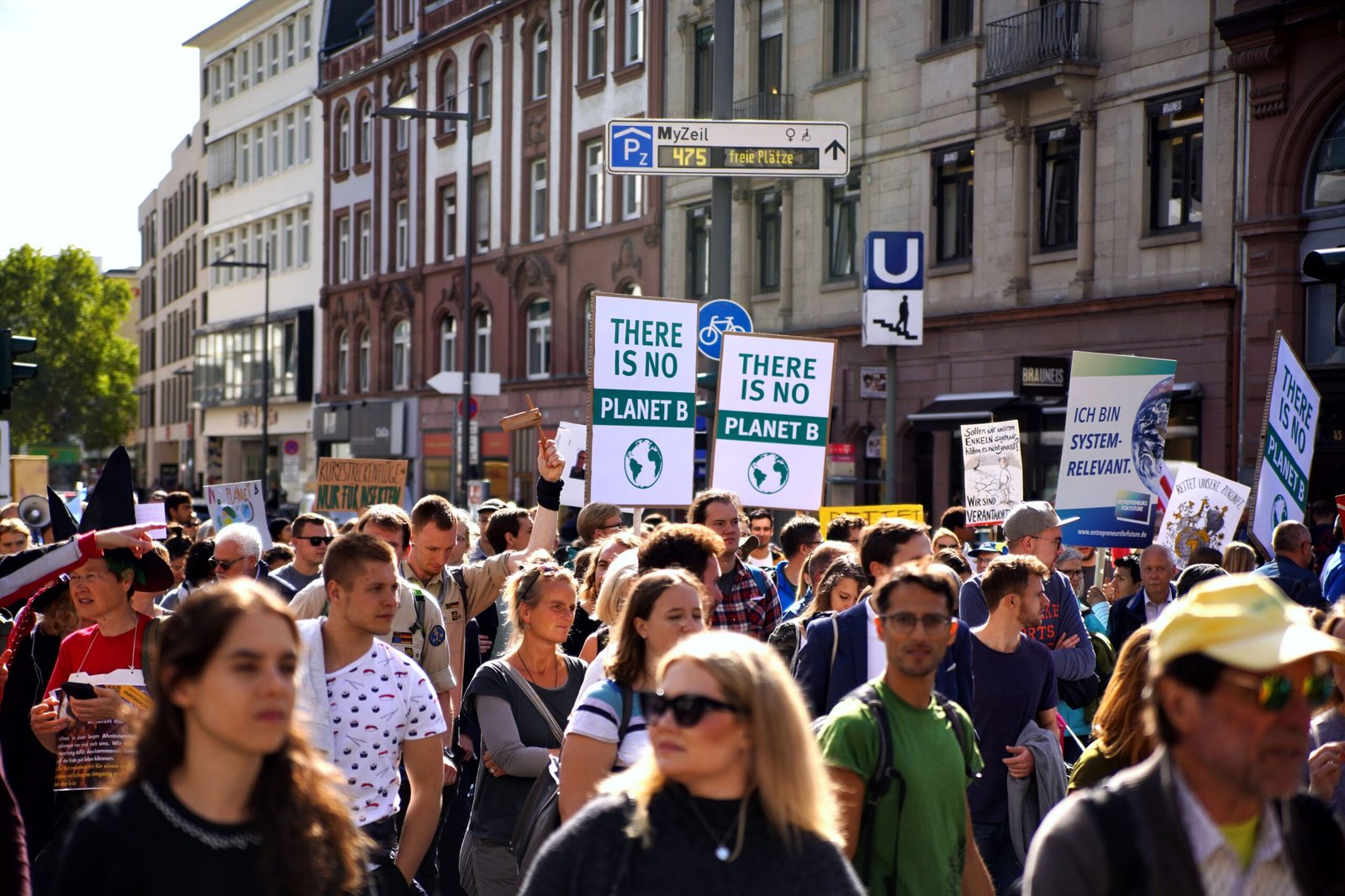
Climate protesters demand stronger action on global warming, highlighting the urgency of translating climate science into effective policy and international commitments.

Disagreement over the publication schedule of the world’s leading climate assessment has exposed a growing tension between the urgency of climate action and the need for equitable scientific participation.
The world’s leading climate science body is approaching a critical decision over when to publish its next major assessment, raising concerns that governments could enter the next phase of global climate negotiations without a comprehensive review of the latest climate science.
The Intergovernmental Panel on Climate Change (IPCC) has repeatedly failed to reach agreement on a timeline for its Seventh Assessment Report (AR7), with disagreements among member countries continuing for nearly three years. The dispute comes ahead of the second Global Stocktake under the Paris Agreement, scheduled to conclude in 2028, when countries will assess collective progress towards addressing climate change.
A Reuters report published on October 9 reported that the deadlock could complicate international climate negotiations. The disagreement centres on whether the IPCC should complete its three main working-group assessments in time to inform the 2028 process or allow additional time for drafting, review and approval.
The IPCC’s assessments inform international climate agreements and national decisions on emissions reduction, adaptation and climate finance. A delay could therefore affect not only when scientific findings become available, but also how governments use them to shape their next climate commitments.
A clash between urgency and equitable participation
The disagreement has exposed differences between countries over the pace of climate action and the conditions required to produce credible scientific assessments.
More than 30 countries, including European nations and small-island states, have supported efforts to complete the assessments in time for the 2028 Global Stocktake. They argue that governments need the most recent scientific evidence when evaluating whether existing climate commitments are sufficient.
Other countries, including India, China, Russia and Saudi Arabia, have called for more time. They argue that a compressed timetable could undermine the ability of researchers and governments in developing countries to review the reports and participate meaningfully in the assessment process.
These concerns matter because IPCC assessments involve extensive scientific drafting, expert review and government scrutiny. Researchers from countries with fewer resources may face constraints in funding, research infrastructure and the time available to contribute to a process that relies heavily on scientific expertise.
Electric vehicle charging point in an urban city.Representational image.Image credit:Pexels
However, the disagreement has also prompted concerns that a delay could weaken the connection between climate science and international decision-making. The competing positions raise a fundamental question: how can the IPCC ensure both timely assessments and fair participation without compromising scientific quality?
Carbon Brief reported in April that governments had failed to agree on the timeline across five consecutive IPCC sessions. The IPCC chair, Jim Skea, said the impasse had produced little progress on resolving the issue, although work on the assessments was continuing.
The disagreement does not mean that climate research has stopped. Scientists are continuing to draft the working-group reports, but uncertainty over the final schedule creates difficulties for planning reviews, meetings and the wider assessment process.
Why the 2028 deadline matters
The Global Stocktake is a central mechanism of the Paris Agreement. It evaluates how far countries have progressed towards the agreement’s goals and informs subsequent national climate plans.
The second stocktake is due to conclude in 2028 at COP33. If the IPCC’s working-group reports are not ready in time, negotiators could have to rely on existing assessments alongside other available scientific evidence.
The IPCC’s Seventh Assessment Report covers three broad areas: the physical science of climate change; climate impacts, adaptation and vulnerability; and options for reducing greenhouse gas emissions. Together, these assessments help governments understand the scale of climate risks and the choices available to address them.
The upcoming IPCC-65 meeting in Addis Ababa, Ethiopia, scheduled for October 12–16, is therefore an important opportunity for governments to seek agreement on the timetable. The outcome could determine whether the assessment process remains aligned with the 2028 stocktake.
For India and other developing countries, the debate has implications beyond scheduling. Their participation in climate assessments can influence how regional vulnerabilities, development priorities and adaptation needs are represented in the scientific evidence used by policymakers.
The challenge for the IPCC is to reconcile two objectives: delivering scientific findings when governments need them and ensuring that the process includes researchers from across regions and income levels.
As the meeting approaches, the question is no longer simply when the next climate assessment will be published. It is whether the international community can establish a timeline that preserves scientific credibility, broad participation and the usefulness of climate evidence for decisions that will shape the planet’s warming future.
Health
Extreme Heat Threatens Pregnancies, Exposing Gaps in Climate Adaptation Plans
Extreme heat is emerging as a growing threat to pregnancy and childbirth. Research from India and an international survey highlight the risks to maternal and newborn health, underscoring the need for stronger healthcare protections and climate adaptation plans.

Evidence from Tamil Nadu and a new international survey shows how rising temperatures threaten maternal and newborn health, with outdoor workers and rural women facing particular risks.
Extreme heat is emerging as a growing threat to pregnancy and childbirth, but climate adaptation plans risk overlooking the women and newborns most vulnerable to its effects. New international survey findings, alongside research from Tamil Nadu, point to a widening public-health challenge as rising temperatures threaten maternal health and expose inequalities in access to safe healthcare.
At least 73% of maternal healthcare professionals surveyed across five countries reported an increase in heat-related cases or complications affecting pregnant women over the past five years, according to a survey commissioned by global charitable foundation Wellcome. Meanwhile, 76% reported an increase in heat-related complications affecting foetal or newborn health.
The findings were highlighted by Simon Stiell, executive secretary of the United Nations Framework Convention on Climate Change (UNFCCC), at an event organised by Wellcome during the Pre-COP ministerial meeting in Fiji on October 5, ahead of the COP31 climate conference in Türkiye in November.
“Rising temperatures mean rising danger in pregnancy,” Stiell said, pointing to links between extreme heat during pregnancy and premature birth, stillbirth, low birth weight and maternal complications.
The survey covered 1,000 maternal healthcare professionals working in Australia, Brazil, India, the United Kingdom and Zimbabwe. It found that 81% were concerned that extreme heat would increasingly threaten maternal, foetal and newborn health without further action. Nearly all respondents had cared for a pregnant woman or baby whose health they believed had been affected by extreme heat, while 92% wanted more training and resources to protect pregnant women.
The findings highlight a critical gap in climate preparedness: although heat-health warnings are becoming increasingly important, pregnancy and newborn care are not always adequately incorporated into plans for responding to extreme temperatures.
Evidence from India highlights unequal risks
Research from Tamil Nadu adds to the growing evidence that occupational heat exposure can have serious consequences for pregnancy.
A prospective cohort study published in BJOG: An International Journal of Obstetrics & Gynaecology examined 800 pregnant women engaged in moderate to heavy physical work in Tamil Nadu. Researchers found that 47.3% experienced high occupational heat exposure. Among heat-exposed women, 29.6% experienced moderate dehydration, while 17.4% recorded an increase in core body temperature.
The study found that women exposed to high occupational heat had 2.4 times the adjusted odds of miscarriage and 2.3 times the adjusted odds of an adverse pregnancy outcome. The latter included outcomes such as miscarriage, preterm birth, low birth weight and stillbirth.
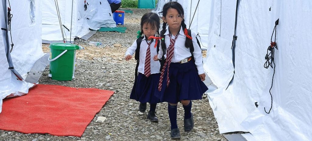
Children are attending school in temporary learning centres following the devastating floods in Nuwakot, Nepal, where climate change and glacial ice melt have played a significant factor.Image credit: UNICEF/Laxmi Prasad Ngakhusi
The researchers also found that high occupational heat exposure was associated with twice the adjusted odds of an adverse outcome at birth. Although the study establishes an association rather than proving that heat alone caused each outcome, it provides evidence of the risks faced by pregnant women working in hot conditions.
A separate observational cohort study involving 680 pregnant women across six Tamil Nadu districts examined differences between rural and urban populations. Researchers found that 55% of rural participants experienced heat exposure above the study’s permissible limit, compared with 45% of urban participants.
Rural women were also more likely to report heat-strain symptoms, including excessive thirst, fatigue, headaches and dizziness. After accounting for potential confounding factors, heat-exposed rural women had nearly twice the risk of adverse pregnancy outcomes and three times the risk of adverse birth outcomes compared with the study’s urban comparison group.
The study also found a fourfold higher risk of miscarriage among heat-exposed rural women during the first trimester compared with urban women. The researchers identified socioeconomic disadvantage, limited awareness of heat risks and reduced access to welfare facilities as factors that could contribute to rural women’s greater vulnerability.
Evidence from a separate study of 126,273 pregnancies recorded in India and Pakistan reinforces the concern. Researchers found that higher average maximum temperatures during the second trimester were associated with an increased risk of preterm birth. The relative risk was 1.05 for the study’s five-degree temperature contrast, indicating a 5% relative increase in risk—not a five-percentage-point increase in the absolute risk of premature birth.
Together, these studies suggest that heat exposure is not simply an environmental inconvenience during pregnancy. It can coincide with dehydration, physically demanding work and barriers to healthcare, creating risks that are unevenly distributed across communities.
From warnings to protection
Stiell warned that the effects of extreme heat are not shared equally. Pregnant women who work outdoors, live in poorly ventilated housing, travel long distances to clinics or depend on healthcare facilities without reliable electricity, water or cooling cannot be protected through public advice alone.
“Staying cool” is not a realistic option for families without access to cool spaces, he argued. Without targeted intervention, extreme heat could deepen existing inequalities in maternal healthcare, making a safe pregnancy increasingly dependent on income, geography and access to medical services.
Stiell outlined three priorities for governments: integrating pregnancy and newborn care into climate adaptation and heat-health planning; translating evidence into practical protection through healthcare-worker training, heat alerts and safer facilities; and improving data to identify where risks are growing and which interventions are effective.
For India, the findings have implications for heat-action plans, occupational safety and maternal healthcare. Measures could include heat-risk guidance during antenatal visits, better protection for pregnant outdoor workers, improved ventilation and cooling in maternity facilities, and reliable access to water and electricity during extreme heat.
The UN climate chief also called for adaptation-finance commitments agreed at COP30 in Belém, Brazil, to be delivered and for countries to work towards mobilising $1.3 trillion annually for developing countries.
Health is expected to remain a key priority in preparations for COP31, scheduled for November 9–20, 2026, in Türkiye’s Antalya province, under the Turkish presidency and with Australia leading negotiations.
The emerging evidence makes the policy challenge clear: protecting pregnant women and newborns must become part of climate resilience, rather than an afterthought. As temperatures rise, governments will need to assess climate action not only by emissions targets and financial commitments, but also by whether healthcare systems can protect people during pregnancy and give newborns a safe start to life.
Society
Inside Gas Kitchens, Workers Face Heat as High as 50°C
Commercial kitchen air pollution can exceed health guidelines, with gas kitchens exposing workers to heat, nitrogen dioxide, benzene and carbon monoxide.




India Captures 5.7% of Global Greenfield Investment, Outpacing China

World Mental Health Day: How Late-Night Scrolling May Be Disrupting Sleep and Fuelling Anxiety

Climate Science Faces a Deadline: Can the IPCC Deliver Before the 2028 Global Stocktake?

Knowing When to Think for Ourselves: AI, Intuition and the Education of Discernment

Puberty, Pregnancy and Menopause Reshape the Female Brain Differently, Study Finds

From Scams to Screens: How the National Stock Exchange Rewrote India’s Equity Story

Aim for the Stars: Anjali Thomas’s Journey from a Small College in Kerala to the Frontiers of Medical Imaging

Two Chemists Win Nobel Prize for Solving a Century-Old Puzzle: Why Life Picks One Hand Over the Other

India’s AI Moment Rests on More Than Code

Marshall Islands: Why the US Nuclear Legacy Is Back Before the UN

-

 Math3 months ago
The 2026 Fields Medals: Four Proofs, Four Decades-Old Problems Solved
-
Climate2 months ago
After Kerala’s Deadliest Landslide, the Hardest Thing to Rebuild Was Childhood
-
Society3 months ago
West Asia Crisis: Can Kerala’s Returning Gulf Migrants Find a Future in the Green Economy?
-
Space & Physics4 months ago
India Semiconductor Mission: ‘It’s Not About Fabs. It’s About Building An Entire Ecosystem’
-
Interviews2 weeks ago
From Scams to Screens: How the National Stock Exchange Rewrote India’s Equity Story
-
Climate4 months ago
The Climate World Cup? How Climate Change Could Affect Player Performance at the 2026 World Cup
-
Society3 months ago
What Is Civilisational Diplomacy? Understanding India’s Newest Foreign Policy Tool
-
Society4 months ago
From Bell Labs to the Classroom: A Second Career in Teaching