
Earth
India’s Green Cover Declined by 5.6 Percentage Points in 25 Years as Summer Heat Intensified: Study
A new study links India’s declining green cover to rising summer temperatures, highlighting the importance of vegetation conservation for climate adaptation.

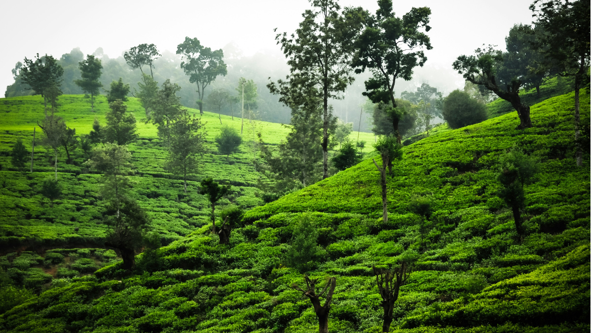
India’s green cover declined from approximately 36.95 per cent in 2001 to 31.35 per cent in 2025, while non-green surfaces expanded across the country, according to a new study by Climate Trends. The analysis found that non-green landscapes consistently recorded higher summer temperatures than vegetated areas, highlighting the role of green cover in moderating local heat.
The study, Assessment of Green Cover Dynamics and Their Influence on Summer Temperature across India Using MODIS Land Cover and ERA5 Reanalysis Data, found that the average summer temperature difference between green and non-green landscapes ranged from approximately 1°C to 2.5°C. Areas experiencing green-cover loss recorded a mean summer temperature increase of 0.26°C.
The findings suggest that vegetation loss can contribute to local warming, although the study also identifies broader regional climate change as a factor influencing temperature trends. Protecting and restoring vegetation could help reduce local thermal stress, but it cannot independently offset the effects of global warming.
“Vegetation is not merely an ecological asset; it is an important component of India’s climate-adaptation infrastructure,” said Dr Palak Balyan, Research Lead at Climate Trends.
The study comes amid growing concerns over extreme heat and its implications for public health, livelihoods and infrastructure. The India Meteorological Department reported that 2024 was the country’s warmest year since records began in 1901, with the annual mean temperature 0.65°C above the 1991–2020 average.
Vegetation Loss and the Local Heat Effect
The Climate Trends analysis used land-cover information from the Moderate Resolution Imaging Spectroradiometer (MODIS) and ERA5-Land temperature data to assess changes between 2001 and 2025. It examined summer conditions during March, April and May to understand how land-cover transitions corresponded with temperature patterns.
Vegetation helps regulate surface temperatures through shading and evapotranspiration, the process by which plants release water vapour into the atmosphere. Trees reduce the amount of solar radiation reaching the ground, while vegetation and soil moisture influence how energy is absorbed and released. When green landscapes are replaced by built-up areas, exposed ground or sparsely vegetated surfaces, these cooling mechanisms may weaken.
Dr Balyan said the persistent temperature difference between green and non-green landscapes demonstrated the importance of vegetation in regulating local thermal conditions.
“Protecting existing natural vegetation should therefore be treated as an adaptation priority, particularly in regions experiencing simultaneous green-cover loss and rising summer temperatures,” she said.
The findings are consistent with the Intergovernmental Panel on Climate Change’s assessment of nature-based cooling measures, which identifies urban trees, vegetation and green infrastructure as potential ways to reduce heat exposure. However, the extent of cooling depends on local climate, vegetation type, water availability and the surrounding built environment.
Regional Differences Require Targeted Action
The study found that green-cover loss was concentrated in parts of western India, the Indo-Gangetic Plain, central India and the peninsula. Localised gains were identified in portions of the northeastern states, the Himalayan foothills and scattered areas of southern and eastern India.
Temperature changes also varied geographically. Warming was particularly evident across northwestern and northern India, while localised cooling occurred in parts of central and southern India. These variations indicate that national averages can obscure differences in local land-use patterns and climate conditions.
The findings have implications for urban planning, particularly in rapidly expanding cities where construction can replace trees, open spaces and other vegetated landscapes. Protecting mature trees, retaining existing green spaces and integrating vegetation into streets and public areas could help reduce heat exposure, particularly in vulnerable neighbourhoods.
However, restoration must be planned around local ecological conditions. Newly planted trees cannot immediately provide the shade offered by mature canopies, and their survival depends on suitable species, soil conditions, water availability and long-term maintenance. Protecting established vegetation is therefore an important complement to new planting initiatives.
Green Cover Cannot Replace Broader Climate Action
The study emphasises that land-cover changes are not the only drivers of summer temperatures. Both green and non-green landscapes experienced warming during the study period, indicating the continuing influence of broader climatic conditions.
Dr S K Dhaka, Professor of Atmospheric Physics at the University of Delhi, cautioned against treating vegetation restoration as a standalone solution.
“Vegetation restoration can reduce local thermal stress, but it should not be viewed as a substitute for broader climate action,” he said.
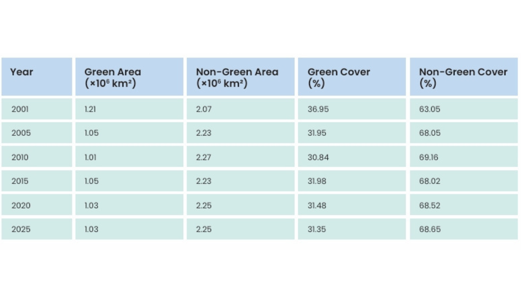
Temporal variation in green and non-green land cover across India
He added that warming observed even in areas that remained continuously green showed that large-scale climatic forces continued to influence regional temperatures.
“India therefore needs a dual strategy: prevent further loss of established vegetation while implementing scientifically targeted restoration in heat-vulnerable regions, alongside stronger action on water management, urban planning and greenhouse-gas emissions,” Dr Dhaka said.
The distinction is important because increasing vegetation alone cannot eliminate heat risks associated with rising background temperatures. Effective adaptation requires combining nature-based measures with emissions reduction, appropriate urban design and improved water management.
Aarti Khosla, Founder-Director of Climate Trends, said the study highlighted the practical consequences of losing vegetation.
“The study puts a number on something we’ve long argued, that vegetation is not a biodiversity afterthought, but a climate-adaptation infrastructure,” she said.
“Where green cover has disappeared, temperatures have risen with it, and that is a cost India’s communities are already paying for,” Khosla added.
She also pointed to international biodiversity commitments, including the target of restoring 30 per cent of degraded ecosystems by 2030, arguing that the gap between commitments and implementation has consequences for climate resilience.
The study recommends protecting existing vegetation, preventing avoidable green-cover loss and promoting ecological restoration as part of sustainable land management.
Its central message is that green cover should be considered more than an environmental amenity. While vegetation cannot prevent all forms of warming, conserving it can help moderate local temperatures and reduce thermal stress. As India faces increasing heat risks, integrating vegetation protection into climate adaptation and development planning could help build more resilient communities.






Earth
Brazil’s Amazon deforestation hits record low. Can the recovery last?
Forest clearing in Brazil’s Amazon fell 41.8% in a year, reaching its lowest level since satellite monitoring began in 1988. Stronger environmental enforcement has helped reverse years of rising forest loss, but agricultural expansion, damage from fires and gaps in land governance continue to threaten the country’s ecosystems.

For decades, the clearing of Brazil’s Amazon has carried consequences far beyond the land being cut down. The rainforest stores vast amounts of carbon, supports an extraordinary range of wildlife and helps regulate rainfall by releasing moisture into the atmosphere. Its trees, soils and waterways form part of a system that sustains ecosystems and livelihoods across the region. When forest is cleared, that system is disrupted: carbon enters the atmosphere, habitats shrink and the land can become more vulnerable to heat, drought and fire.
Brazil’s latest deforestation figures offer a significant change in that trajectory. Forest loss in the Amazon fell by 41.8% in the year to July 2026, reaching its lowest level since satellite monitoring began in 1988. The country’s National Institute for Space Research (INPE) estimates that 3,335 square kilometres were cleared between August 2025 and July 2026, compared with 5,731 square kilometres in the previous year.
The decline is a major achievement for President Luiz Inácio Lula da Silva’s administration, which has pledged to end deforestation by 2030. It also points to the influence of political choices on forest protection. After years in which Amazon forest loss rose sharply, Brazil has restored anti-deforestation programmes and strengthened environmental enforcement.
The progress matters. But the figures also raise a larger question: what does it take to sustain a decline in forest loss when agriculture, land use and political priorities continue to shape the fate of the Amazon?
Brazil’s Amazon: When Forest Loss Became a Political Choice
The Amazon’s recent history shows how strongly deforestation responds to government policy. Brazil had already demonstrated that forest loss could be reduced through coordinated action. In 2004, it launched the Action Plan for the Prevention and Control of Deforestation in the Legal Amazon, known by its Portuguese abbreviation, PPCDAm. The plan combined satellite monitoring and enforcement with measures related to land management and sustainable economic activity. It helped drive a major decline in deforestation during the following years.
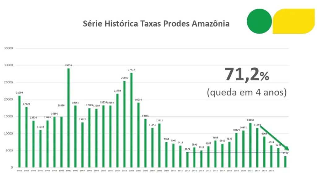
That progress later faltered. During Jair Bolsonaro’s presidency from 2019 to 2022, annual forest loss rose sharply, exceeding 13,000 square kilometres in 2021. The latest figure is around 71% below that peak, reflecting a substantial reversal of the trend.
The change under Lula began with a shift in the government’s approach. On taking office in January 2023, his administration reinstated PPCDAm and re-established an interministerial commission to coordinate action against deforestation. The renewed plan brought forest protection back into the work of multiple government departments, rather than leaving it solely to environmental agencies.
That distinction matters because illegal forest clearing is not simply a matter of people cutting down trees. It can involve land grabbing, the conversion of forest to pasture or farmland, and the expectation that cleared land will eventually be recognised or used for economic gain. Satellite monitoring can identify changes in forest cover, but stopping them requires agencies that can investigate violations, impose penalties and prevent illegal activity from continuing.
The Lula administration’s renewed emphasis on enforcement and its support for agencies such as Ibama, Brazil’s environmental protection agency, have been central to its strategy. Márcio Astrini, executive secretary of Brazil’s Climate Observatory, described the latest figures as evidence of what political commitment can achieve.
“The figures released today mark a historic achievement. They position Brazil as a global leader in forest protection and show the world that, with political will, it is possible to curb deforestation and greenhouse gas emissions”.
The result is significant, but it should not be attributed to a single intervention. The latest data show that deforestation has fallen during a period of stronger environmental enforcement and renewed policy commitments. They do not, by themselves, establish how much of the decline can be assigned to any one measure.
The Climate Value of Keeping Forests Standing
The consequences of the decline extend beyond Brazil. Forest clearing releases carbon stored in vegetation and soils, adding to greenhouse gas emissions. Preventing that loss helps preserve the Amazon’s role as a major carbon store at a time when countries are under pressure to reduce emissions.
The forest also influences regional rainfall. Trees draw water from the soil and release moisture into the atmosphere, contributing to the movement of water through the region. Large-scale forest loss can weaken this process, with implications for rainfall patterns and the ecosystems and agricultural activities that depend on them. Fragmentation also leaves remaining forest more exposed to surrounding disturbances, including fire.
For wildlife, the damage is direct. Clearing removes habitat and divides continuous forest into smaller patches, making it harder for some species to find food, shelter and breeding areas. Indigenous peoples and other forest-dependent communities also face consequences when clearing damages the landscapes on which their livelihoods and cultural practices depend.
Reducing deforestation helps limit these pressures, but it does not reverse damage already done. Forest that has been cleared cannot be counted as restored simply because the annual rate of new clearing has fallen. Recovery depends on the condition of the land, the extent of degradation and whether natural regeneration or active restoration is possible.
Cristiane Mazzetti, Greenpeace Brazil’s Zero Deforestation Coordinator, said the latest milestone reflected sustained investment in enforcement and the continuation of environmental policies. She also warned that the gains could be vulnerable to a change in political direction.
Her concern points to a central issue for Brazil: maintaining the decline will require consistent enforcement and long-term policy support, particularly when political leadership changes.
The Cerrado Presents a Different Challenge
The Amazon is not the only Brazilian ecosystem under pressure. Deforestation in the Cerrado, a vast tropical savannah that is also a major agricultural region, fell by 23.8% to about 5,517 square kilometres in the year to July 2026. This was the lowest level recorded since monitoring began in 2001.
The reduction is encouraging, but the Cerrado’s land-use pressures complicate the task of protecting it. Much of the clearing takes place on private properties under legally authorised land-use changes. Enforcement aimed at illegal deforestation cannot, on its own, prevent all vegetation loss where land conversion is permitted under existing rules.
This creates a broader policy challenge. Forest protection depends on detecting and penalising illegal clearing, but it also requires decisions about how much native vegetation can be converted, where agricultural expansion should take place and how landowners can earn a living while retaining natural ecosystems. The distinction between the Amazon and the Cerrado matters because the same enforcement approach will not address every cause of vegetation loss.
Record Low is Not an Endpoint
The latest Amazon estimate is preliminary and will be subject to final confirmation by INPE next year. Even so, the direction of change is clear: the area cleared fell substantially over the past year, reaching the lowest annual figure in the satellite record that began in 1988.
Brazil has committed to ending deforestation by 2030. Reaching that goal will require the country to sustain the present decline, tackle the incentives that make forest clearing profitable and protect the agencies responsible for enforcing environmental law. It will also require attention to ecosystems such as the Cerrado, where legal land conversion poses challenges beyond the reach of enforcement alone.
The latest figures show what can happen when forest protection becomes a government priority. Whether Brazil can maintain that progress will depend on the policies that follow—and on whether the country continues to treat its natural ecosystems as assets worth protecting over the long term.
Earth
Hunter Valley Coal Mine Gets Approval to Run to 2045. What Does It Mean for Australia’s Climate Transition?
Australia’s Hunter Valley coal mine has been approved to operate until 2045, raising questions about how the extension fits into the country’s transition towards lower emissions and its net-zero target.
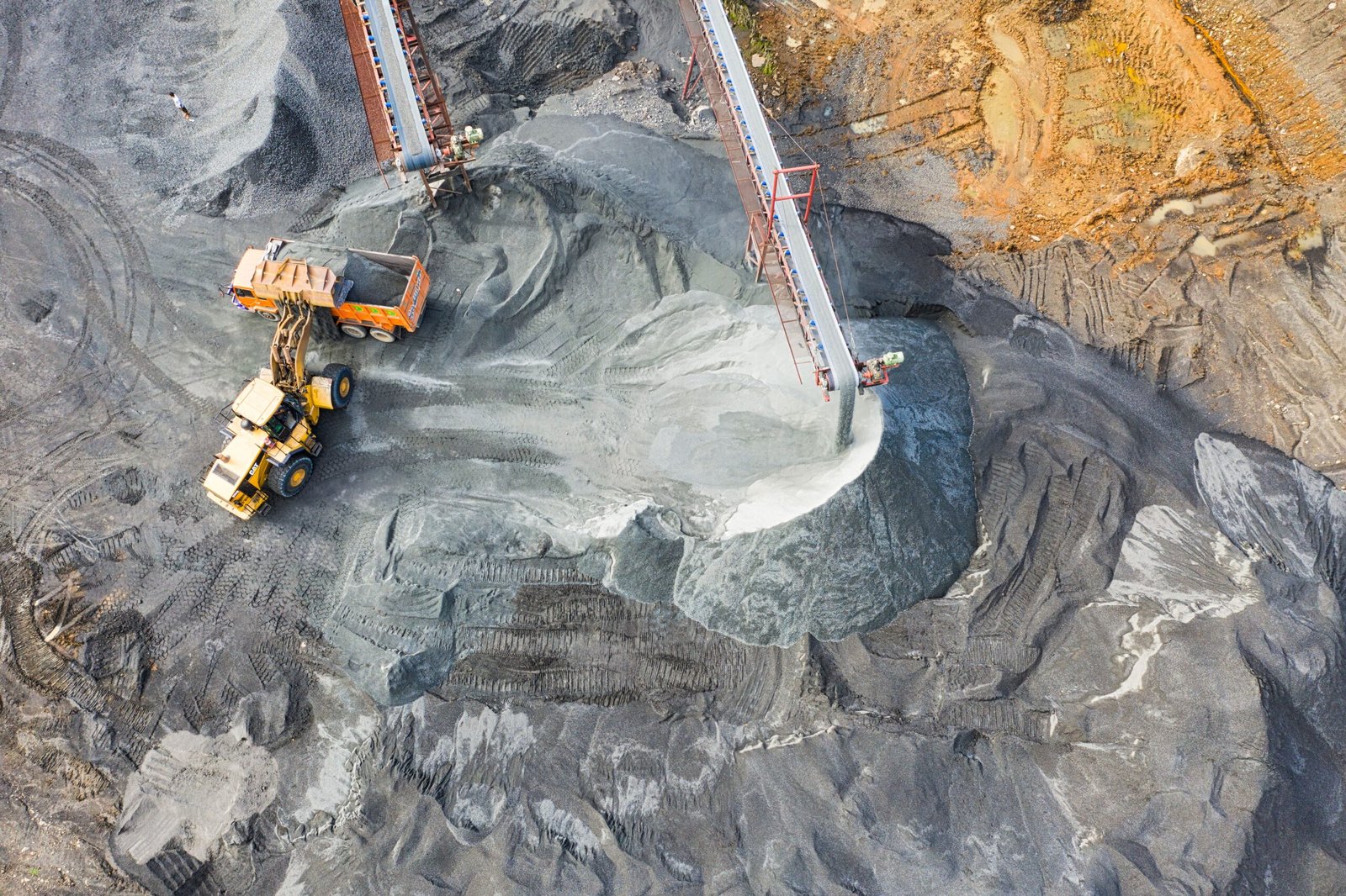
Australia’s transition away from fossil fuels faces a new test after New South Wales approved the continuation of the Hunter Valley Operations (HVO) coal mine until 2045.
The NSW Independent Planning Commission (IPC) on September 30 approved the continuation of HVO North until the end of 2045 and HVO South until the end of 2042. The project would allow an estimated 429 million tonnes of coal to be extracted from the Hunter Valley near Singleton.
The decision is significant not only because of the scale of the mine, but because it extends a major coal operation into the period in which Australia is committed to sharply reducing its greenhouse-gas emissions.
Australia’s current climate commitments include cutting national emissions by 43 per cent from 2005 levels by 2030 and by 62–70 per cent by 2035, with net-zero emissions targeted for 2050.
The latest government inventory estimates Australia’s emissions at 452.4 million tonnes of carbon dioxide equivalent in the year to June 2026, a preliminary 1.8 per cent decline from the previous year. Emissions in the year to March 2026 were 25 per cent below 2005 levels.
Against that backdrop, the IPC acknowledged that the HVO project would have a substantial climate footprint. Its statement of reasons estimates that the project could result in about 809 million tonnes of greenhouse-gas emissions from local mining operations and the eventual combustion of exported coal overseas. The commission said those emissions would contribute to climate impacts in the Hunter, NSW and globally.
The 809-million-tonne figure needs an important qualification to note. it is a lifecycle-related estimate that includes overseas combustion emissions and should not be interpreted as emissions produced directly by the mine.
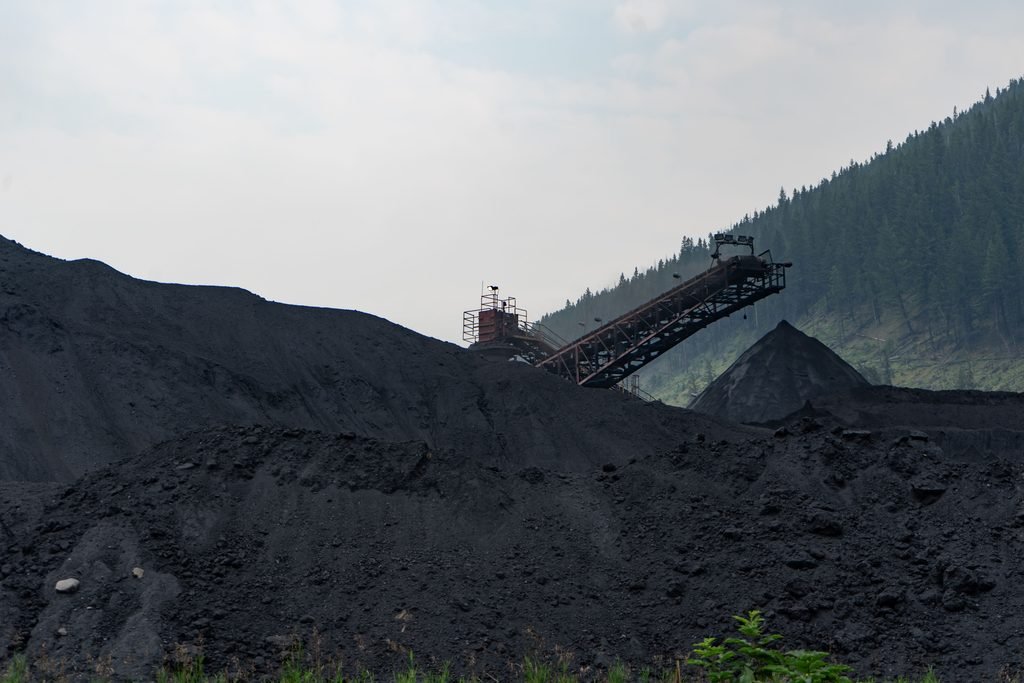
Coal mine.Representational image.Image credit:Pexels
The economic case for the extension is substantial. HVO employs more than 1,500 people and engages more than 800 suppliers, according to evidence presented to the IPC. The NSW Government says the continuation could secure up to 1,500 ongoing jobs and create about 600 temporary positions through infrastructure upgrades, subject to federal approval.
The approval also comes with conditions intended to address the mine’s emissions and its eventual transition. HVO must prepare a Scope 3 Management Plan dealing with emissions associated with exported coal, maximise renewable electricity use at the mine and purchase additional carbon offsets. It must also prepare a comprehensive closure plan within 12 months, in consultation with local councils and communities, outlining how the mine will transition towards closure while supporting workers and the local economy.
The NSW Government argues that the decision can support regional employment while maintaining the state’s broader emissions-reduction pathway. It says the approved proposal has 43 per cent lower Scope 1 emissions than the company’s 2022 application. NSW’s 2026–50 coal policy also allows extensions of existing mines while ruling out applications for new greenfield coal mines.
At the national level, the federal Safeguard Mechanism is intended to reduce emissions from Australia’s largest industrial facilities. The government says the mechanism is designed to put covered facilities on a trajectory consistent with the country’s 2030 target and net-zero goal.
That creates the central question around HVO’s extension. How does Australia manages the economic and employment role of existing coal regions while reducing emissions over the same period.
The NSW approval does not settle that question. The project still requires approval from the Australian Government under the Environment Protection and Biodiversity Conservation Act.
For the Hunter Valley, the decision provides a longer operating horizon for an established coal industry. For Australia’s climate transition, it brings the challenge of managing an economy in which existing fossil-fuel assets continue operating while national policy seeks progressively sustainable energy and lower emissions.
Earth
Earth is Heating Up: The Economic Cost of a Rising Sea
Rising seas are turning coastal exposure into an economic challenge. Cities must weigh the cost of protecting infrastructure, livelihoods and communities against the growing risks of inaction.
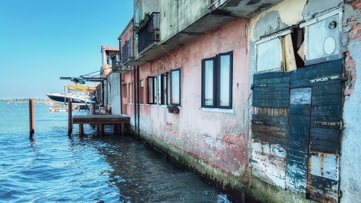
For Mumbai, the sea has always been an economic asset. Its position along the Arabian Sea helped turn the city into a centre of trade, finance, industry and transport. But the same coastline that sustains its economy also exposes homes, roads, businesses and critical infrastructure to flooding and rising sea-level. The United Nations identifies Mumbai and Kolkata, along with Dhaka, as low-lying South Asian cities where more than 14 million people face the immediate risk of losing their homes to permanent inundation.
What rising seas cost, however, depends on what a coastline holds. In Bangladesh, a one-metre rise could inundate around 4,000 sq km of land, nearly 3% of the country and climate impacts including rising seas could force more than 13 million people to move within the country by 2050. In Saint Kitts and Nevis, saltwater intrusion threatens the freshwater aquifers on which communities depend. In New York City, sea levels could rise by up to 1.3 metres by the end of the century, putting a vast concentration of infrastructure and economic activity at greater risk.
Around 770 million people, roughly one in every 10 people on Earth, live in coastal areas less than five metres above the high-tide line. Nearly 900 million people live in low-lying coastal zones, and more than one billion could be exposed to coastal hazards by 2050. These are not empty margins of the map. They contain ports, roads, industries, homes, tourism facilities and freshwater systems that support economies and everyday life.
That makes sea-level rise more than a question of where the water will reach. It is a question of what sits in its path, who depends on it, and how much it will cost to protect, rebuild or relocate what cannot be saved.
The Baseline is Already Moving
Global mean sea level remained near the record high observed in 2024, according to the World Meteorological Organization’s State of the Global Climate 2025. Between 2012 and 2025, sea level rose at an average rate of 4.75 millimetres a year, compared with 2.65 mm a year between 1993 and 2011. In 2024 alone, global mean sea level rose 5.9 mm, the highest annual increase in the satellite record, with exceptional ocean warming a major factor.
The economic significance lies in what that extra water does to the baseline. A higher sea means tides can reach critical infrastructure more often. Storm surges can travel farther inland. Drainage systems can become less effective. Flooding that was once rare can become recurrent, bringing repeated repair costs and disruption.
The UN estimates that an extreme sea-level event that historically occurred once every 100 years could occur at least annually at more than half of the world’s tide-gauge locations by 2100 under all the scenarios examined. For businesses and governments, that changes the economics of risk.
When the Sea Threatens More Than Land
Mexico’s coastline is more than a boundary between land and sea. With more than 11,000 kilometres of coastline and nearly half its population living in coastal states, the country is already confronting the wider consequences of a rising sea.
In its contribution to the UN negotiations, Mexico said sea-level rise is putting pressure on ecosystems, infrastructure, livelihoods and water security. Its message was that the response cannot stop at protecting land from encroaching water. It must address the systems and communities that depend on vulnerable coasts. Mexico also called for the international response to move from broad commitments towards a smaller set of clear, actionable priorities, grounded in international law.
That shifts the question from how much land could be lost to the sea to what happens to the people and systems that depend on that land. For coastal countries, that distinction could determine how the cost of rising seas is ultimately distributed.
Trillions of Dollars are Exposed
The physical assets at risk are already enormous. Infrastructure worth at least 1.8 trillion dollars is exposed to sea-level risks globally. More than 80% of global goods trade is carried by sea, making ports and the networks connected to them particularly important to the world economy.
The potential losses rise sharply as sea levels climb. The UN report cites estimates of $1.7 trillion to 5.5 dollars trillion in residual damage costs from sea-level rise over the coming century. A global mean sea-level rise of 20 centimetres by 2050 could contribute to more than $1 trillion in annual flood losses across the world’s 136 largest coastal cities. Without adaptation, global annual losses have been estimated at 1.2 trillion dollars to 4 trillion dollars.
These figures capture more than the cost of repairing flooded buildings. A damaged port can interrupt manufacturing hundreds of kilometres inland. Flooded roads can prevent workers from reaching businesses. Power and sanitation failures can halt economic activity. Repeated disruption can make coastal locations more expensive to insure and less attractive for investment. The economic damage can therefore travel well beyond the flood line.
Cities Face a Compounding Bill
Coastal cities concentrate both people and capital. Their economic advantage has historically come partly from proximity to the sea. Ports connect them to global trade. Waterfronts support tourism and real estate. Rivers and estuaries provide transport, fisheries and access to freshwater.
The same geography now creates concentrated exposure. Nearly 500 million people live in low-lying river-ocean zones. In South Asia, more than 14 million people in low-lying cities, including Mumbai and Kolkata, are identified as being at immediate risk of losing their homes to permanent inundation. In some areas, land subsidence compounds sea-level rise, increasing the rate at which relative water levels rise.
For households, the consequences can include damaged homes, lost income and rising costs of recovery. For cities, the bill can include repeated repairs to roads, drainage, public buildings and utilities. And there is a less visible cost: the money that must be spent simply to keep existing systems functioning as the baseline changes.
India: Exposure Meets Rapid Development
India’s coastline makes the challenge clearer. Coastal cities and industrial regions are expanding alongside a coastline exposed to cyclones, storm surges, flooding and erosion. As development continues, more assets are being placed in areas where future climate risks need to be considered.
INCOIS has assessed future changes in average and extreme sea levels at 11 locations of India’s coast and islands. Under the high-emissions SSP5-8.5 scenario, relative mean sea level by 2100 is projected to rise between 0.62 metres at Visakhapatnam and 0.87 metres at Bhavnagar, relative to the 1995–2014 baseline.
Projected extreme sea-level increases are higher, ranging from 0.68 metres at Chennai to 1.12 metres at Bhavnagar. These numbers matter economically because cities do not experience mean sea level in isolation. A higher baseline interacts with tides, cyclones, storm surges and waves, increasing the potential for damaging events.

INCOIS found that coastal regions north of 13°N are particularly vulnerable to changes in extreme sea levels, with the Gulf of Gujarat and northern Bay of Bengal showing some of the largest changes in tidal maxima and climate extremes. The challenge for India is therefore not simply protecting today’s coastline. It is deciding where tomorrow’s infrastructure, housing and economic activity should be concentrated.
The Cost of Adaptation
Avoiding losses will itself require substantial investment. The UN estimates that developing countries need 310 billion dollars to 365 billion dollars every year for adaptation, while adaptation finance stood at about 26 billion dollars in 2023. Adaptation costs in developing countries are estimated to be 10–18 times current public adaptation finance.
Cities may need to strengthen drainage, raise roads, protect ports, upgrade water systems and reinforce critical infrastructure. Coastal ecosystems may need restoration and space to migrate inland. Some communities may eventually require planned relocation. A seawall may make sense around a densely developed port. A wetland may offer better protection in another location. In places facing persistent inundation, continuing to rebuild may cost more than planned relocation.
The UN report points to a combination of measures, including risk-informed planning, early-warning systems, resilient infrastructure, nature-based approaches and, where necessary, relocation.
Paying Later Could Cost More
One of the central economic questions is timing. Sea-level rise is a slow-onset hazard. Its costs accumulate gradually, while much disaster financing is designed around sudden events. Waiting until repeated flooding becomes a crisis can leave governments paying for emergency repairs instead of planned adaptation.
Money spent before infrastructure is repeatedly damaged can reduce future losses. Coastal planning can prevent new assets from being locked into high-risk locations. Early-warning systems can limit casualties and economic disruption. Protecting wetlands can preserve a natural buffer while supporting fisheries and other livelihoods. Adaptation is therefore not simply an expenditure. It can also be a way of limiting future losses.
Changing Coastline, an Economic Choice
The ocean will continue to rise for centuries because of heat already stored in the climate system and the slow response of glaciers and ice sheets. The economic question is how societies respond to that trajectory.
The sea will not wait for cities to settle their priorities. For Mumbai, rising seas will shape decisions about what to protect, where to build and how much risk communities can bear. The water may rise gradually. The cost of being unprepared will not.


India’s Green Cover Declined by 5.6 Percentage Points in 25 Years as Summer Heat Intensified: Study

Europe’s 2026 Heatwaves Linked to More Than 32,000 Deaths, Study Estimates

What Does Changing Western Disturbances Mean for Himalayan Rainfall?

Greece Passes Social Media Ban for Children Under 15

Istanbul Floods Reveal How Climate Change and Urbanisation Combine to Raise Flood Risks

Knowing When to Think for Ourselves: AI, Intuition and the Education of Discernment

After a Scorching Summer, Delhi’s Children Are Slow to Return Outdoors

Two Chemists Win Nobel Prize for Solving a Century-Old Puzzle: Why Life Picks One Hand Over the Other

Marshall Islands: Why the US Nuclear Legacy Is Back Before the UN

How Wind Turbines Could Produce More Power From the Same Wind

-

 Math3 months ago
The 2026 Fields Medals: Four Proofs, Four Decades-Old Problems Solved
-
EP Deep Dive: Data & Solutions3 months ago
After Kerala’s Deadliest Landslide, the Hardest Thing to Rebuild Was Childhood
-
EP Deep Dive: Data & Solutions4 months ago
West Asia Crisis: Can Kerala’s Returning Gulf Migrants Find a Future in the Green Economy?
-
Space & Physics5 months ago
India Semiconductor Mission: ‘It’s Not About Fabs. It’s About Building An Entire Ecosystem’
-
Interviews1 month ago
From Scams to Screens: How the National Stock Exchange Rewrote India’s Equity Story
-
Climate5 months ago
The Climate World Cup? How Climate Change Could Affect Player Performance at the 2026 World Cup
-
Society4 months ago
What Is Civilisational Diplomacy? Understanding India’s Newest Foreign Policy Tool
-
Society4 months ago
From Bell Labs to the Classroom: A Second Career in Teaching