
Earth
Five Deaths in a Week: How Kerala’s Heatwave Is Driving Snakes Indoors
Rising heat is driving snakes into human spaces. Kerala’s deaths highlight how climate change is reshaping snakebite risk across India.




Climate change is rewriting the boundaries between human spaces and snake habitats. Kerala’s deadly summer of 2026 is the latest — and most visible — chapter in a global crisis hiding in plain sight.
By Dipin Damodharan & Lakshmi Narayanan
The pencil drawing of a crowned king is still on the wall. It sits low — only as high as a small boy could reach. Dikshal was eight years old when he drew it, and eight years old when he died, bitten by a cobra that had slipped into his home in Chirayinkeezhu, Thiruvananthapuram, Kerala, seeking refuge from the punishing April heat. The snake was found later, hiding beneath a sewing machine.
His family had heard about the snakebite deaths spreading across Kerala. They had covered the gaps in their walls with sheets, reasoning that the heat inside would keep snakes away. They had never seen a venomous snake near their home before. When Dikshal woke complaining of a wound, his father Dileep could not make out the bite mark — there was only one puncture, not the two most people expect. The family rushed him to the nearest taluk hospital. Staff, uncertain whether it was a snakebite, did not administer anti-venom. By the time Dikshal reached the Medical College Hospital in Thiruvananthapuram, he had stopped breathing.
He was not alone. On April 18, eight-year-old Aljo from Kodakara in Thrissur district died after being bitten by a common krait while asleep. His brother Anoj was also bitten and remained in treatment. Within days, Kerala had recorded around five snakebite deaths in a single week, prompting widespread alarm. The answer to where all these snakes had suddenly come from, scientists and field workers say, is not sudden at all. Kerala lost 660 people to snakebites over the last decade.
The Physics of a Cold-Blooded Crisis
Snakes are ectotherms — cold-blooded creatures whose body temperature, metabolism, and behaviour are governed entirely by their external environment. Mithun A.S., an experienced snake rescuer who has worked across Kerala, explains it plainly: snakes depend entirely on external sources to maintain their body temperature. When the environment becomes too hot to sustain them, they do not adapt. They move.
“When temperatures cross a threshold, their metabolism accelerates, their need for food increases, and their natural burrows become unbearably hot,” Mithun says. “They have no choice but to come out and find somewhere cooler.”
In a Kerala summer that has broken decade-long heat records, that somewhere is increasingly inside our homes. As cold-blooded animals, snakes cannot regulate their body temperature or sweat, so they come out in search of cooler conditions. This is also the breeding season, which increases the likelihood of human-snake encounters.
What makes this moment particularly dangerous, Mithun notes, is the combination of heat and hunger. As metabolism speeds up, snakes need to feed more frequently. They are not only seeking cool shelter — they are also actively hunting. The two imperatives together drive them deeper into human territory than they would ordinarily venture.
The Microclimate We Built for Them
Krishnan T.J., a SARPA volunteer and snake expert with years of field experience across Kerala, has a precise term for what is happening to our homes. They have become microclimates — islands of thermal relief in an increasingly hostile landscape.
“Our bathrooms, our wells, our shaded corners — these are now the coolest places available to a snake within range,” Krishnan says. “The water sources outside are drying up. The burrows are overheating. The snake is not invading. It is surviving.”
The ecological concept behind this observation is microhabitat compression — as climate change narrows the zones where temperature, moisture, and shelter align, both humans and wildlife converge on the same shrinking refuges. In Kerala’s case, that refuge is often a tiled bathroom floor, the space beneath a bed, or the cool shadow of a sewing machine.
Krishnan points to the role of ornamental plants that climb walls, cracks in compound walls, and gaps in roofing as the entry points snakes most commonly exploit. “People grow decorative creepers along their walls and think nothing of it,” he says. “For a snake, that is a ladder.” The physical infrastructure of the Kerala home — designed for ventilation and shade in a warm climate — has inadvertently become optimal snake habitat.
Breeding Season and the Invisible Danger
Muhammed Anwar, nodal officer for Mission SARPA under Kerala’s Forest Department, adds a dimension that makes the current moment even more acute. April and May are not just the hottest months in Kerala — they are also when the Big Four venomous species hatch.
“The cobra, the krait, the Russell’s viper — this is their breeding season,” Anwar explains. “The hatchlings carry venom as potent as the adults. They are smaller and harder to see. And they are looking for exactly the same cool, damp spaces that the adults are.”
This convergence — record heat, accelerated snake activity, and a new generation of venomous juveniles dispersing across the landscape — is what transformed April 2026 into something beyond a seasonal spike. Anwar is particularly concerned about the structural features of Kerala homes that create easy access. “Ornamental plants climbing walls, gaps in compound walls, cracks where pipes enter — these are the highways,” he says. “And once inside, a snake will settle in the coolest spot it can find. That is often exactly where a child sleeps.”
Anwar has been at the centre of Kerala’s effort to reduce snakebite deaths since the SARPA programme launched in 2020. Chief Minister Pinarayi Vijayan has stated the programme’s goal as bringing snakebite deaths in the state to zero. The infrastructure — over 1,200 trained rescuers, a public app, and rapid response protocols— is among the most developed in India. But Anwar is candid about the limits of even the best response system when the underlying environmental conditions keep worsening.
India’s Hidden Epidemic
What is unfolding in Kerala is a concentrated, visible expression of something far larger across the subcontinent. India had an estimated 1.2 million snakebite deaths between 2000 and 2019 — an average of 58,000 per year. Over a quarter of those deaths were children under 15. Most occurred at home, in rural areas.
India accounts for approximately half of all snakebite-related deaths globally. Every year, an estimated 5.4 million people worldwide are bitten by snakes, resulting in as many as 138,000 deaths and three times as many cases of permanent disability. The World Health Organization classified snakebite as a neglected tropical disease in 2017, with a target to halve deaths by 2030. That target now looks increasingly difficult to meet — not because medicine has failed to advance, but because the climate is accelerating the problem faster than health systems can absorb it.
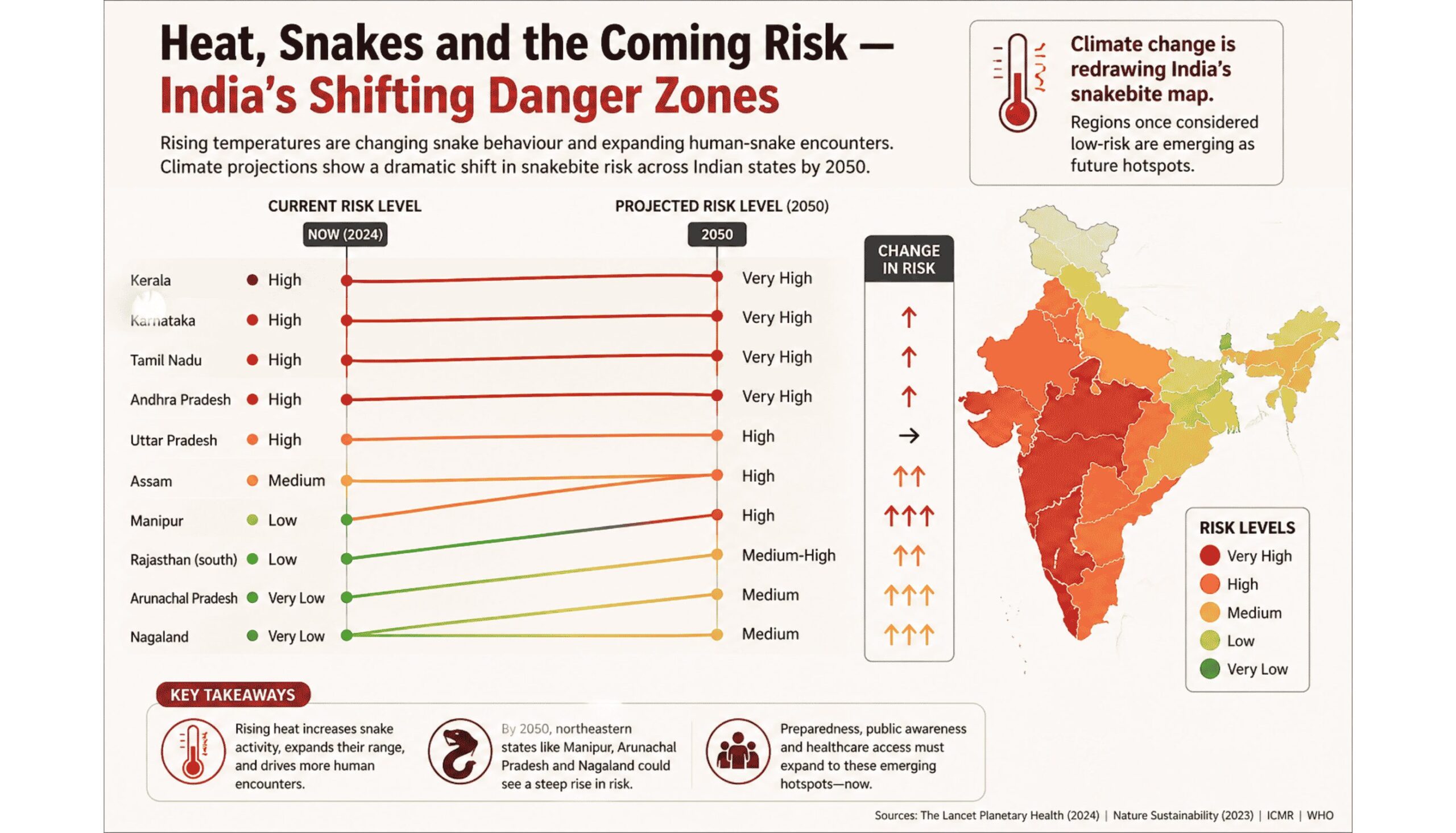
A landmark study published in PLOS Neglected Tropical Diseases in 2025, conducted by Indian and South Korean scientists, modelled the future distribution of India’s Big Four venomous species under climate change scenarios through 2080. Climate change is anticipated to significantly impact the distribution of snakes, leading to notable shifts in their habitats towards human-dominated landscapes. Under future scenarios, many northern and northeastern states — including parts of Assam, Manipur, and Rajasthan — are projected to show dramatically increased snakebite risk, in regions that currently have minimal suitable snake habitat. The snakebite map of India is being redrawn.
Did You Know? Kerala lost 660 people to snakebites over the last decade. India as a whole records between 46,000 and 58,000 snakebite deaths every year — more than any other country in the world, and roughly half the global total. The WHO has set a target to halve global snakebite deaths by 2030. Climate scientists say rising temperatures will make that target significantly harder to achieve unless the environmental drivers are addressed alongside the medical ones.
A 2025 cross-sectional survey published in Nature Communications found that nearly half of snakebite deaths in India occur outside hospital settings, falling overwhelmingly on rural, low-income households. Dikshal’s father told reporters the family had no safe place to sleep. Kerala declared itself free of extreme poverty in November 2025. The distance between that declaration and a child dying on a floor because his family could not afford a bed illustrates precisely how climate risk compounds existing vulnerability — not abstractly, but fatally.
A Global Pattern
The Kerala deaths of April 2026 are not anomalous. They are, in the language of climate science, a signal. Research published in The Lancet Planetary Health has established a direct correlation between rising temperatures and snakebite incidence. An Oxford University study projects that by 2050, 41% of the global population will be exposed to extreme heat events — with South Asia absorbing the largest share. Similar patterns of snakes moving into urban and peri-urban spaces have been documented in Australia and across sub-Saharan Africa as temperatures rise. According to a Climate Central analysis, in 47 countries, every single day of what scientists classify as “risky heat” was attributable to climate change.
The communities most exposed are precisely those least equipped to respond: rural households with limited access to antivenom, local hospitals uncertain about diagnosis, and families who cannot afford the beds and mosquito nets that would keep a sleeping child above the floor.
The Ecological Argument
There is a dimension of this crisis that public health conversations consistently underweight. Snakes are not the enemy. As Krishnan T.J. puts it: “The snake did not choose to come into your home. Your home became the safest place in its world.”
Snakes play a crucial ecological role by controlling populations of rats and rodents, which spread diseases like leptospirosis and plague and damage crops. The panic-driven killing of non-venomous species disrupts the very ecological balance that keeps those populations in check. Mithun A.S. has watched this cycle play out repeatedly. “Every summer, people kill dozens of harmless snakes out of fear. The rats multiply. The crops suffer. And the venomous snakes, the ones people are actually afraid of, keep coming — because the food is there.”
The WHO’s classification of snakebite as a neglected tropical disease recognised the medical emergency. What remains underrecognised is its ecological dimension — that snakebite mortality is, at least in part, a symptom of ecosystem breakdown driven by rising heat.
What Must Change
Muhammed Anwar’s immediate guidance is practical: maintain clean surroundings, remove woodpiles and debris from around homes, seal wall cracks and pipe gaps, trim ornamental climbing plants, use torches at night, sleep on raised beds with nets properly secured. If a snake is spotted, do not attempt to catch or kill it — call SARPA. If bitten, follow the Do it RIGHT protocol: Reassure, Immobilise, Go to Hospital, Tell the Doctor. Do not waste time on traditional remedies. The first hour is the only variable that can be controlled once a bite has occurred.
But beyond the immediate, Anwar, Krishnan, and Mithun all point to the same deeper truth: the precautions help at the margins. They do not address the driver.
As long as temperatures continue to rise — compressing the thermal refuges available to both humans and reptiles, pushing snakes into spaces that used to be ours alone — the encounters will multiply. Kerala’s SARPA programme is one of the most sophisticated snakebite response systems in India. It cannot outrun the climate.
The snakes entering Kerala’s bedrooms and hiding beneath its sewing machines are not acting out of aggression. They are doing what every living creature does when its habitat becomes uninhabitable. They are looking for somewhere cooler to survive.
So, increasingly, are we.








Earth
Scientists Map Earth’s Sand Dunes in a New Global Survey
A new global map of Earth’s sand dunes is giving scientists a clearer picture of how wind, sediment and climate interact to shape dry landscapes. The dataset could also help researchers interpret ancient climates on Earth and dune patterns on Mars.

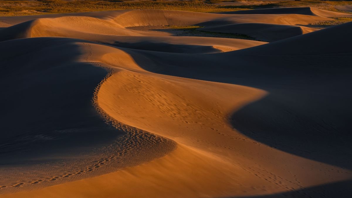
Scientists have mapped the distribution of Earth’s wind-blown sand dunes at a global scale, providing a new way to study how sediment, wind and climate shape some of the planet’s driest landscapes. A sand dune is a hill or ridge of loose sand that has been formed and shaped by the wind. Dunes are commonly found in deserts and along beaches, wherever there is plenty of loose sand and enough wind to move it. Sand dunes are mainly classified into barchan (crescent-shaped), linear, star, parabolic, and transverse dunes, based on their shape and wind patterns.
The study, published in Nature Communications, finds that dune formation cannot be explained by aridity or wind speed alone. In dry regions, dunes are strongly associated with the movement of sediment towards areas where it accumulates. In wetter regions, stronger winds are needed to move enough sand to overcome the effects of vegetation and other surface conditions.
Andrew Gunn, a researcher at Monash University’s School of Earth, Atmosphere and Environment, built the map using globally available satellite imagery and topographic data. The resulting dataset identifies dunes across Earth’s continents and distinguishes their different forms.
The map covers dunes detected across about 7.8% of Earth’s surface. Their distribution is concentrated largely in the lower mid-latitudes, although the study found that the presence of dunes depends on a combination of sediment supply and the way wind transports that material.
Wind is Only Part of the Story
A desert may have strong winds and still lack dunes.
That is because wind needs loose sediment to move. The study found that in arid landscapes, the location of a dune field is closely tied to the availability and movement of sediment. Where material is supplied from several directions and transported towards the same area, sand can accumulate and produce dunes.
The picture changes in places with more rainfall. Vegetation and surface moisture can hold sediment in place, meaning winds need to be stronger before enough sand starts moving to build dunes.
The distinction matters when scientists use dunes as evidence of past environments. A dune’s shape and orientation can preserve information about the winds that formed it, but those features can also reflect the source and movement of the sand itself.
The researchers demonstrated this using barchan dunes, the crescent-shaped formations commonly found in areas where winds blow predominantly in one direction. Their orientation can provide information about wind direction, while their arrangement can also reveal something about sediment transport.
A Reference Point for Past Climates
Dunes can outlast the conditions that created them. Their position and form can therefore provide clues about earlier wind regimes, sediment movement and climate, particularly in places where direct observations do not exist. The new dataset gives researchers a consistent global reference rather than requiring them to compare separate regional maps made using different methods. That could be useful for studies of how dry landscapes have changed over time and how wind-driven erosion may respond to shifts in climate.
The map also has a planetary application. Mars has extensive dune fields, but scientists cannot measure its surface winds with anything close to the coverage available on Earth. Dune forms are therefore among the clues used to reconstruct Martian surface conditions.
The Earth dataset does not provide a direct translation from one planet to the other. Instead, it gives researchers a better understanding of how particular dune shapes relate to wind and sediment on Earth, which can inform interpretations of similar landforms on Mars.
The study’s value gives scientists a common dataset for asking why dunes occur where they do — and what their patterns can tell us about the landscapes that produced them.
Climate
Record Drought and Extreme Heat Push European Rivers to Lows as Wildfires Spread North
The European drought is driving rivers to record lows as extreme heat, wildfires, crop losses and water shortages put Europe’s energy and transport systems under pressure.

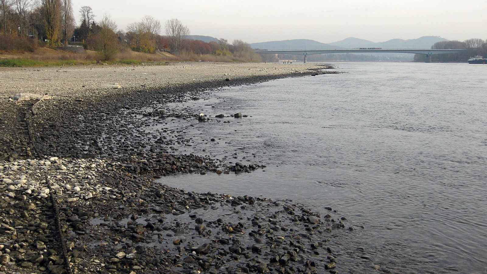
A prolonged European drought combined with extreme heat is pushing major rivers to record lows, disrupting shipping and energy production while worsening crop losses and wildfire risks. As dry conditions spread north, Europe’s water, agriculture, ecosystems and public health systems are coming under increasing pressure.
A long period of low rainfall combined with extreme heatwaves has placed half of the European Union and the United Kingdom under drought conditions. A report published on August 12 by the European Commission Joint Research Centre and the European Drought Observatory reveals that nine percent of the region reached a critical alert level by late July.
Satellite data from Copernicus, the Earth monitoring program of the European Union, shows that severely dry soil is now damaging crops and plants across the continent. In its latest assessment, the observatory warned that “the drought has built up since early spring due to lower rainfall and higher than average temperatures, turning into fuel for devastating wildfires.”
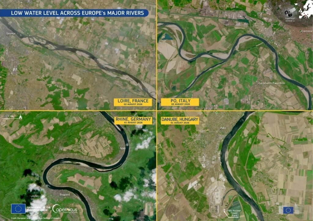
European Drought Reaches Across the Continent
The lack of rain has driven four of Europe’s largest rivers—the Rhine, Danube, Loire, and Po—to dangerously low levels. Near Cologne, Germany, the Rhine fell to a fresh record low of 49 centimetres by mid-August, according to the Rhine Waterways and Shipping Authority — nearly 20 centimetres below the previous record of 68 centimetres set earlier in the summer, which had itself broken the prior all-time low recorded in 2018. Because large cargo boats need deeper water to float safely, operators have been forced to carry much lighter loads to avoid getting stuck on the riverbed, and in places river traffic has largely halted. Carrying smaller loads requires more trips, creating major shipping delays for important industrial materials across central Europe.
At the same time, low water levels and rising temperatures are creating a serious energy crisis across the continent. In France, power companies had to cut back nuclear energy production because river water became too warm to safely cool reactors without harming aquatic life. Hydroelectric power generation has also plunged across the Alps, northern Italy, and central-eastern Europe. Copernicus analysts noted that low river flows on the Danube are creating “serious operational challenges” for power plant cooling. In Italy’s Po Valley, the dried-out river basin has triggered a separate disaster: saltwater from the Adriatic Sea has flowed inland into depleted channels, ruining farmland soil and cutting off freshwater supplies for local crops.
Wildfires Burn Over 550,000 Hectares Across Europe
Dry plants and extreme heat have triggered widespread wildfires across the continent. According to August 11 data from the European Forest Fire Information System, 552,437 hectares of land have burned within the European Union since the start of the year, spread across 1,614 individual fires of 30 hectares or larger. Although this total remains below the 667,342 hectares burned by the same date in 2025 — a season that went on to become the worst on record for EU wildfires, with 1,034,552 hectares burned in total — it is significantly higher than the 20-year historical average.
Recent satellite data shows a clear shift: large wildfires are no longer staying just in southern hotspots like Spain and Greece. As dry weather pushes northward, fire risks are expanding into cooler regions, including northwestern France, southern Great Britain, the Alps, and the Balkans. Experts at the Joint Research Centre emphasized that “wildfire risk is no longer confined to southern Europe but is increasingly affecting wider parts of the continent under prolonged hot and dry conditions.”
Declining Harvests and Rising Health Risks
Continued heat and dry soil are dealing a heavy blow to European farmers. According to assessments by the European Joint Research Centre, crop yields across central and eastern Europe have dropped significantly. Production estimates for key spring and summer crops, such as grain maize and sunflowers, have fallen by six to seven percent. Winter crops have also suffered, with yield forecasts declining between one and four percent compared to earlier projections.
High temperatures are having a severe impact on human health as well. Monitoring data from public health agencies and the World Health Organization reveals a sharp surge in heat-related emergency admissions and deaths during extreme temperature episodes. Data compiled from national health agencies — including Germany’s Robert Koch Institute, which alone recorded an estimated 11,900 heat-linked deaths — put the region’s heat-related death toll above 25,000 as of early August, highlighting the severe human cost of this summer’s weather.
Seasonal Outlook and Emergency Response
Weather predictions indicate that dry conditions will continue through early autumn. According to the Copernicus Climate Change Service, drier and warmer weather is expected to persist across central-western Europe and southern Scandinavia through September. Climate experts also warn that a developing El Nino pattern could keep global temperatures higher than normal well into spring 2027. “Water resources, crops, energy systems, river transport, and ecosystems are all under growing pressure,” the report warned, with heatwave risks remaining high through August.
To coordinate emergency aid, the European Union activated its Civil Protection Mechanism. A dedicated fleet of 22 firefighting aircraft, 5 helicopters, and ground teams have been placed on standby across 12 countries. Meanwhile, the Copernicus satellite service has responded to more than 30 emergency requests since June, providing real-time mapping data to help local authorities track active fires and assess land damage on the ground.
Earth
Asiatic Lions See Remarkable 70% Rise in a Decade
India’s Asiatic lion population has risen from 523 in 2015 to 891 in 2025, marking a 70.4% increase in a decade. But with the species still concentrated largely in Gujarat, the recovery also raises questions about habitat, disease risks, human–lion coexistence and the need for greater geographic resilience.

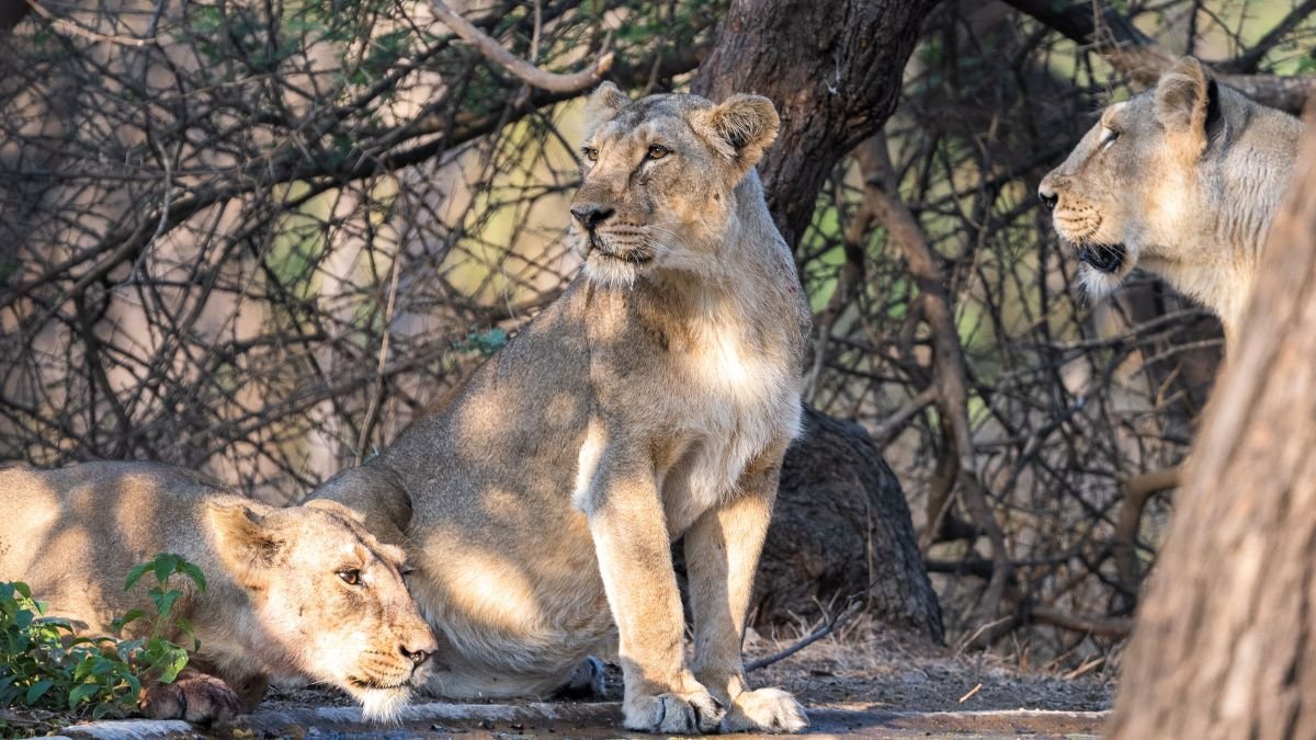
India’s Asiatic lion population has increased from 523 in 2015 to 891 in 2025, a 70.4% rise over a decade. Union Environment Minister Bhupender Yadav highlighted the increase on World Lion Day, August 10, crediting forest officials, conservationists and local communities for the recovery. The increase is an important conservation milestone. But for a species whose wild population remains concentrated in a relatively small geographical range, rising numbers are only part of the story.
The Asiatic lion (Panthera leo persica) is one of India’s most significant wildlife conservation successes. Once found across parts of Asia, the subspecies was driven to near extinction by hunting and habitat loss. Its remaining wild population is now concentrated primarily in Gujarat’s Gir landscape and surrounding areas.
A Decade of Population Growth
India’s lion population increased from 523 in 2015 to 674 in 2020 and reached 891 in 2025. The latest increase represents a 70.4% growth over ten years.

The recovery reflects the impact of long-term protection, habitat management, prey availability, scientific monitoring and the involvement of communities living around lion habitats. But population size alone does not establish whether a species is fully secure.
For the Asiatic lion, where the animals live is almost as important as how many there are.
The Risk of a Concentrated Population
Unlike many large carnivore populations distributed across multiple countries and ecosystems, India’s Asiatic lions remain concentrated largely in Gujarat.
This creates a potential vulnerability. A major disease outbreak, extreme weather event, environmental contamination or other ecological disturbance affecting the Gir landscape could threaten a significant proportion of the population.
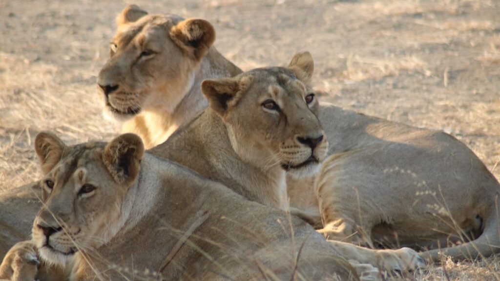
The risk became particularly evident during the 2018 canine distemper virus outbreak, when several Asiatic lions died. The episode demonstrated how infectious disease can become a serious conservation concern when a species is concentrated within a relatively limited landscape. Disease surveillance, veterinary care and monitoring have therefore become increasingly important alongside conventional habitat protection.
Why a Second Population Matters
The concentration of lions has also driven a long-running debate over establishing another free-ranging population. Kuno National Park in Madhya Pradesh has been proposed as a potential second home for Asiatic lions. The objective is not simply to increase the number of lions but to reduce the species’ dependence on a single geographical stronghold.
A geographically separate population could provide an additional safeguard if disease or another major disturbance affected the Gir landscape. However, the proposal has remained contentious, with questions around habitat suitability, prey availability, management and the transfer of lions from Gujarat. The debate reflects a wider conservation challenge: a species can have a growing population while remaining vulnerable because most of its individuals occupy the same landscape.
More Lions Also Mean a Greater Coexistence Challenge
Population recovery brings another issue into focus: human–wildlife coexistence. As lion numbers increase and animals disperse, they can move through agricultural and other human-dominated landscapes around the protected forests. This creates opportunities for wider habitat use but can also increase interactions with people and livestock.
For local communities, these encounters can mean livestock losses and safety concerns. Lions themselves face risks from roads, open wells, disease and other human-associated hazards.
This makes communities living around lion habitat an important part of the conservation equation. The long-term survival of the species will depend not only on protected forests but also on whether people and lions can continue to share the wider landscape.
For Sustainable Conservation
The increase from 523 lions in 2015 to 891 in 2025 shows that sustained conservation efforts can reverse a historic decline. But the next phase of conservation needs to ask more than whether the population is growing.
It must examine whether available habitat and prey can support further expansion, whether lions are becoming more geographically distributed, whether disease surveillance can detect outbreaks early and whether human–lion conflicts are increasing as the population grows.
The Asiatic lion’s recovery is therefore both an achievement and a reminder of the work ahead. For a species with a highly concentrated wild population, conservation success cannot be measured by numbers alone. Its real test will be whether the population becomes resilient enough to withstand disease, environmental change and the pressures of sharing its habitat with people.


Meteorite Dust Reveals Evidence of Magnetic Field in the Young Solar System

When Decarbonisation Becomes the Real Conversation at Tiruppur’s Knit Show

Chinese Humanoid Robots Beat Human Records at Beijing Games

Our Algorithm Knows What We Want Before We Do. That is the Problem.

Scientists Map Earth’s Sand Dunes in a New Global Survey

After Kerala’s Deadliest Landslide, the Hardest Thing to Rebuild Was Childhood

When the Monsoon Returns, Fear Returns: How Climate Disasters Are Reshaping Mental Health in Himachal Pradesh

Astronomers Discover a ‘Black Hole Star’, a New Kind of Object in the Early Universe

From Bell Labs to the Classroom: Finding Purpose After Retirement

Why Is India Flooding If El Niño Predicted a Weak Monsoon?

-

 Math1 month ago
The 2026 Fields Medals: Four Proofs, Four Decades-Old Problems Solved
-
Climate4 weeks ago
After Kerala’s Deadliest Landslide, the Hardest Thing to Rebuild Was Childhood
-
Society2 months ago
West Asia Crisis: Can Kerala’s Returning Gulf Migrants Find a Future in the Green Economy?
-
Space & Physics3 months ago
India Semiconductor Mission: ‘It’s Not About Fabs. It’s About Building An Entire Ecosystem’
-
Climate3 months ago
The Climate World Cup? How Climate Change Could Affect Player Performance at the 2026 World Cup
-
Society1 month ago
What Is Civilisational Diplomacy? Understanding India’s Newest Foreign Policy Tool
-
Society2 months ago
From Bell Labs to the Classroom: A Second Career in Teaching
-
Space & Physics3 months ago
Engineers Develop Dual-Mode Propulsion System for Next-Generation Small Satellites