
Climate
Europe’s 2026 Heatwaves Linked to More Than 32,000 Deaths, Study Estimates
Heat-related deaths in 854 European cities reached an estimated 50,391 in summer 2026, according to a new study. Malta, Italy and Hungary recorded the highest modelled mortality rates, while a severe June heatwave accounted for nearly one-third of the estimated toll.


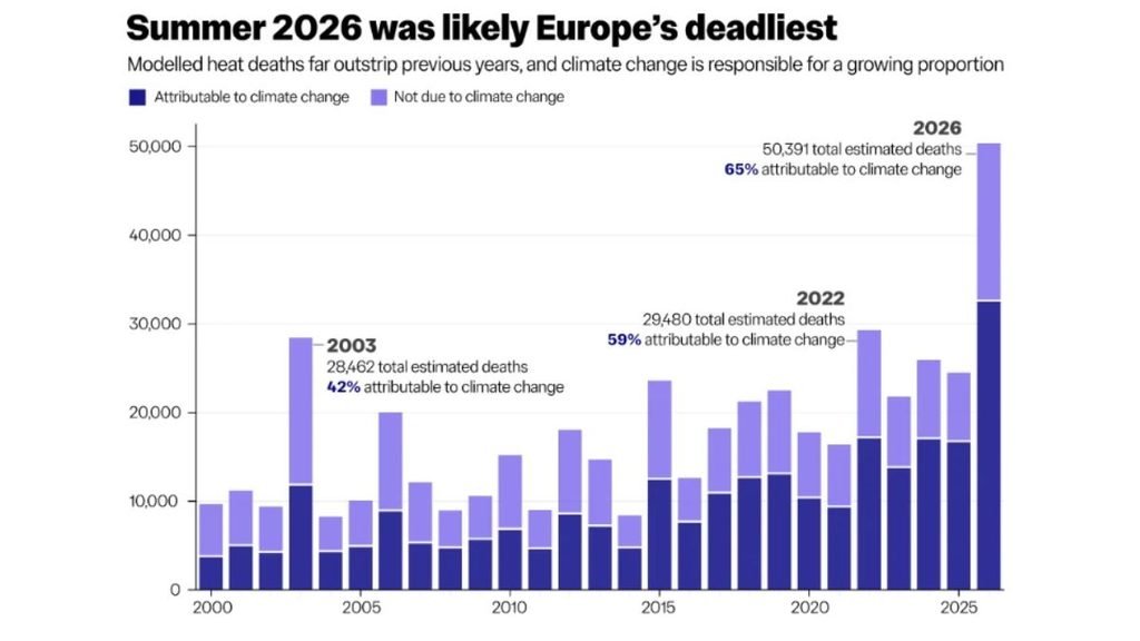
Europe’s summer heat took an estimated 50,391 lives across 854 cities in 2026, with human-induced climate change contributing to nearly two-thirds of the heat-related deaths, according to a new study. The researchers estimate that 32,619 deaths—65% of the total—would not have occurred in the same way without the additional warming caused by human activities.
The findings point to a particularly heavy toll in southern Europe, where heat-related mortality rates were substantially higher than in the continent’s northern regions. Malta recorded the highest modelled rate, at 716 deaths per million people, followed by Italy at 561, Hungary at 537 and Croatia at 461.
The estimates cover June to August and are based on 854 cities across 30 countries, including the 27 European Union member states, the United Kingdom, Norway and Switzerland. These cities had a combined population of about 173 million in 2026, representing nearly 40% of the population across the countries studied. The figures therefore describe the burden in the cities covered by the research, rather than a complete count for Europe.
The scale of the estimated toll is striking against the backdrop of another exceptionally hot European summer. The Copernicus Climate Change Service ranked summer 2026 as the continent’s third warmest on record and the warmest on record in western Europe. The region’s seasonal mean temperature reached 21.69°C, which was 2.54°C above the 1991–2020 average.
Southern Europe Bears the Heaviest Mortality Burden
The study’s age-standardised estimates show a marked regional divide. Southern Europe recorded 380 heat-related excess deaths per million people, compared with 277 in western Europe, 250 in eastern Europe and 129 in northern Europe.
These rates account for differences in population age structure, making regional comparisons more meaningful. They also show why the number of deaths attributed to warming and the overall mortality rate should not be treated as interchangeable measures.
The proportion of heat-related deaths attributed to human-induced climate change was highest in Estonia and Bulgaria, at 81% in each, followed by Finland at 80%. Southern Europe’s estimated share was 69%, while northern Europe’s was 59%.
A high climate-attributable proportion does not necessarily mean a country had the highest heat mortality rate. The two measures answer different questions: how much heat-related mortality occurred, and how much of that burden can be attributed to human-caused warming. The researchers also caution that Malta’s estimate of the climate-attributable share carries considerable uncertainty.
Summer Heat: Deadly Fortnight in June
Nearly one-third of the estimated summer deaths occurred between June 17 and July 1, when the average daily mean temperature across the cities was 5.3°C above the 1991–2020 average. The study estimates that 57% of heat-related deaths during this period were attributable to human-induced climate change.
That share was lower than the 65% estimate for the summer as a whole. It does not mean climate change had little influence on the June heatwave. The researchers explain that the episode was so extreme that it would still have caused substantial harm even in a hypothetical climate without human-caused warming.
“I think we can be quite confident in stating that the summer of 2026 is likely to have been
the worst on record for heat-related mortality across much of Europe. These numbers are a
stark reminder that our hotter, more extreme summers are having an increasingly severe
impact on public health. Behind these statistics are real people whose lives were lost and
real families who grieve for them.
“It is yet another reminder both of the imperative of rolling out targeted interventions to protect those who are most vulnerable to this increasingly extreme heat, and of the growing need to rapidly transition away from fossil fuels to slow the pace of change and limit future warming.” said, Dr Clair Barnes, Extreme Weather and Climate Change Researcher at the Centre for Environmental Policy, Imperial College London
The city-wide average also conceals local extremes. The study found that the average daily temperature anomaly across the cities peaked at 7.3°C above normal, while some countries experienced days with temperatures as much as 12°C above their usual levels. Western Europe recorded an average summer temperature anomaly of 2.9°C, and southern Europe 2.6°C. The analysis also estimated 1,508 additional heat-related deaths between May 21 and May 31. These are reported separately from the headline June–August total.
Older People Face the Greatest Risk
Age was a major factor in the estimated mortality burden. People aged 85 and older accounted for 22,502 heat-related excess deaths—close to 45% of the summer total. By comparison, the estimated number among people aged 20 to 44 was about 833.
The toll was not confined to older adults. The study estimates that around 6,000 heat-related excess deaths occurred among people under 65, underscoring the risk faced by working-age adults as well as older residents.
Heat exposure can become especially dangerous when high daytime temperatures persist into the night, leaving the body with less opportunity to recover. The researchers note that the June episode involved high humidity and unusually warm nights, conditions that may have contributed to the health burden and could mean the model underestimated its effects.
The figures are statistical estimates of excess mortality, not a tally of death certificates naming heat or climate change as the cause. The researchers modelled the relationship between temperature and mortality, then estimated how many deaths were associated with observed temperatures and how that burden changed when the human-caused component of warming was removed.
Toll Higher Than Previous Benchmark Summers
Using the same group of 854 cities and the same analytical framework, the researchers estimated 29,480 heat-related excess deaths in summer 2022, 28,462 in 2003 and 24,572 in 2025. The 2026 estimate of 50,391 is substantially higher than each of those figures.
The comparison matters because estimates produced using different methods, time periods or geographical coverage can give misleading impressions of how mortality has changed. Applying a consistent framework to the same cities provides a more direct comparison, although the figures remain modelled estimates. National monitoring systems have also reported large mortality burdens during the 2026 heat episodes, but their estimates cannot be directly added to or compared with the study’s total.
In France, the national public health agency estimated at least 5,764 excess deaths from all causes during the June 17–July 2 heatwave across 92 departments covering 98.5% of mainland France’s population. Around two-thirds of those deaths were among people aged 75 and older. The measure captures excess deaths during the heatwave; it does not mean every death was individually certified as heat-related.
In England, the UK Health Security Agency estimated 2,124 heat-associated deaths during the June 21–28 heatwave and another 753 during a May episode, giving an interim combined estimate of 2,877. Germany’s Robert Koch Institute estimated around 16,000 heat-related excess deaths over a longer period, from April 6 to September 6, while Spain’s mortality monitoring system reported 5,123 excess deaths for June to August. Differences in coverage, time periods and methods mean these national figures should be read in their own context.
What the Estimates Can/Cannot Tell
To estimate the effect of climate change, the researchers compared observed temperatures with a counterfactual scenario in which the human-caused component of warming was removed. They then applied age-specific relationships between temperature and mortality, drawing on mortality data from 232 European Union cities covering 2000–2019, alongside population and mortality estimates for 2026.
The approach allows researchers to estimate the contribution of human-induced warming across many cities, but it has limitations. The underlying exposure–response data may not fully reflect changes in healthcare, adaptation, health conditions or vulnerability since 2019. The model also uses daily mean temperatures and assumes vulnerability remains constant throughout the year.
The study’s findings are therefore not a direct count of deaths that can individually be assigned to climate change. They are an estimate of how much the summer’s heat-related mortality burden changed because of human-caused warming.
Even with those qualifications, the size of the estimated toll raises practical questions for cities facing increasingly severe heat. Early warnings, accessible cooling spaces, support for older people and others at higher risk, and health services prepared for heat-related illness can help reduce exposure and its consequences. Cutting greenhouse gas emissions remains essential to limiting further warming, while public-health measures can help protect people from the heat already occurring.







Earth
India’s Green Cover Declined by 5.6 Percentage Points in 25 Years as Summer Heat Intensified: Study
A new study links India’s declining green cover to rising summer temperatures, highlighting the importance of vegetation conservation for climate adaptation.

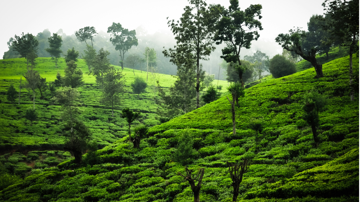
India’s green cover declined from approximately 36.95 per cent in 2001 to 31.35 per cent in 2025, while non-green surfaces expanded across the country, according to a new study by Climate Trends. The analysis found that non-green landscapes consistently recorded higher summer temperatures than vegetated areas, highlighting the role of green cover in moderating local heat.
The study, Assessment of Green Cover Dynamics and Their Influence on Summer Temperature across India Using MODIS Land Cover and ERA5 Reanalysis Data, found that the average summer temperature difference between green and non-green landscapes ranged from approximately 1°C to 2.5°C. Areas experiencing green-cover loss recorded a mean summer temperature increase of 0.26°C.
The findings suggest that vegetation loss can contribute to local warming, although the study also identifies broader regional climate change as a factor influencing temperature trends. Protecting and restoring vegetation could help reduce local thermal stress, but it cannot independently offset the effects of global warming.
“Vegetation is not merely an ecological asset; it is an important component of India’s climate-adaptation infrastructure,” said Dr Palak Balyan, Research Lead at Climate Trends.
The study comes amid growing concerns over extreme heat and its implications for public health, livelihoods and infrastructure. The India Meteorological Department reported that 2024 was the country’s warmest year since records began in 1901, with the annual mean temperature 0.65°C above the 1991–2020 average.
Vegetation Loss and the Local Heat Effect
The Climate Trends analysis used land-cover information from the Moderate Resolution Imaging Spectroradiometer (MODIS) and ERA5-Land temperature data to assess changes between 2001 and 2025. It examined summer conditions during March, April and May to understand how land-cover transitions corresponded with temperature patterns.
Vegetation helps regulate surface temperatures through shading and evapotranspiration, the process by which plants release water vapour into the atmosphere. Trees reduce the amount of solar radiation reaching the ground, while vegetation and soil moisture influence how energy is absorbed and released. When green landscapes are replaced by built-up areas, exposed ground or sparsely vegetated surfaces, these cooling mechanisms may weaken.
Dr Balyan said the persistent temperature difference between green and non-green landscapes demonstrated the importance of vegetation in regulating local thermal conditions.
“Protecting existing natural vegetation should therefore be treated as an adaptation priority, particularly in regions experiencing simultaneous green-cover loss and rising summer temperatures,” she said.
The findings are consistent with the Intergovernmental Panel on Climate Change’s assessment of nature-based cooling measures, which identifies urban trees, vegetation and green infrastructure as potential ways to reduce heat exposure. However, the extent of cooling depends on local climate, vegetation type, water availability and the surrounding built environment.
Regional Differences Require Targeted Action
The study found that green-cover loss was concentrated in parts of western India, the Indo-Gangetic Plain, central India and the peninsula. Localised gains were identified in portions of the northeastern states, the Himalayan foothills and scattered areas of southern and eastern India.
Temperature changes also varied geographically. Warming was particularly evident across northwestern and northern India, while localised cooling occurred in parts of central and southern India. These variations indicate that national averages can obscure differences in local land-use patterns and climate conditions.
The findings have implications for urban planning, particularly in rapidly expanding cities where construction can replace trees, open spaces and other vegetated landscapes. Protecting mature trees, retaining existing green spaces and integrating vegetation into streets and public areas could help reduce heat exposure, particularly in vulnerable neighbourhoods.
However, restoration must be planned around local ecological conditions. Newly planted trees cannot immediately provide the shade offered by mature canopies, and their survival depends on suitable species, soil conditions, water availability and long-term maintenance. Protecting established vegetation is therefore an important complement to new planting initiatives.
Green Cover Cannot Replace Broader Climate Action
The study emphasises that land-cover changes are not the only drivers of summer temperatures. Both green and non-green landscapes experienced warming during the study period, indicating the continuing influence of broader climatic conditions.
Dr S K Dhaka, Professor of Atmospheric Physics at the University of Delhi, cautioned against treating vegetation restoration as a standalone solution.
“Vegetation restoration can reduce local thermal stress, but it should not be viewed as a substitute for broader climate action,” he said.
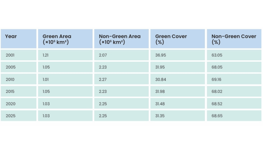
Temporal variation in green and non-green land cover across India
He added that warming observed even in areas that remained continuously green showed that large-scale climatic forces continued to influence regional temperatures.
“India therefore needs a dual strategy: prevent further loss of established vegetation while implementing scientifically targeted restoration in heat-vulnerable regions, alongside stronger action on water management, urban planning and greenhouse-gas emissions,” Dr Dhaka said.
The distinction is important because increasing vegetation alone cannot eliminate heat risks associated with rising background temperatures. Effective adaptation requires combining nature-based measures with emissions reduction, appropriate urban design and improved water management.
Aarti Khosla, Founder-Director of Climate Trends, said the study highlighted the practical consequences of losing vegetation.
“The study puts a number on something we’ve long argued, that vegetation is not a biodiversity afterthought, but a climate-adaptation infrastructure,” she said.
“Where green cover has disappeared, temperatures have risen with it, and that is a cost India’s communities are already paying for,” Khosla added.
She also pointed to international biodiversity commitments, including the target of restoring 30 per cent of degraded ecosystems by 2030, arguing that the gap between commitments and implementation has consequences for climate resilience.
The study recommends protecting existing vegetation, preventing avoidable green-cover loss and promoting ecological restoration as part of sustainable land management.
Its central message is that green cover should be considered more than an environmental amenity. While vegetation cannot prevent all forms of warming, conserving it can help moderate local temperatures and reduce thermal stress. As India faces increasing heat risks, integrating vegetation protection into climate adaptation and development planning could help build more resilient communities.
Climate
What Does Changing Western Disturbances Mean for Himalayan Rainfall?
New research reveals how changes in Western Disturbances are reshaping winter precipitation across the Western Himalayas, affecting rainfall, snowfall and regional water patterns.
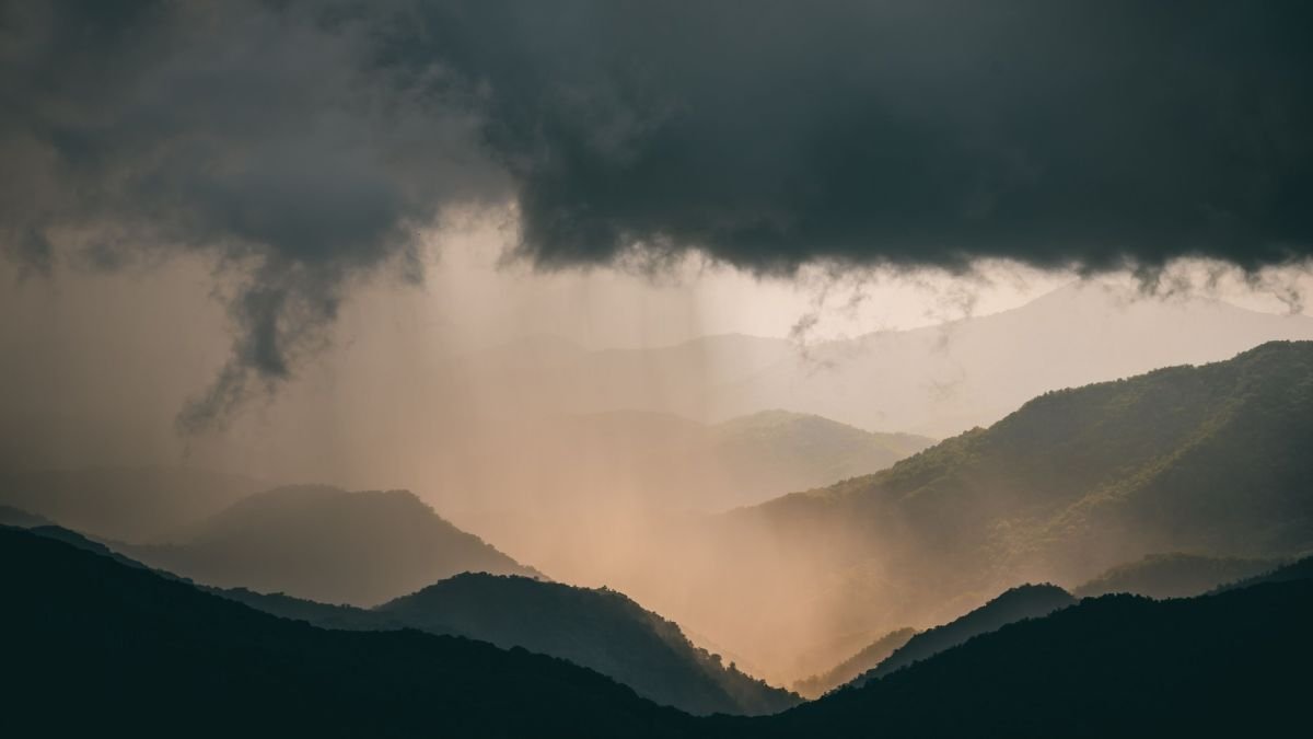
The atmospheric systems that bring winter rain and snow to the Himalayas are changing in ways that complicate a familiar assumption that more weather systems mean more precipitation.
A study published in the International Journal of Climatology in March 2026 examined winter precipitation across the Western Himalayan region over two 30-year periods, 1961–1990 and 1993–2022. Using ERA5 atmospheric reanalysis data, the researchers found that Western Disturbances and the number of days associated with them had increased, while the density of their tracks across the study region had declined as their paths shifted northward.
The study also identified a decline in large-scale precipitation. A greater proportion of the precipitation that did occur fell as rain rather than snow, partly offsetting the reduction in snowfall. These findings point to changes in the location, form and mechanisms of precipitation, rather than a uniform increase in rainfall across the Himalayas.
What are Western Disturbances?
Western Disturbances are eastward-moving weather systems that originate in the Mediterranean and adjoining regions and travel towards South Asia. They are embedded in the westerly flow of the middle and upper atmosphere and are an important source of winter precipitation over northwestern India and the western Himalayas.
When these systems reach the mountains, their effects depend on several interacting factors: the amount of moisture they carry, the strength and direction of atmospheric winds, the temperature profile of the air and the shape and elevation of the terrain.
As moist air rises over mountain slopes, it cools and water vapour condenses into cloud droplets or ice crystals. Depending on atmospheric conditions, precipitation can fall as rain or snow. The distribution of precipitation varies with the system’s track and intensity, as well as local topography. A shift in the path of a Western Disturbance can therefore change which valleys and mountain slopes receive precipitation, even if the overall number of systems increases.
Why Frequency Alone Does Not Explain the Rainfall
The 2026 study highlights an important distinction between the occurrence of Western Disturbances and the precipitation they produce. Although the researchers found an increase in the number of disturbances and associated days, their analysis showed that fewer tracks passed through the Western Himalayan study region. The northward shift was associated with a decline in large-scale precipitation.
The study also found that rising temperatures increased the atmosphere’s capacity to hold moisture, while weaker vertical winds reduced the upward movement of air. Reduced transport of moisture into the upper troposphere also affected cloud microphysical processes that support large-scale precipitation.
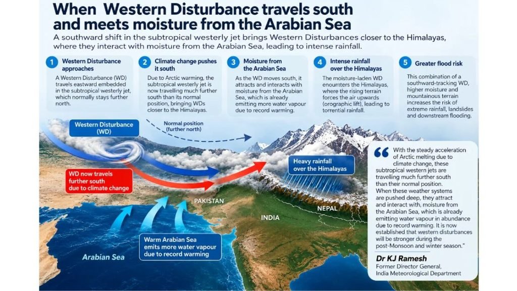
These processes help explain why a warmer atmosphere does not automatically translate into greater precipitation everywhere. Temperature, moisture availability, vertical air movement and the location of weather systems all influence how much precipitation forms and where it falls.
The findings also have implications for snowfall. When temperatures rise, a larger share of precipitation can fall as rain instead of snow, depending on conditions within the atmosphere and near the surface. Such a change can affect seasonal snow accumulation and the timing of water entering Himalayan river systems.
How Does Climate Change Fit Into the Picture?
Climate change alters the background conditions in which Western Disturbances develop and travel. Rising temperatures influence atmospheric moisture, while changes in circulation can affect the systems’ tracks and the way they interact with mountain terrain.
However, researchers have identified different trends across different parts of the wider Himalayan region. Findings from the Western Himalayas cannot automatically be applied to Nepal or the eastern Himalayas, where the influence of weather systems, topography and moisture sources may differ.
The October 11, 2026, flash flood in Nepal’s Budhi Gandaki river system illustrates why this distinction matters. According to the International Centre for Integrated Mountain Development (ICIMOD), a preliminary assessment suggested that a landslide may have blocked the river before the temporary barrier failed, releasing water, sediment and debris downstream. The organisation said further investigation was needed to establish the event’s precise trigger.
The flood, therefore, cannot be attributed to a change in Western Disturbances on the available evidence. The scientific questions surrounding the event include the mechanics of the landslide, the temporary river blockage and the release of the accumulated water. Establishing whether weather conditions contributed to the initial slope failure requires separate evidence.
What Scientists Need to Examine Next
Understanding changes in Himalayan precipitation requires researchers to look beyond the number of Western Disturbances recorded in a season. Their tracks, intensity, moisture transport, vertical wind patterns and the proportion of rain and snow all need to be examined together.
Long-term observations and atmospheric reanalysis can help identify regional trends, while measurements of snow cover, precipitation and mountain hydrology can show how those changes affect water availability. Comparisons across the western, central and eastern Himalayas are also necessary to establish where trends are consistent and where they differ.
The central finding is that changes in atmospheric circulation can redistribute precipitation even as the climate warms. For the Himalayas, where snow accumulation, river flow and mountain ecosystems depend on the timing and form of precipitation, understanding these regional differences is essential to explaining how the water cycle is changing.
Climate
Istanbul Floods Reveal How Climate Change and Urbanisation Combine to Raise Flood Risks
Urban flooding highlights the growing challenges cities face in managing extreme rainfall, protecting vulnerable communities and strengthening climate resilience.
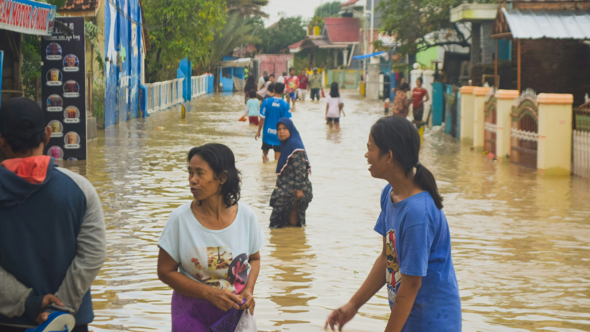
The torrential rainfall that flooded Istanbul on October 14–15 has highlighted a growing challenge for cities confronting extreme weather: how to prepare for heavier rainfall when the extent of climate change’s influence varies across regions, and the damage depends partly on how urban landscapes are built.
A new analysis by the ClimaMeter research team finds that weather patterns similar to those behind the floods now bring about 7% heavier rainfall and 9% stronger winds than comparable patterns recorded between 1950 and 1987. Temperatures in the region of heaviest rainfall are up to 1.5°C higher than in the historical comparison period.
However, the increase in rainfall was not statistically significant over Istanbul itself. The researchers identified significant rainfall increases across parts of western and north-western Anatolia and along the Black Sea coast north of the city, while natural climate variability also contributed to the event.
The floods triggered 1,277 flooding incidents and 15 landslides across Istanbul, according to the analysis. ClimaMeter reported 194 millimetres of rainfall at Ömerli in the Beykoz district, while Istanbul’s disaster coordination centre, AKOM, reported 277.1 millimetres in Beykoz during the event. Two people died, 595 people were evacuated after becoming trapped, and roads and schools were affected.
The findings underline an important distinction: climate change can alter the conditions associated with extreme rainfall, but it does not explain every aspect of an individual flood. Urban drainage, land use and exposure determine how rainfall translates into damage.
What climate attribution reveals
The ClimaMeter analysis compared the atmospheric conditions of October 14–15, 2026, with similar weather patterns from 1950–1987 and 1988–2025. Using the European Centre for Medium-Range Weather Forecasts’ ERA5 reanalysis data, researchers examined changes in precipitation, temperature and wind.
They estimated that about 3% of the rain-linked damage associated with the event was attributable to human-driven climate change, with an estimated range of 1–4%. This is a rainfall-based attribution estimate, not a calculation of the proportion of all damage caused by global warming. The methodology does not account for drainage capacity, impermeable surfaces or construction along streambeds.
The physical basis for heavier rainfall is well established. The Intergovernmental Panel on Climate Change (IPCC) explains that the atmosphere can hold approximately 7% more water vapour for every 1°C of warming. When atmospheric conditions are favourable, additional moisture can contribute to more intense precipitation.
The IPCC’s Sixth Assessment Report concludes that heavy precipitation has become more frequent and intense across most land regions with sufficient observational coverage, primarily because of human influence. Regional trends, however, are not uniform, and Mediterranean precipitation patterns are affected by considerable natural variability.
The Istanbul findings therefore point to a need for preparedness without overstating the evidence. The absence of a statistically significant local rainfall trend does not mean the city faces no climate risk. It means that the specific analysis did not establish a significant rainfall increase over Istanbul for the weather pattern examined.
Urban development can magnify flood damage
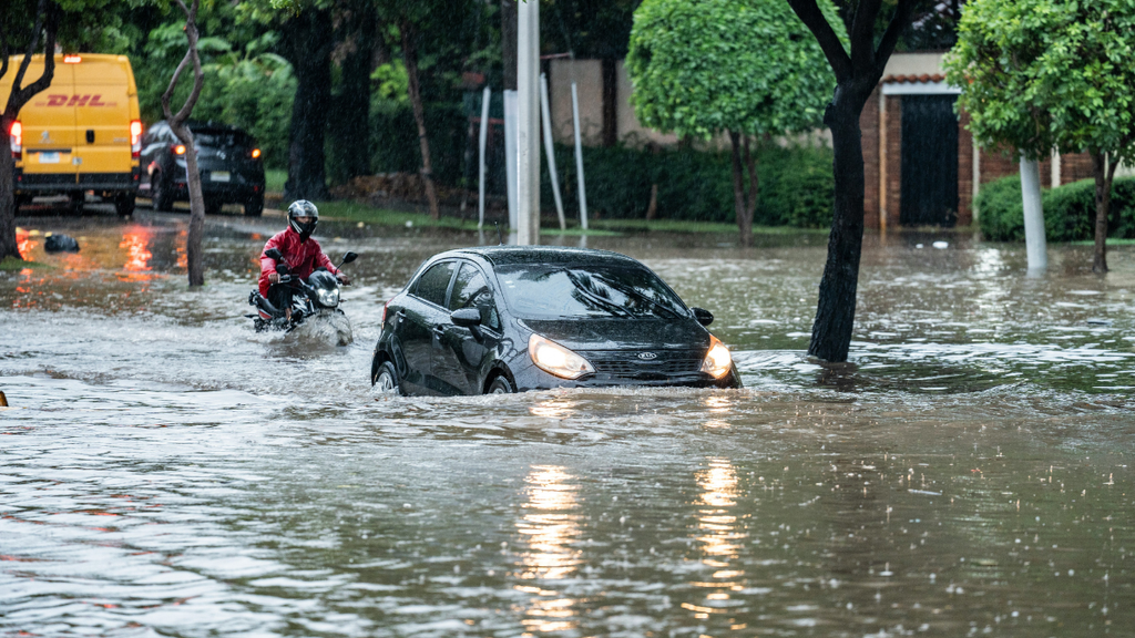
How a city responds to rainfall depends on more than the volume of water falling from the sky. Roads, buildings and other impermeable surfaces reduce the amount of water absorbed into the ground, increasing runoff. If drainage systems cannot carry away the additional water, streets and low-lying areas can flood rapidly.
Research conducted in Istanbul provides evidence of how planning decisions can influence this risk. A 2021 study by Seda Ertan and Rahmi Nurhan Çelik, published in Sustainability, modelled flood scenarios across a 1,653-hectare catchment of the Kağıthane Stream.
Representational image.image credit:Pexels
The researchers examined measures including green roofs, permeable road surfaces, rainwater collection and drainage channels. Their results indicated that green infrastructure could reduce surface runoff and peak flow rates, as well as the area inundated and the number of structures exposed to flood risk.
The findings suggest that flood management should extend beyond expanding conventional drainage infrastructure. Permeable surfaces can allow more rainwater to enter the ground, while green roofs and rainwater collection systems can help retain water before it reaches drainage networks. Their effectiveness nevertheless depends on local conditions and the intensity of rainfall.
A separate study published in the Journal of Flood Risk Management in January 2025 examined flood exposure and vulnerability in Istanbul’s Pendik district. The researchers found that flood-prone areas were associated with lower land values and greater concentrations of socially disadvantaged residents, including older people, refugees and people with lower levels of education.
The study identified substantial differences in vulnerability within the district. About 21% of the assessed Kaynarca basin fell into the study’s very-high-vulnerability category, while 20.4% was classified as high vulnerability. These classifications reflect the study’s specific assessment framework and should not be interpreted as estimates for Istanbul as a whole.
The research highlights an important dimension of urban resilience: communities do not experience flood risk equally. Housing conditions, access to resources, the location of residential areas and the ability to respond to warnings can influence how severely households are affected.
Building resilience beyond emergency response
The implications extend beyond Istanbul. Cities facing intense rainfall need to combine reliable drainage systems with land-use planning, early-warning mechanisms and protection of natural waterways.
Nature-based approaches can complement conventional flood defences. A 2024 review published in npj Urban Sustainability examined the role of nature-based solutions in flood-risk management, emphasising the importance of considering social and ecological outcomes alongside physical protection. Wetland restoration, urban green spaces and restored stream corridors can help retain water and reduce runoff, although they cannot eliminate the risk of flooding during extreme events.
For Istanbul, the findings also raise questions about development near waterways and the preservation of natural drainage routes. A recent report by the Turkish news agency Anadolu Agency, published on October 20, quoted Istanbul Technical University disaster-management researcher Ömer Ekmekcioğlu warning that heavily urbanised catchments and areas where natural drainage systems have been altered require particular attention.
The ClimaMeter team estimated that approximately 14.6 million people and US$558 billion in economic activity were exposed within the wider rainfall-hazard area. These figures represent exposure to the identified hazard, not the number of people directly affected or the economic losses incurred during the floods.
The broader lesson is that climate attribution and urban planning answer different but connected questions. Climate science helps establish how warming may change the intensity of weather hazards; urban-risk research examines why certain places and communities suffer greater consequences.
Istanbul’s floods demonstrate why both are necessary. Preparing for a changing climate requires understanding the rainfall, but reducing the damage also depends on where cities build, how they manage water and whether their infrastructure protects the people most exposed to risk.


India’s Green Cover Declined by 5.6 Percentage Points in 25 Years as Summer Heat Intensified: Study

Europe’s 2026 Heatwaves Linked to More Than 32,000 Deaths, Study Estimates

What Does Changing Western Disturbances Mean for Himalayan Rainfall?

Greece Passes Social Media Ban for Children Under 15

Istanbul Floods Reveal How Climate Change and Urbanisation Combine to Raise Flood Risks

Knowing When to Think for Ourselves: AI, Intuition and the Education of Discernment

After a Scorching Summer, Delhi’s Children Are Slow to Return Outdoors

Two Chemists Win Nobel Prize for Solving a Century-Old Puzzle: Why Life Picks One Hand Over the Other

Marshall Islands: Why the US Nuclear Legacy Is Back Before the UN

How Wind Turbines Could Produce More Power From the Same Wind

-

 Math3 months ago
The 2026 Fields Medals: Four Proofs, Four Decades-Old Problems Solved
-
EP Deep Dive: Data & Solutions3 months ago
After Kerala’s Deadliest Landslide, the Hardest Thing to Rebuild Was Childhood
-
EP Deep Dive: Data & Solutions4 months ago
West Asia Crisis: Can Kerala’s Returning Gulf Migrants Find a Future in the Green Economy?
-
Space & Physics5 months ago
India Semiconductor Mission: ‘It’s Not About Fabs. It’s About Building An Entire Ecosystem’
-
Interviews1 month ago
From Scams to Screens: How the National Stock Exchange Rewrote India’s Equity Story
-
Climate5 months ago
The Climate World Cup? How Climate Change Could Affect Player Performance at the 2026 World Cup
-
Society4 months ago
What Is Civilisational Diplomacy? Understanding India’s Newest Foreign Policy Tool
-
Society4 months ago
From Bell Labs to the Classroom: A Second Career in Teaching