
Space & Physics
Joint NASA-ISRO radar satellite is the most powerful built to date
NISAR – a portmanteau for the NASA-ISRO synthetic aperture global radar earth observation satellite — will only be the latest collaboration between the two space agencies.

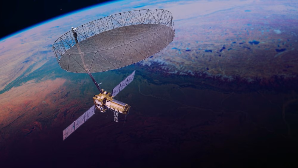
On July 30th, NISAR — the NASA-ISRO joint space mission — launched to space aboard the GSLV Mark II rocket from Sriharikota, Andhra Pradesh. The satellite, now safely tucked into a sun-synchronous orbit around earth, will enter a commissioning phase over the next three months, to deploy all its instruments.
Perched at an altitude of 750 km, the three ton satellite will complete an orbit around the earth every 12 days, while studying the planet’s diverse geology with unprecedented detail.
NISAR, a portmanteau for the NASA-ISRO synthetic aperture radar mission, marks the culmination of a decade-long effort to build the most powerful earth observation satellite to date.
In 2007, NASA had begun actively exploring an ambitious undertaking to build a satellite, which could map the earth and the whole ecosystem. On the agenda were investigations into studying climate change and its role in exacerbating extreme weather events. These include surveillance over vulnerable hotspots, such as Greenland and Antarctica, where disappearing ice sheets have been linked to the global average increase in sea-levels over the years.
Remote sensing satellites traditionally used can’t capture the full picture, without uninterrupted sunlight exposure or obstructions namely cloud cover. But synthetic aperture radar is a fix to these problems. Clouds are transparent to radio and microwaves unlike visible light. As such, a synthetic aperture radar can work across any weather, whether sunlit or not alike.
That said, SAR technology isn’t new. They have been around for about seventy years, since the first proof of principle was proven in the 1950s. In 1978, the US launched the first SAR-equipped earth observation satellite, Seasat, to monitor oceans. Neither Seasat or for that matter any SAR-based successors, could bear resolutions as high as 1 cm, or map terrain across a swath area as wide as about 240 km, as NISAR can.
NASA engaged in a cost-effective strategy, opening doors for international partners to pool resources, and co-develop the satellite and the scientific campaigns.

A
B
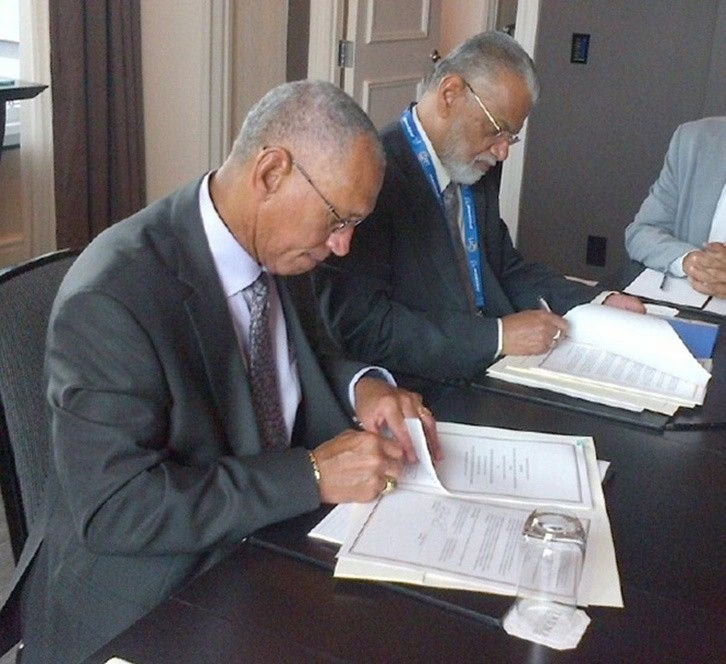
(A) Melt pond in Greenland | Photo Credit: Michael Studinger (2008) (B) NASA administrator Charles Bolden and ISRO chairman K. Radhakrishnan sign documents, which included a charter on NISAR, in Toronto | Photo Credit: NASA (2014)
NASA and ISRO share expertise
NASA found an interested party in ISRO, which at the time was developing the Radar Imaging Satellite (RISAT), which had a smaller scope to study India’s geology. India, being especially vulnerable to floods, landslides and cyclones, couldn’t overlook the incentives an extra eye in the sky could provide.
NISAR can track and relay even the minutest of changes on the surface in near real-time. In principle, the satellite should detect a flooded area hidden from view to rescuers on-ground, or even traditional remote sensing satellites which use passive receivers. The satellite can serve a key role in an integrated multi-hazard early warning system.
In 2014, ISRO inked the NISAR agreement with NASA. The mission would only be their latest collaboration between the two space agencies. Previously, they had collaborated on 2008’s Chandrayaan-1. Back then, NASA’s Moon Mineralogy Mapper (M3) instrument and miniSAR radar onboard the Chandrayaan orbiter, led the famous detection of water ice on the moon.
Although NISAR was originally slated for launch in 2020, innumerable delays followed as they sorted technical challenges, and the abrupt global lockdown amid COVID pandemic.
Upon project completion last year, NISAR had become the most expensive satellite built, with NASA and ISRO pouring some $1.5 billion into development. The costs were unevenly split between them; with NASA spending some $1.3 billion, and ISRO bearing a modest amount at $91 million.
But a white paper details ISRO had contributed an equal value in engineering various components, re-establishing parity. ISRO engineered the spacecraft body, readied tracking stations on-ground, and developed the short wavelength S-band radar. The S-band (at 12 cm) complements NASA’s longer wavelength L-band (24 cm) radar.
The L-band can track changes under thick foliage or leaves, under forests. It can even measure land deformation rates as tiny as 4 mm/year. While the L-band serves as NISAR’s primary means of acquiring radar data, ISRO’s S-band radar will help provide details that concern Indian earth scientists, monitoring coastal erosion for example. Both radars work in tandem with NASA-designed radar receiver and reflector – a 12-meter wide meshed net, resembling a canopy attached to the spacecraft body via a boom.
Three months from now, once the commissioning phase is complete, NISAR will begin its observational runs, and beam radar data back to earth continuously. The National Remote Sensing Centre in Hyderabad, and Goddard Space Flight Centre in Maryland, will process the respective L & S-band data independently, and archive them online for the world to see, all in a matter of few hours.












Space & Physics
World Space Week 2026: How the Rocket Revolution Is Changing Space
World Space Week 2026 explores the Rocket Revolution, from reusable launchers and private space companies to the growing role of satellites.


Space & Physics
A Dead Star Feeds Off Planet Formed From Its Ashes
It adds to a known coterie of planets now found orbiting dead stars, astronomers are busy studying to spot signs of life.
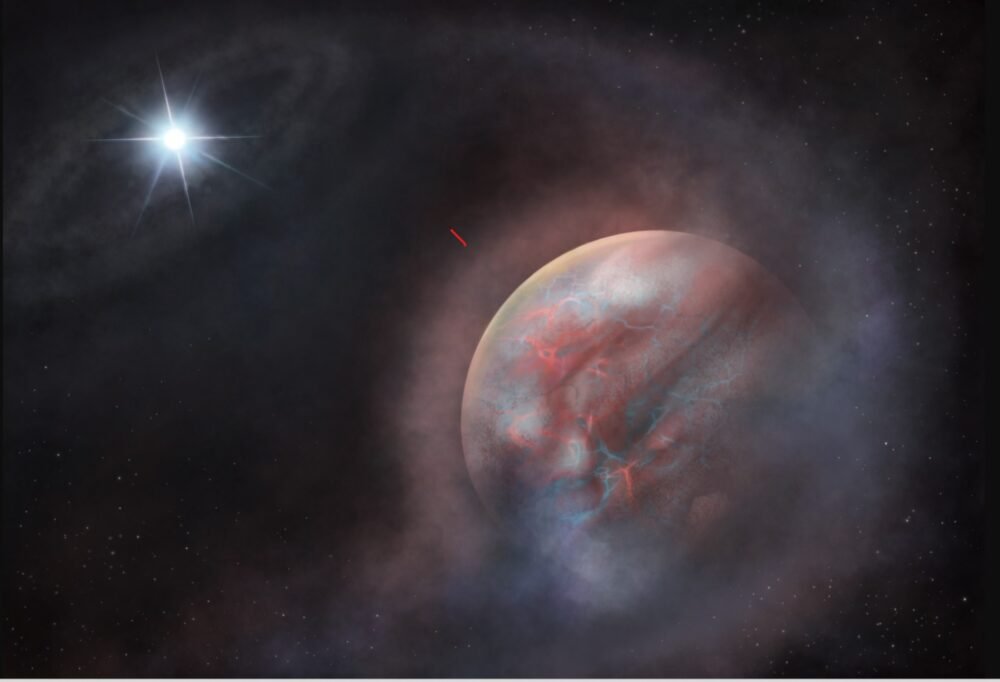
A planet orbiting once every 4 days around a white dwarf star HS 0209+0832 – about 270 light years in the direction of the constellation Pisces – is steadily losing its atmosphere to its host star. While many stars in solar systems beyond our own often feed on their planets, this particular star feeds on its own ashes.
The gaseous planet HS 0209+0832 b was discovered in 2024, when the Transiting Exoplanet Survey Satellite, a NASA space telescope, found it orbiting the white dwarf star over the course of four days. The new study followed through with detailed observations from TESS data, NASA’s space-based Far Ultraviolet Spectroscopic Explorer, in addition to the ESO’s mountain-based Very Large Telescope, to study the star’s atmosphere and in turn inferring some chemistry occurring in the planet.
In a study published in the journal Nature Astronomy on Monday and funded by NASA, European Research Council, Fundación Occident and the Instituto de Astrofísica de Canarias, an international team of astronomers have reported imprints of niobium, a heavy element, in the atmosphere of a white dwarf star.
Astronomers predict the transiting young planet around the dead star is supplying that niobium back to its host. The sighting is evidence of a “second generation” planet, one of many candidates identified over several years, manifesting in a myriad different ways from spent gas ejected in the wake of stellar deaths.
It adds to a known coterie of planets now found orbiting dead stars, astronomers are busy studying to spot signs of life.
What are white dwarf stars?
White dwarves are an exotic stars, and are all that’s left off giant stars shedding their large gaseous skin in violent deaths. Our sun is destined one day to transform into a white dwarf, but only after swelling in size some five billion years from now to become a red giant when it will eclipse past the earth’s orbit. It would take several million years after that for the red giant sun to shed its gaseous exterior to become a white dwarf.
Planets if any, found orbiting these dead stars may have likely migrated from the new solar system’s outer reaches. All that’s left off the progenitor star’s past are imprints of light metals and other elements on the white dwarf’s atmosphere. Such planets have previously been spotted orbiting pulsars, a kind of neutron star, back in 1992. In fact, its discovery had marked the first ever detection of any planet orbiting a star beyond our sun.
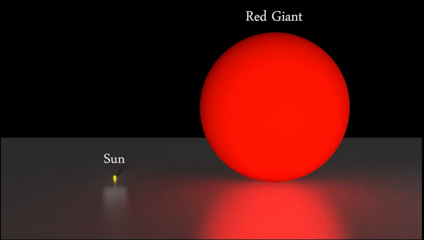
In five billion years, our sun will evolve to become a red giant star. Credit: Svitlana Leonidivna Malchenko
Sighting niobium
Elements such as niobium don’t typically form in the core of stars like our sun. Chemical production usually limits to elements lighter than or until iron, with its 26 protons and 30 neutrons. Beyond that, slamming an extra proton or neutron will cause those to split, leaving iron to be the last element to be directly forged.
Niobium, with 41 protons and 52 neutrons, is thought to be born after absorbing slow passing neutrons when the red giant star dies to form a white dwarf star. This niobium hitches a ride along with rest of the contents of the red giant star, farther into the outer reaches of the system after the formation of the white dwarf.
These contents could create a new disc of circumstellar material with dust and gas that could condense one day to form new planets. The “second generation” planet found orbiting the white dwarf star from the new study, could have been born this way.
Alternatively, it may have been a planet in the outskirts like Neptune, migrating inwards, and enriching itself with niobium-rich star material.
Either way, the planet got too close to its host star, which is irradiating its newfound niobium-rich atmosphere, stripping it away and devouring it.
While it’s likely not a candidate planet for life as we know it to be found, it’s discovery can help ascertain how such worlds are formed in the aftermath of a star’s various phases of evolution.
Space & Physics
Artemis Accords Reach 76 Countries: What It Means for India
The Artemis Accords now have 76 signatories. With NASA inviting ISRO to its Moon Base programme, India’s role in lunar exploration is expanding.
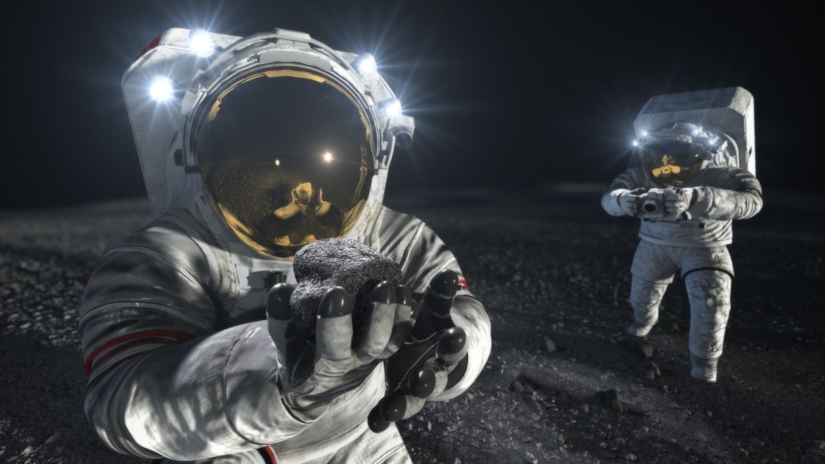
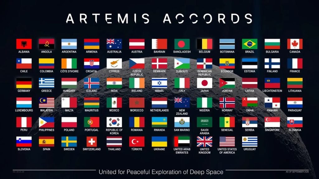
The Artemis Accords now have 76 signatories, expanding the international framework around the next phase of lunar exploration. For India, the milestone comes weeks after NASA invited the Indian Space Research Organisation (ISRO) to participate in its planned Moon Base programme.
Albania, Croatia, Côte d’Ivoire and San Marino joined the Accords in September, taking participation to 76 countries. NASA says nearly 40% of the world’s nations are now part of the framework, which sets principles for peaceful, transparent and responsible exploration of the Moon, Mars and beyond.
India became the 27th signatory in June 2023. At the India-US Civil Space Joint Working Group meeting in Bengaluru in August, NASA invited ISRO to participate in its Moon Base programme. The two countries also agreed to advance discussions on open scientific-data sharing under the Accords.
India’s Moon Base opportunity
The invitation does not specify what India will contribute. NASA has said every Artemis Accords signatory can participate through scientific payloads, technology demonstrations, CubeSats and other capabilities. Any specific Indian contribution would require further agreements.
India, however, is developing its own increasingly ambitious lunar programme. ISRO’s Chandrayaan-4 is planned as a lunar sample-return mission, designed to collect samples from the Moon’s polar region and bring them back to Earth. Chandrayaan-5/LUPEX, being developed with Japan’s JAXA, will study lunar polar volatiles in situ.
These missions could give India experience and scientific capabilities relevant to a future international lunar infrastructure.
ISRO Shaping the Data Conversation
Scientific data could be another area of Indian participation. In May 2026, ISRO led an initial Artemis Accords discussion on advancing open-data practices. NASA subsequently held two workshops focused on making lunar scientific data more accessible, interoperable and reproducible across countries.
That is significant as more lunar missions target the same regions. Shared standards could allow researchers to combine observations from different spacecraft instead of treating each mission’s data separately.
Moon – Space Coperation
India-US space cooperation is also expanding into human spaceflight. ISRO’s 2025–26 annual report records that Indian astronaut Shubhanshu Shukla travelled to the International Space Station in June 2025 as part of the Axiom-4 mission and conducted seven microgravity experiments. ISRO also held discussions with NASA on potential cooperation related to Gaganyaan.
The Artemis relationship therefore sits alongside an existing programme of India-US cooperation, including the NASA-ISRO Synthetic Aperture Radar (NISAR) mission.
What Changes for India?
The significance of the 76-country milestone lies in the network developing around it. The Artemis Accords cover scientific-data sharing, interoperability, non-interference between missions, emergency assistance and protection of historically significant lunar sites. NASA says signatories are now working through technical meetings and workshops to put these principles into practice.
For India, that creates several possible avenues: contributing technology or science to NASA’s Moon Base effort, sharing lunar data, and working with a growing group of countries on standards for increasingly crowded lunar operations. What India’s specific contribution to the Moon Base remains undecided. But with Chandrayaan-4, LUPEX and its human-spaceflight programme advancing alongside deeper NASA cooperation, India is entering the next phase of lunar exploration with its own capabilities already taking shape.


India Captures 5.7% of Global Greenfield Investment, Outpacing China

World Mental Health Day: How Late-Night Scrolling May Be Disrupting Sleep and Fuelling Anxiety

Climate Science Faces a Deadline: Can the IPCC Deliver Before the 2028 Global Stocktake?

Knowing When to Think for Ourselves: AI, Intuition and the Education of Discernment

Puberty, Pregnancy and Menopause Reshape the Female Brain Differently, Study Finds

From Scams to Screens: How the National Stock Exchange Rewrote India’s Equity Story

Aim for the Stars: Anjali Thomas’s Journey from a Small College in Kerala to the Frontiers of Medical Imaging

Two Chemists Win Nobel Prize for Solving a Century-Old Puzzle: Why Life Picks One Hand Over the Other

India’s AI Moment Rests on More Than Code

Marshall Islands: Why the US Nuclear Legacy Is Back Before the UN

-

 Math3 months ago
The 2026 Fields Medals: Four Proofs, Four Decades-Old Problems Solved
-
Climate2 months ago
After Kerala’s Deadliest Landslide, the Hardest Thing to Rebuild Was Childhood
-
Society3 months ago
West Asia Crisis: Can Kerala’s Returning Gulf Migrants Find a Future in the Green Economy?
-
Space & Physics4 months ago
India Semiconductor Mission: ‘It’s Not About Fabs. It’s About Building An Entire Ecosystem’
-
Interviews3 weeks ago
From Scams to Screens: How the National Stock Exchange Rewrote India’s Equity Story
-
Climate4 months ago
The Climate World Cup? How Climate Change Could Affect Player Performance at the 2026 World Cup
-
Society3 months ago
What Is Civilisational Diplomacy? Understanding India’s Newest Foreign Policy Tool
-
Society4 months ago
From Bell Labs to the Classroom: A Second Career in Teaching