
Space & Physics
Chandrayaan-3: The moon may have had a fiery past
A magma ocean might’ve wrapped the ancient moon, suggests findings from India’s robotic lunar mission, Chandrayaan-3.

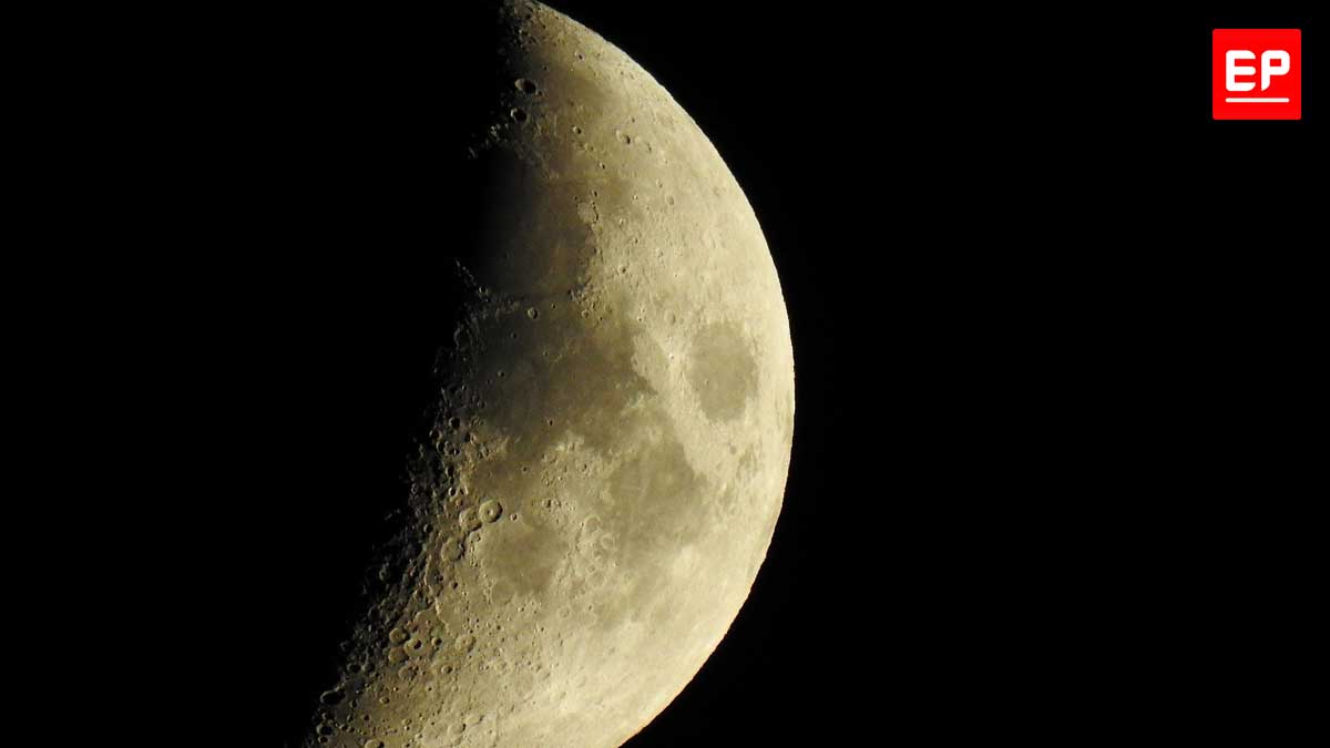
On 23rd August last year, India’s Chandrayaan-3 made history being the first to soft-land on the moon’s south polar region. The landing marked the end of the high-octane phase of the mission. But its next phase was a slow-burner.
Pragyan, the suitcase-sized rover, that hitched a ride to the moon aboard the lander, Vikram, rolled off a ramp onto the lunar surface. It traversed along the dusty lunar surface slowly, at a pace even a snail could beat. Handlers at the Indian Space Research Organization (ISRO) didn’t want the suitcase-sized rover to risk stumbling over a rock or near a ridge, and jeopardize the mission.
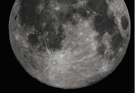
The whitish spots are material excavated from the moon’s interior.
Nevertheless, the rover had a busy schedule to stick to. It was to probe the lunar soil, and relay that scientific data back to earth. Pragyan covered 100 meters in two weeks, before it stopped to take a nap ahead of a long lunar night. At the time, the rover’s battery pack was fully charged, thanks to the on-board solar panels soaking up sunlight during the day.
But lunar weather is harsh, especially at the south pole, where Pragyan napped, temperatures can reach as low as -250 degrees centigrade during the night. Added to that, a lunar night lasts two weeks. ISRO deemed Pragyan had only a 1% chance to survive.
Later, the expected happened, when the rover went unresponsive to ISRO’s pings to wake up.
But ISRO said the rover achieved what it was tasked to do. It relayed data all along for two weeks, examining soil from some 23 locations around the mission’s landing point, Statio Shiv Shakti. As months passed by, a slew of discoveries were made. Sulphur was discovered at the south pole, early on while the mission was ongoing. And only a few months ago, Pragyan found evidence of past weathering activity at the south pole.
But since August this year, research teams from ISRO and the Physical Research Laboratory in Ahmedabad, India, reported Pragyan’s most important findings yet – one of which sheds light onto the moon’s origins.
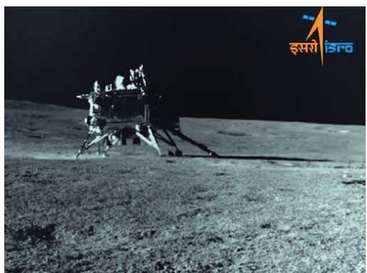
Chandrayaan-3’s Vikram lander, seen from the Pragyan rover’s camera
Moon and the Early Earth
Chandrayaan-3 had carried a radioactive passenger to the moon’s surface – curium-244.
The radioactive curium helps lase the surface: firing alpha particles (which are helium nuclei) at the dusty terrain. Some of these alpha particles bounce off the dust, whereas others evict electrons from the lunar soil, thereby producing x-ray emissions. Keeping watch is the Alpha Particle X-ray Spectrometer (APXS) on-board the Pragyan rover. In August, PRL scientists published findings in the journal, Nature, based on APXS data, reporting discovery of ferroan anorthosite.
It wasn’t the first ever detection per se of ferroan anorthosite. In fact, Apollo 11 had brought back anorthosite rocks to earth, where they were identified as such. That was in 1969, and Apollo sampled them from the equator. Successive missions by the Soviet Union and most recently China affirmed likewise from mid-latitude – equatorial regions as well. But Pragyan’s detection of the rock type was the first ever from the polar region.
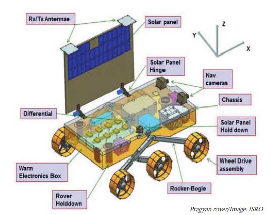
The Pragyan rover’s payload.
Anorthosites are common on earth. In fact, just a year after the Apollo 11 sampled the rock, scientists had evidence of the earth and the moon’s entangled history. The authors noted the similar composition between these rocks, that are geographically widespread. Furthermore, ferroan anorthosite is an igneous rock that forms on earth when hot lava produced in volcanic eruptions cools down.
And scientists had piled up evidence in support of a similar process that underwent on the moon. The anorthosite rocks on the moon are old, in fact, more than 4 billion years ago – a figure close to the earth’s inception with rest of the solar system – around 4.5 billion years. Scientific consensus has been that the moon was formed from remnants of a collision between the early earth and a rogue Mars-sized planetary body.

But the collision energy would have yielded a moon that was molten. A lava blanketing the surface – aka a global magma ocean. As this ocean cooled, minerals amongst which is plagioclase (a class of feldspar) crystallized and formed the anorthosite rocks on the moon. It’s commonly called the lunar magma ocean hypothesis.
When Pragyan treaded over the dusty lunar terrain, it didn’t register the anorthosite as a physical rock per se. Instead, it observed remnants of the rock, as fine powder.
Meteorites beat down rocks to fine powder, as they slam into the moon from space with regular impunity. On earth, the ground is saved by the presence of an atmosphere. But the moon virtually has no atmosphere. Nor does it have water to wear down the rocks. The surface is extremely hot during the lunar day – in fact, when Chandrayaan-3 landed on the moon, the surface temperature was some 50 degrees centigrade. Just a few months ago, Pragyan revealed possible signs of rock degradation from the rims of a crater.
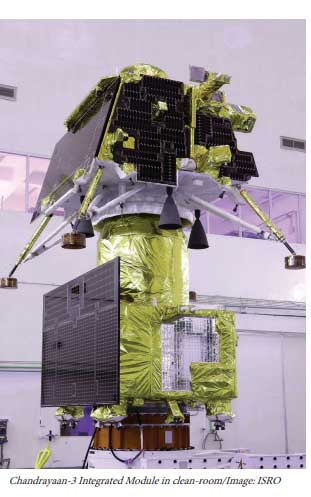
Moon dust opens doors to the past
The fact the moon doesn’t (and can’t) sustain an atmosphere helps it make an attractive destination to learn more about our planet and the satellite’s shared origins. There’s no chemistry to remove traces of the moon’s early evolution from the lunar dust. As such, the dust opens doors to the past.
Space explorations missions soft-landing on the surface study this dust – or sample and shuttle them to earth for scientists to study them in detail.
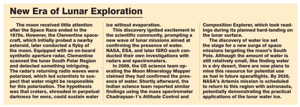
In fact, Pragyan revealed a crater that’s amongst the oldest ever discovered on the moon. The findings were published in the journal, Icarus, in September. Hidden in plain sight, the rover’s navigation camera, NavCam, spotted subtle stretch marks on the surface, that were confirmed later with the Chandrayaan-2 orbiter (which has been orbiting the moon since 2019). In fact, this crater was found buried under nearby craters, most notably the South Pole-Aitkin basin located 350 km away. The basin is the largest impact crater in the entire solar system (some 2,500 km wide and 8 km deep) touted to have formed millions of years ago.
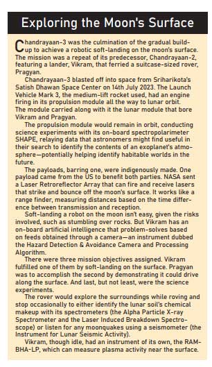
And this became subject to an earlier paper that PRL scientists authored, and was published in August. Pragyan identified material thought to have emerged from the moon’s interior. The APXS instrument picked up unusually high magnesium content in the vicinity. The authors speculate the meteorite that created the basin probably dug up magnesium from deep inside the moon’s upper mantle, and spewed them into Pragyan’s vicinity.
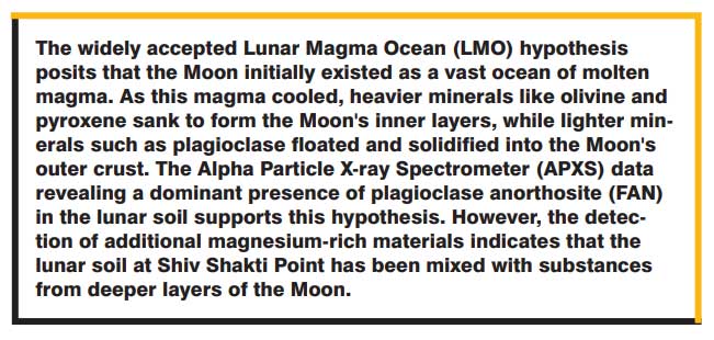
But some experts believe in an alternate explanation. They believe the magnesium might have come from surface rocks in the vicinity, and not from the upper mantle. In fact, the authors acknowledged this amongst other possible alternatives. Nonetheless, the Chandrayaan-3’s findings doesn’t dispute the lunar magma ocean hypothesis either, if not backing it outright. Saying that, the theory lives on to fight another day.











Space & Physics
Artemis Accords Reach 76 Countries: What It Means for India
The Artemis Accords now have 76 signatories. With NASA inviting ISRO to its Moon Base programme, India’s role in lunar exploration is expanding.

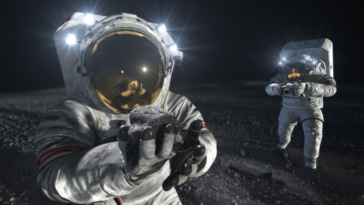
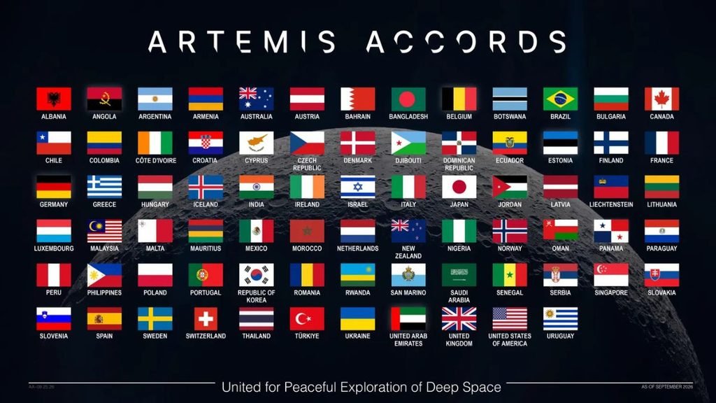
The Artemis Accords now have 76 signatories, expanding the international framework around the next phase of lunar exploration. For India, the milestone comes weeks after NASA invited the Indian Space Research Organisation (ISRO) to participate in its planned Moon Base programme.
Albania, Croatia, Côte d’Ivoire and San Marino joined the Accords in September, taking participation to 76 countries. NASA says nearly 40% of the world’s nations are now part of the framework, which sets principles for peaceful, transparent and responsible exploration of the Moon, Mars and beyond.
India became the 27th signatory in June 2023. At the India-US Civil Space Joint Working Group meeting in Bengaluru in August, NASA invited ISRO to participate in its Moon Base programme. The two countries also agreed to advance discussions on open scientific-data sharing under the Accords.
India’s Moon Base opportunity
The invitation does not specify what India will contribute. NASA has said every Artemis Accords signatory can participate through scientific payloads, technology demonstrations, CubeSats and other capabilities. Any specific Indian contribution would require further agreements.
India, however, is developing its own increasingly ambitious lunar programme. ISRO’s Chandrayaan-4 is planned as a lunar sample-return mission, designed to collect samples from the Moon’s polar region and bring them back to Earth. Chandrayaan-5/LUPEX, being developed with Japan’s JAXA, will study lunar polar volatiles in situ.
These missions could give India experience and scientific capabilities relevant to a future international lunar infrastructure.
ISRO Shaping the Data Conversation
Scientific data could be another area of Indian participation. In May 2026, ISRO led an initial Artemis Accords discussion on advancing open-data practices. NASA subsequently held two workshops focused on making lunar scientific data more accessible, interoperable and reproducible across countries.
That is significant as more lunar missions target the same regions. Shared standards could allow researchers to combine observations from different spacecraft instead of treating each mission’s data separately.
Moon – Space Coperation
India-US space cooperation is also expanding into human spaceflight. ISRO’s 2025–26 annual report records that Indian astronaut Shubhanshu Shukla travelled to the International Space Station in June 2025 as part of the Axiom-4 mission and conducted seven microgravity experiments. ISRO also held discussions with NASA on potential cooperation related to Gaganyaan.
The Artemis relationship therefore sits alongside an existing programme of India-US cooperation, including the NASA-ISRO Synthetic Aperture Radar (NISAR) mission.
What Changes for India?
The significance of the 76-country milestone lies in the network developing around it. The Artemis Accords cover scientific-data sharing, interoperability, non-interference between missions, emergency assistance and protection of historically significant lunar sites. NASA says signatories are now working through technical meetings and workshops to put these principles into practice.
For India, that creates several possible avenues: contributing technology or science to NASA’s Moon Base effort, sharing lunar data, and working with a growing group of countries on standards for increasingly crowded lunar operations. What India’s specific contribution to the Moon Base remains undecided. But with Chandrayaan-4, LUPEX and its human-spaceflight programme advancing alongside deeper NASA cooperation, India is entering the next phase of lunar exploration with its own capabilities already taking shape.
Space & Physics
JWST Finds Water Around a Dying Star Near the Milky Way’s Black Hole
A dying star near the Milky Way’s central black hole is shedding water, gas and dust into one of the galaxy’s most extreme environments.
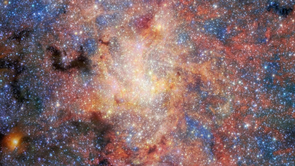
A dying star nearing the end of its life is shedding material into space just 0.55 light-years from the Milky Way’s central black hole. And somehow, some of that material is holding on. New observations from the James Webb Space Telescope have revealed water and oxygen-rich dust surrounding IRS 3, an evolved star living remarkably close to Sagittarius A*, the supermassive black hole at the heart of our galaxy.
The finding gives astronomers a rare view of what happens when an ordinary stage of stellar evolution unfolds in an anything-but-ordinary neighbourhood.
A Dying Star Beside a Black Hole
IRS 3 is an asymptotic giant branch (AGB) star, a late stage in the life of stars like this one. As such stars age, they swell, cool and lose material through powerful stellar winds. IRS 3 is doing exactly that. Gas and dust are streaming away from the star, creating a large envelope around it.
The star sits only about 0.55 light-years from Sagittarius A*. That may sound distant, but on the scale of the Galactic Centre it is remarkably close. Earth is about 26,000 light-years away from the same black hole.
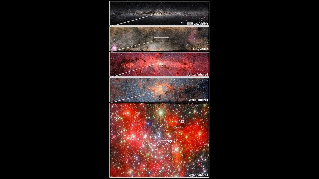
Around Sagittarius A* is a crowded, energetic environment filled with intense radiation, dense gas and powerful gravitational forces. Astronomers have long wondered how stars manage to evolve and shed material there. IRS 3 is offering an answer.
Webb Finds Water in the Stellar Outflow
NASA‘s James Webb Space Telescope looked at IRS 3 using its Mid-Infrared Instrument, or MIRI. Infrared observations are particularly useful here because the dust surrounding the star glows strongly at these wavelengths.
The observations revealed oxygen-rich dust in the star’s envelope. They also produced the first detection of water in this material. This does not mean Webb found a pool, cloud or droplets of water. The water exists as molecules mixed into the hot gas and dust surrounding the star.
That distinction matters because molecules can be vulnerable in the harsh environment around the Galactic Centre. Radiation can break them apart, while the conditions around a supermassive black hole can affect the material being expelled by nearby stars. Yet water molecules are present around IRS 3.
The Star is Feeding Its Surroundings
IRS 3 is losing material rapidly as it approaches the end of its life. Researchers estimate that the star is shedding roughly the mass of Earth every 18 days. That enormous outflow is important beyond IRS 3 itself.
When evolved stars lose their outer layers, they return material to the space between stars. The gas carries elements produced during the star’s lifetime, while newly formed dust becomes part of the reservoir from which future cosmic structures can emerge. IRS 3 is therefore caught in a familiar cycle of stellar life: a star is dying, but the material it releases can become part of something else.
What makes this case unusual is that the recycling process is happening almost next door to a supermassive black hole.
How Much Can Survive Here?
The observation does not mean that the black hole has little influence on its surroundings. Sagittarius A* still creates an extreme environment, and the researchers are interested precisely because IRS 3 shows that stellar material can persist within it.
“Galactic centres are among the most extreme environments,” said Florian Peißker of the University of Cologne, the study’s lead author to media. With Webb, researchers can now examine the material around stars such as IRS 3 in much greater detail and ask how stellar winds, dust formation and molecular chemistry behave so close to a black hole. The answer emerging from IRS 3 is intriguing: the environment may be extreme, but it does not necessarily shut down the chemistry of a dying star.
For IRS 3, the end of its stellar life is already underway. Its outer layers are drifting away into the Galactic Centre, carrying dust, molecules and the chemical ingredients of future cosmic systems with them. Even in the shadow of the Milky Way’s central black hole, a dying star is still leaving something behind.
Space & Physics
India’s New Satellite Will Be Tested During Disasters
India’s latest Earth-observation satellite, EOS-05, could give disaster agencies a broader and more frequent view of floods, landslides and other hazards. But its real value will depend on how quickly satellite data can be turned into information that helps authorities act on the ground.


Trump’s AI Accord Puts Big Tech in Charge of Its Own Safety. Is That Enough?

Standing with Teachers: The People Who Shape India’s Future

An Ageing Teacher Workforce Is Becoming a Recruitment Problem

India’s Supercomputing Capacity Hits 68 PF as Applications Expand Beyond Research

The Climate Problem Hiding in Your Kitchen Bin

From Scams to Screens: How the National Stock Exchange Rewrote India’s Equity Story

Aim for the Stars: Anjali Thomas’s Journey from a Small College in Kerala to the Frontiers of Medical Imaging

India’s AI Moment Rests on More Than Code

From Silicon Valley to Sustainable Period Care; How This Engineer Is Rethinking Menstruation with Science

Marshall Islands: Why the US Nuclear Legacy Is Back Before the UN

-

 Math2 months ago
The 2026 Fields Medals: Four Proofs, Four Decades-Old Problems Solved
-
Climate2 months ago
After Kerala’s Deadliest Landslide, the Hardest Thing to Rebuild Was Childhood
-
Society3 months ago
West Asia Crisis: Can Kerala’s Returning Gulf Migrants Find a Future in the Green Economy?
-
Space & Physics4 months ago
India Semiconductor Mission: ‘It’s Not About Fabs. It’s About Building An Entire Ecosystem’
-
Interviews2 weeks ago
From Scams to Screens: How the National Stock Exchange Rewrote India’s Equity Story
-
Climate4 months ago
The Climate World Cup? How Climate Change Could Affect Player Performance at the 2026 World Cup
-
Society3 months ago
What Is Civilisational Diplomacy? Understanding India’s Newest Foreign Policy Tool
-
Society4 months ago
From Bell Labs to the Classroom: A Second Career in Teaching